
What's New
Fixed issues relating to Create Grid and displaying distances on deed plot.
App Description
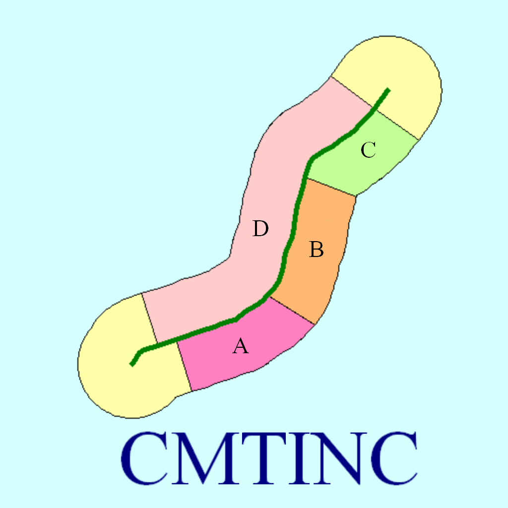
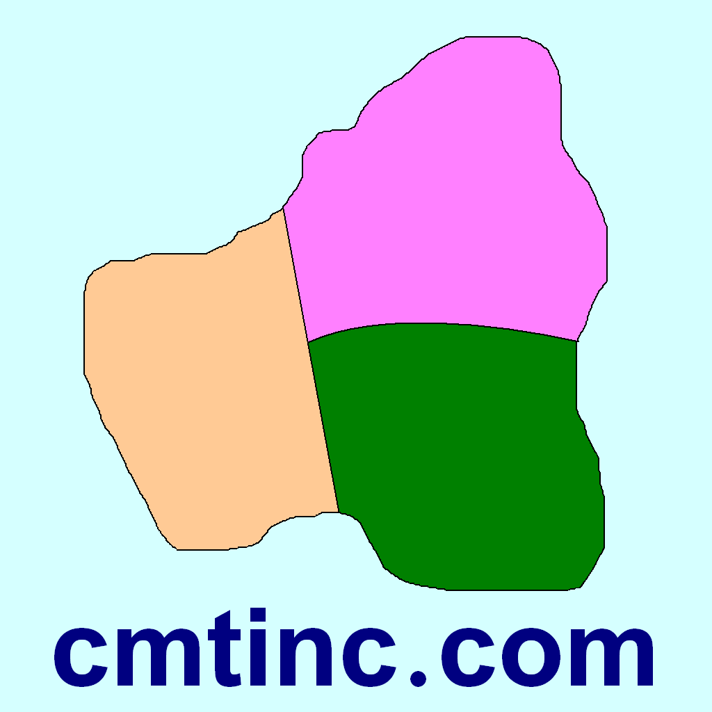
iCMTGIS III is a professional GPS/GIS mapping app that will let you record Points, Lines and Area Features with date/time stamp and pre-defined or manually added descriptions. You could also digitize Features on top of a background map or create points by entering angles and distances. LLA, UTM, State Plane and local coordinate systems supported.You could record your track while performing other tasks using this app. View distances and areas on the spot. Stakeout to points or along a Line or Area Feature. Easily import/export Shapefiles, send/receive files via ftp or email, and store files in the Cloud. Effectively collect data and increase productivity for utilities, natural resources, land management, archeology and other GPS/GIS applications. Please note: Location data depends on the GPS receiver used. Continued use of GPS running in the background can dramatically decrease battery life. iCMTGIS III will let you easily toggle the built-in GPS on or off. This app comes with a built-in help file.
Requires iOS 9 or newer version of iOS.
iCMTGIS III provides the following enhancements over the iCMTGIS II GPS/GIS Data Collection app.
1. Ability to load geo-referenced .tif file as off-line background image for GPS mapping
2.Ability to enter Antenna Height and specify incoming GPS datum for RTK data collection
3. Distance mode for offset GPS data collection
4. Classify Features on a Topic layer
5. Export Shapefiles into a folder; import Shapefiles from a folder
6. Import/Export Feature data in Excel, DXF, KML formats
7. Export Feature data to GPX
8. Import/Export Text Files (with fixed-length field option) for Point Topics
9. Photo support
10. Point Stakeout and Line Stakeout functions.
11. Insert node or Delete node to modify a Line or Area
12. Join or Disconnect Line/Area
13. Nested Point defaults to last used Point Topic.
14. New Feature List format with symbol/pattern support
15. Ability to add built-in Attributes for a Topic
16. Sort/Search/Batch Delete Features and view statistics
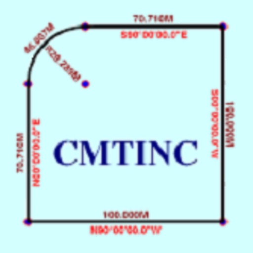
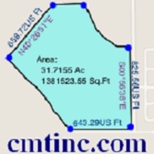
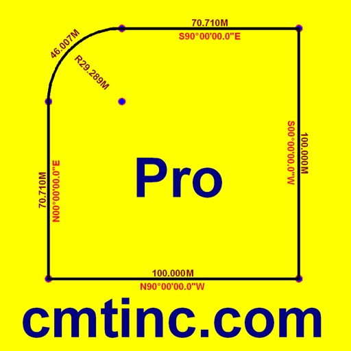
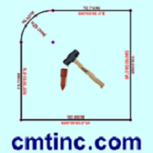
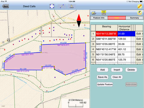
17. Create deed plot by entering Deed Calls
18. Export to PDF
iPhone Screenshots
(click to enlarge)


iPad Screenshots
(click to enlarge)


App Changes
- May 08, 2015 Initial release
- June 26, 2015 New version 1.1.0
- August 25, 2015 New version 1.1.1
- October 18, 2015 New version 1.1.2
- February 05, 2016 New version 1.1.3
- July 07, 2016 New version 1.1.5
- June 14, 2019 New version 1.1.7
- October 23, 2020 New version 1.1.8
- September 16, 2023 New version 1.2.0
- November 03, 2023 New version 1.2.1
- April 25, 2024 New version 1.2.3
Other Apps From Corvallis Microtechnology, Inc.