
What's New
General app update.
App Description
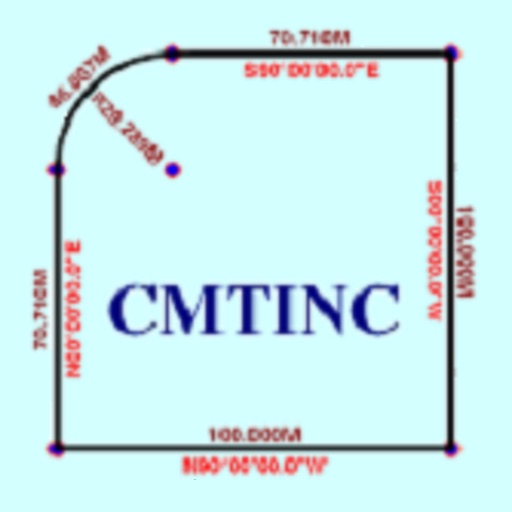
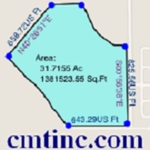
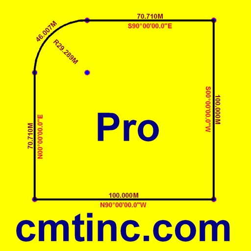
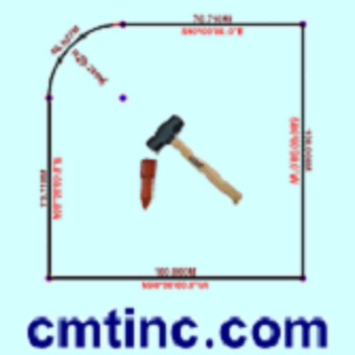
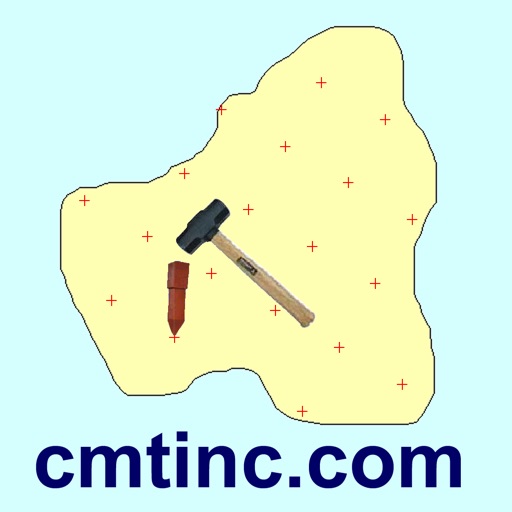
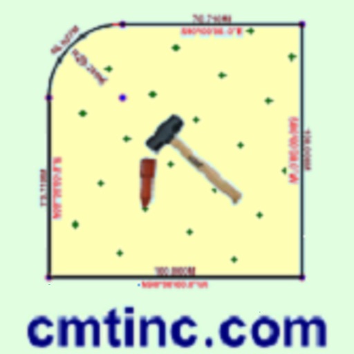
If you need to create a buffer zone around a building, along a road or a river, or along the perimeter of an area, the Buffer & Stakeout app will help you do that easily. This app will run on the iPAD, iPhone and iPod touch. It will let you digitize a Point, Line or Area Feature, view its position, length or area, and create buffer zones around it. You may create one or more buffer zones, such as for calculating the area to mow inside and outside a fence around a large complex, or for figuring the tax credit for an unfarmed riparian zone
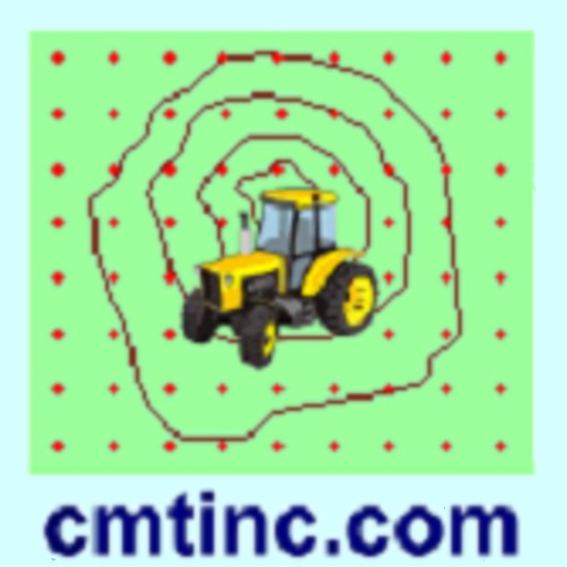
The Point Stakeout function provided by this app can help you approach a point or a node on an area boundary. The Line Stakeout function can help guide you along a path or an area boundary. You can turn the navigation beeps on or off.
You may specify the distance unit (metric or English) and choose between Azimuth and Bearing for displaying angles.
You will be able to work with multiple job files, and you will be able to export the Features and coordinates to a PDF file. This app will let you view the PDF file it has created and also any PDF file you have copied into the Documents folder of this app. It will also let you email the PDF files (*.pdf) and job file (*.pmp).
If your device has GPS capability, you may pick the GPS location as a node for your Feature. Please note: Location data depends on the GPS receiver used. Continued use of GPS running in the background can dramatically decrease battery life. This app will let you easily toggle the built-in GPS on or off. It comes with a built-in help file.
iPhone Screenshots
(click to enlarge)


iPad Screenshots
(click to enlarge)


App Changes
- April 03, 2014 Initial release
- July 16, 2014 New version 1.0.1
- October 13, 2014 New version 1.0.2
- June 13, 2019 New version 1.0.3
- June 13, 2019 Price increase: $19.99 -> $24.99
- June 13, 2019 Price increase: $19.99 -> $24.99
- June 14, 2019 Price increase: $19.99 -> $24.99
- June 14, 2019 Price increase: $19.99 -> $24.99
- June 15, 2019 Price increase: $19.99 -> $24.99
- June 15, 2019 Price increase: $19.99 -> $24.99
- June 16, 2019 Price increase: $19.99 -> $24.99
- November 20, 2020 New version 1.0.4
Other Apps From Corvallis Microtechnology, Inc.