
What's New
Update app to follow the latest App Review Guidelines.
App Description
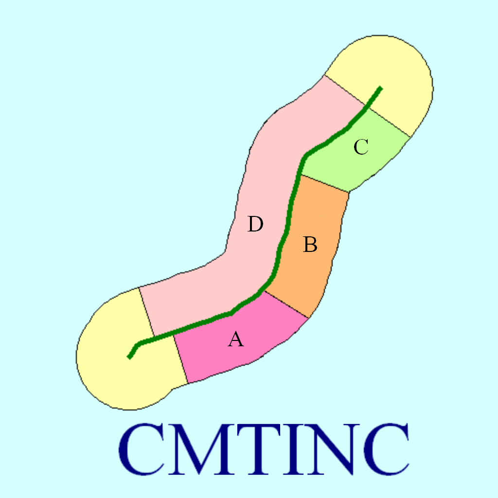
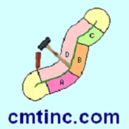
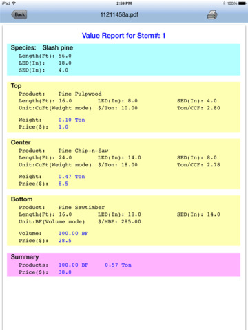
When cutting a tree stem into log products, the important question to ask is how to maximize the income from the stem. In some cases, it will be more profitable to divide the tree into a saw log segment and a pulpwood segment. In other cases, it may make more sense to sell the entire stem as chip-n-saw and not bother cutting it up. When there is the possibility of getting three different log products out of the same stem, the decision will become even more difficult to make.
The Virtual Tree Bucking application software will help you determine how to segment a tree stem for best utilization. Before actually cutting up the stem, you can use this app to try various scenarios and view the yield of wood quantity and potential revenue for each case. You may enter up to three products per stem and report the values based on the conversion factors and pricing that you enter for each specific log merchandise class. You may work with Metric or English units. This app does not tally the logs, but it provides the option to save the reported results to a PDF file for later review.
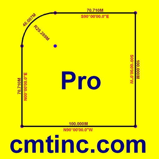
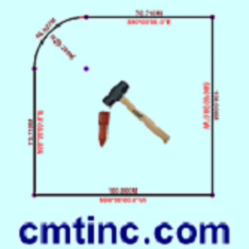
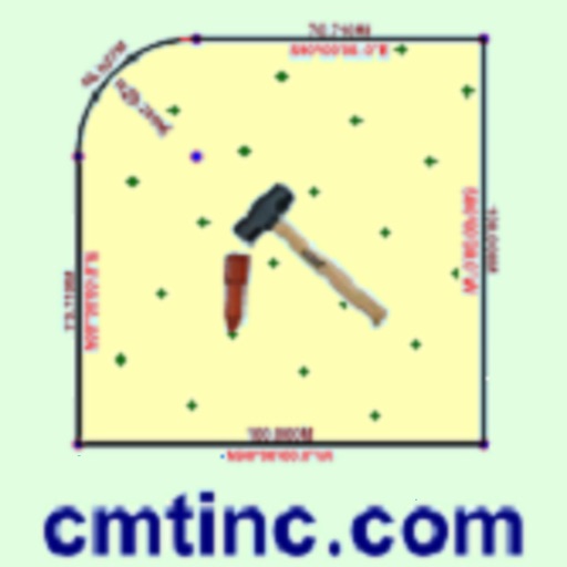
This app comes with functions for precisely adding points, lines and areas to the screen as well as the ability to measure distances and areas. A detailed help document is built in.
You will be able to do the following using the Virtual Tree Bucking app on your iPAD, iPhone or iPod touch:
* Segment the tree stem on the screen before actually cutting it up.
* Set up detailed conversion factor tables for various log sorts.
* Enter up to three log products for the same stem.
* View log volume or log weight for any stem segment.
* Compare price bids in $/MBF, $/Cord, $/CuFt or $/CuM.
* Save the tree-stem value reports to PDF.
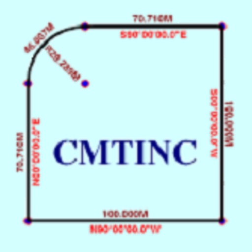
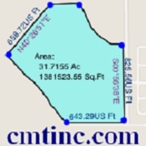
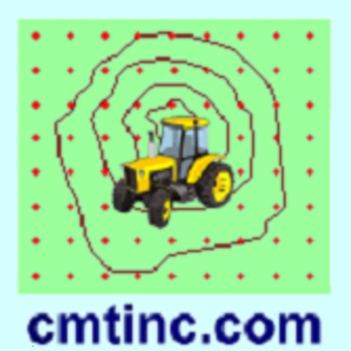
* Precisely digitize Points, Lines and Areas and save them as Features.
* View position, length and area values for the saved Features.
* Label the Lines with segment lengths and directions as well as corner angles.
* Label the Areas with size in acres and square feet or hectares and square meters.
* Measure distances and areas without saving the shapes.
* Move existing nodes to fine-tune the map drawing.
* Create Points from entered coordinates.
* Create a Point or record a node by picking the GPS location.
* Search a location by address or by coordinates.
* Save the job data file for later use.
* Output the drawing and the coordinates to PDF.
* Email the job data files and the PDF files to your colleagues.
Please note: Location data depends on the GPS receiver used. Continued use of GPS running in the background can dramatically decrease battery life. This app will let you easily toggle the built-in GPS on or off.
iPhone Screenshots
(click to enlarge)


iPad Screenshots
(click to enlarge)


App Changes
- June 06, 2014 Initial release
- November 03, 2014 New version 1.0.1
- June 13, 2019 New version 1.0.2
- June 13, 2019 Price increase: $19.99 -> $44.99
- June 13, 2019 Price increase: $19.99 -> $44.99
- June 14, 2019 Price increase: $19.99 -> $44.99
- June 14, 2019 Price increase: $19.99 -> $44.99
- June 15, 2019 Price increase: $19.99 -> $44.99
- June 15, 2019 Price increase: $19.99 -> $44.99
- June 16, 2019 Price increase: $19.99 -> $44.99
- November 11, 2020 New version 1.0.3
Other Apps From Corvallis Microtechnology, Inc.