
What's New
Minor bug fixes, and preparing for a major update that will be coming in a few months.
App Description
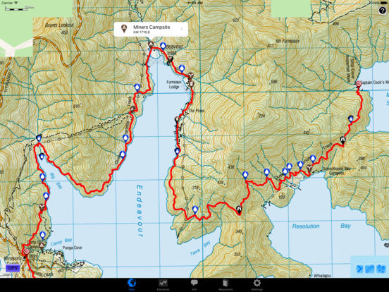
Te Araroa Hiker is a detailed, map-based 4-part smartphone guide for your hike on New Zealand's 3000-kilometre Te Araroa, created by the developers of the popular series of Guthook's Guides long-distance hiking guides. Te Araroa Hiker maps and lists over 2,000 important hiker waypoints such as water sources, tenting sites, junctions, road crossings, resupply information, and many others.
NO PHONE OR INTERNET SERVICE IS REQUIRED to use Te Araroa Hiker after the initial setup. Te Araroa Hiker uses a combination of your smartphone's GPS, downloaded topo maps, and the Apple Maps interface to accurately locate your position on the Te Araroa. Your device's GPS pinpoints your location on the downloaded topo maps.
The free demo covers a 60 kilometre portion of the Te Araroa on the North Island from Silverdale through Auckland. The demo is fully functional with all features of the paid version. In-app purchases include guides for the North Island from Cape Reinga to Hamilton (800 km), North Island from Hamilton to Wellington (900 km), South Island from Ship Cove to Lake Tekapo (690 km), and South Island from Lake Tekapo to Bluff (610 km).
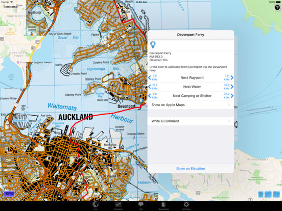
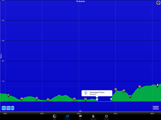
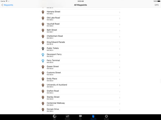
A bright red line indicates the location of the main trail on the map. Waypoints of interest to the hiker are plotted on the map, listed in a guide, and plotted on an elevation profile.
Send your current location to friends and family via text message or e-mail.
Each waypoint includes a detail page, providing further details about that particular waypoint. Details include the waypoint's mileage point and elevation, distance to the next water source and tent site, a Comments section where you may post comments and read other users' comments, and other details that will help you during your hike, and help you plan your hike.
The types of waypoints include:
-->Water sources
-->Tenting sites/camping sites
-->Trail junctions
-->Picnic areas, campgrounds, ranger stations
-->Roads, stiles, gates
-->Natural landmarks (e.g. mountain peaks)
-->Toilets
-->Views
-->Resupply and town information, such as supermarkets and lodging
iPhone Screenshots
(click to enlarge)


iPad Screenshots
(click to enlarge)
App Changes
- November 05, 2016 Initial release
- November 24, 2016 New version 5.2
Other Apps From Guthook Hikes, LLC