
App Description
The Forest of Dean, a green island nestled between two rivers; the mighty Severn and the winding Wye. This ancient forest has had a rather traumatic past. In medieval times it was a royal hunting forest, then a source of timber for the navy's Tudor warships. By Victorian times it was a major site of industry; it's noisy landscape greatly scarred by coal and iron mining, quarrying and associated industries.
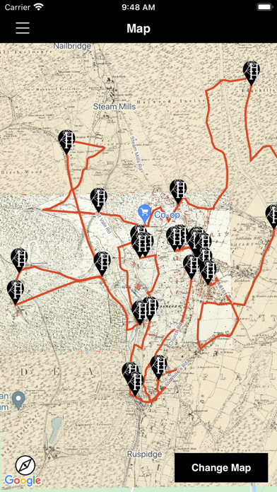
Use this App to explore Cinderford’s hidden heritage following a route including the Town Centre / The Triangle, Ruspidge Halt and Edgehills nature Reserve.
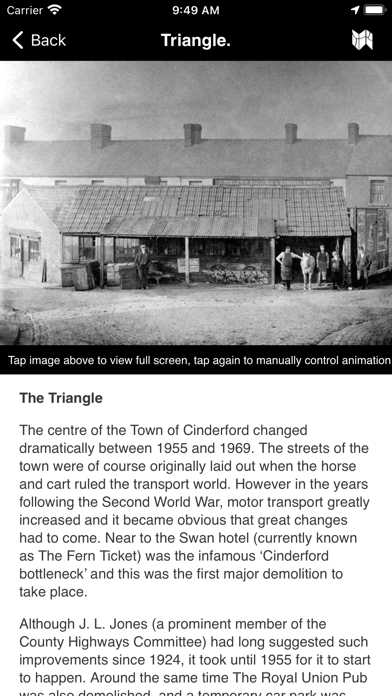
As you explore the route, your location will be tracked on the map using the GPS on your device. When you near a point of interest, see how the past merges into the present with text, a static historic picture or a “fade image” that shows a smooth transition between the historic and modern landscape, taking you from what you see now to what life used to be like.
Features:
- 30+ points of interest to explore as you travel this exciting trail.
- Offline mapping based on vintage, highly detailed, 6 and 25 inch to the mile OS map.
- GPS located position shows your exact location on the map.
- Stunning, GPS triggered, "Fade images" show a transition from historic photo to modern landscape.
This app makes use of GPS to show you places of interest close to your current location. Continued use of GPS running in the background can dramatically decrease battery life.
iPhone Screenshots
(click to enlarge)

iPad Screenshots
(click to enlarge)


App Changes
- September 15, 2023 Initial release
Other Apps From AT Creative Limited