
What's New
Completely new and redesigned app that is faster and more responsive and now works on both iPad and iPhone. New, icon-driven interface that can be accessed from either the right or left side of the screen. Scale bar. Slide out shows GPS latitude, longitude and elevation. Support for Spanish.
App Description
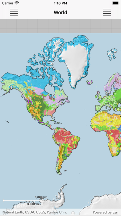
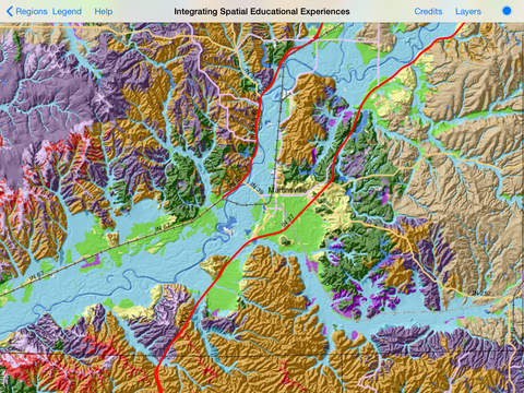
Explore detailed maps of soil properties and landscapes for various U.S. states, as well as small-scale maps of soil distributions for the world. Examine the details for a specific area, but also see the overview for a large area. Learn how features shown on the maps correspond to what you observe in the field.
Soil Explorer utilizes detailed soil survey data from the USDA Natural Resources Conservation Service and data and maps from the U. S. Geological Survey and other sources to produce informative, highly engaging maps. These maps are designed to show the complex interrelationships between soil properties and the landscapes in which soils occur.
iPhone Screenshots
(click to enlarge)


iPad Screenshots
(click to enlarge)


App Changes
- May 31, 2015 Initial release
- July 03, 2016 New version 1.5
- June 14, 2019 New version 1.5.1
- October 22, 2020 New version 2.0.1
Other Apps From Purdue University