
What's New
- We have revamped the Community section with more editing options for you.
- Additionally, a few minor errors have also been fixed.
- We have prepared the app for the winter season: ski resorts and avalanche reports are back on board.
Please note: If you encounter any problems or bugs, we ask you to please send us a message directly to [email protected].
If you like the app, we are pleased to receive your rating in the Play Store!
App Description
Get the app from Europe’s largest outdoor platform and be well prepared for your next adventure in nature!
Please note: If you encounter any problems or bugs, we ask you to please send us a message directly to [email protected]. If you like the app, we are pleased to receive your rating in the App Store!
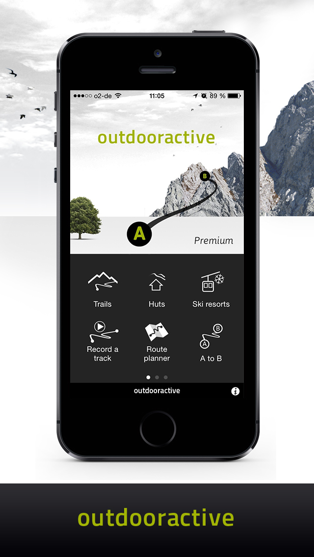
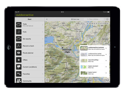
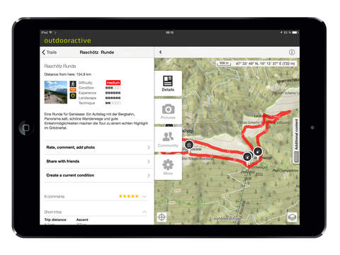
More than 130,000 summer and winter routes that have been equipped primarily with editorial descriptions, topographic maps, elevation profiles, tour data, pictures and GPX tracks are all accessible by mobile device and can be rated, commented on and backed by images directly via the app. Thanks to our intuitive search you can easily find the right tour for yourself. The results can be sorted by distance, difficulty and duration.
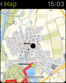
Maps: Outdooractive provides you with topographic maps for the entire German-speaking region, inclusive of cycle and hiking trails. Outstanding OSM maps as well as maps in summer and winter style are made available to you worldwide.
Synchronization of content: The app is directly linked to your Outdooractive account, which gives you access to previously published tours on your iPhone or iPad. Finished tours can be published on the Outdooractive community platform directly via the app with a description and pictures.
Extended favorites function: Your memo on Outdooractive.com and the favorites in your app are being synchronized and you can easily set up and manage your own lists. You can view your routes on a map mode and add or delete lists as you wish.
Offline storage: All tours and topographic maps are made readily available for download. In addition, you can also access them in offline mode, which is ideal when on holiday in foreign countries or areas with weak or no network coverage. All the downloaded map sections can be reviewed in the settings of the app.
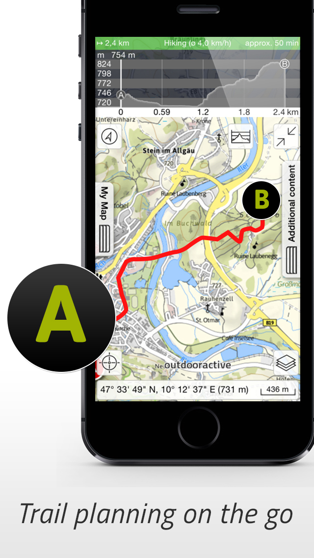
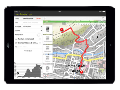
Route planner: Plan your tours in great detail on summer and winter maps throughout Europe and particularly in Germany with cycle, hiking trail and gradient overlays as well as the automatic display of elevation, kilometers and elevation profile. Afterwards you can publish the tour via the app on Outdooractive.com.
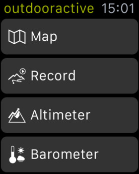
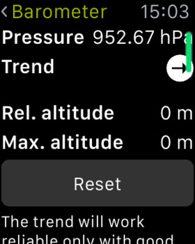
Apple Watch: Use the Apple Watch for your track logs or measure your altitude, speed and the weather trend on your wrist. Display map sections directly via the Outdooractive app on your watch.
Mountain huts: You receive an extensive database of all the mountain huts along with information on opening times and accommodation developed in collaboration with the German, Austrian and South Tyrolean Alpine Clubs. You can integrate the huts in the route planner when planning your own tours.
Current conditions: You can easily enter current conditions on-site via the Outdooractive app. Either you determine the position on our map or you simply enter the current condition directly for a tour or a hut – including images, weather, hazard information and description.
Track log: Record your tracks and obtain important data, such as kilometers, average speed, elevation, time elapsed and elevation profile. Import a GPX track and use it as a template or publish the logged tour directly via the app on Outdooractive.com.
Navigation: Let us navigate you along existing trails or choose the start and end point and allow the app to show you the way.
Summit finder: The mountains are calling! Thanks to our interactive 360 degree live panoramic view you will always be aware of which summits are situated around you (offline available).
Additional features:
* Toolbox
* Universal app – the app is adjusted to the
* Community
* Share content with friends
* My maps (display your own tours)
* Health Support for navigation and logging of bike trails
Note:
Continued use of GPS running in the background can dramatically decrease battery life.
iPhone Screenshots
(click to enlarge)


iPad Screenshots
(click to enlarge)


Apple Watch Screenshots
(click to enlarge)

App Changes
- August 15, 2013 Initial release
- September 01, 2013 New version 1.6
- December 10, 2013 New version 1.7
- April 08, 2014 New version 1.8
- April 20, 2014 New version 1.9
- May 15, 2014 New version 2.0
- May 30, 2014 New version 2.1
- June 28, 2014 New version 2.2
- July 20, 2014 New version 2.3
- August 11, 2014 New version 2.4
- August 28, 2014 New version 2.5
- November 15, 2014 New version 2.6
- January 27, 2015 Price decrease: $10.99 -> $9.99
- February 11, 2015 New version 2.7
- February 27, 2015 New version 2.8
- May 02, 2015 New version 2.9
- May 18, 2015 New version 2.10
- June 04, 2015 New version 2.11
- July 03, 2015 New version 2.12
- July 28, 2015 New version 2.13
- September 14, 2015 New version 2.14
- October 20, 2015 New version 2.15
- December 17, 2015 New version 2.16
- January 07, 2016 New version 2.17
- July 11, 2016 New version 2.20
- July 13, 2016 New version 2.21
- August 03, 2016 New version 2.22
- December 12, 2016 New version 2.23
Other Apps From Outdooractive GmbH & Co. KG