
What's New
- Bug fixed on Nautical Chart & map not showing in lower zoom levels in IOS 13.
- Compatible to new devices and iOS 13.
App Description
THE ALL NEW ADVANCED MARINE RASTER NAUTICAL CHARTS APP FOR BOATERS AND SAILORS!
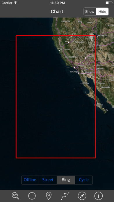
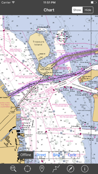
THIS MAP PROVIDES ALL THE NECESSARY TOOLS FOR EASY NAVIGATION ON WATER. CONTINUOUS CHARTS DISPLAY MAKES IT MORE EASIER FOR SAILING AND AS THERE WILL BE NO INTERNET ON SEA, THIS CHART IS FASTER FOR NAVIGATION.
NO WAITING TIME FOR NAUTICAL CHART DOWNLOADS. READY TO USE, SEAMLESS FOR CONTINUOUS NAVIGATION!
COMBINATION OF COASTAL CHARTS, SMALL CRAFT AND HARBOR CHARTS FOR EASY NAVIGATION.
ALL CHARTS OVERLAY IS ARRANGED IN A SEAMLESS ORDER, BASED ON CHART SCALE AND PRIORITY.
NO NEED TO CHANGE CHARTS MANUALLY, THEY ARE READY FOR CONTINUOUS NAVIGATION.
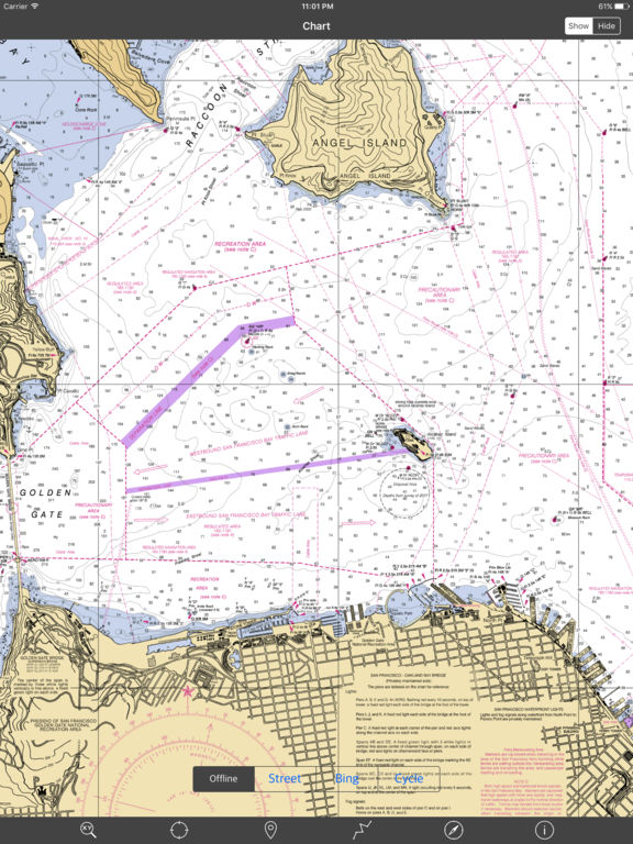
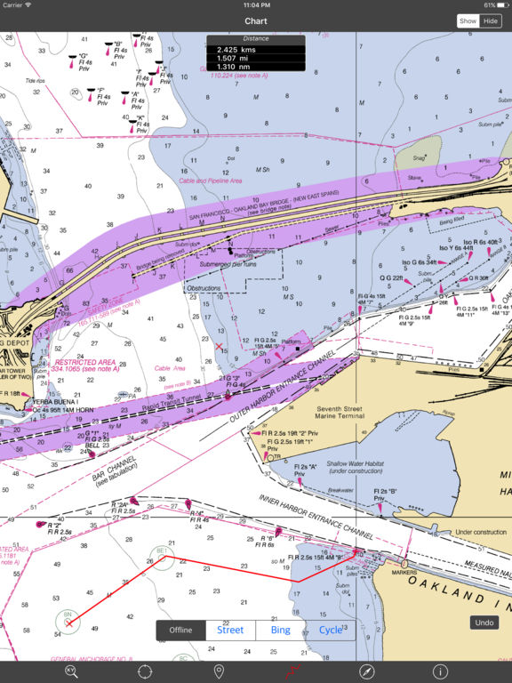
● ALL MARINE RASTER NAUTICAL CHARTS ARE FROM NOAA SOURCES.
● ALL CHARTS ALIGNED WITH ORIGINAL CHART CO-ORDINATES, ARE ACCURATE FOR USE.
● GPS - SHOWS & UPDATES USER CURRENT LOCATION ON MAP.
● SEAMLESS CHART OVERLAY DISPLAY, USE THEM AS LONG AS YOU BOAT.
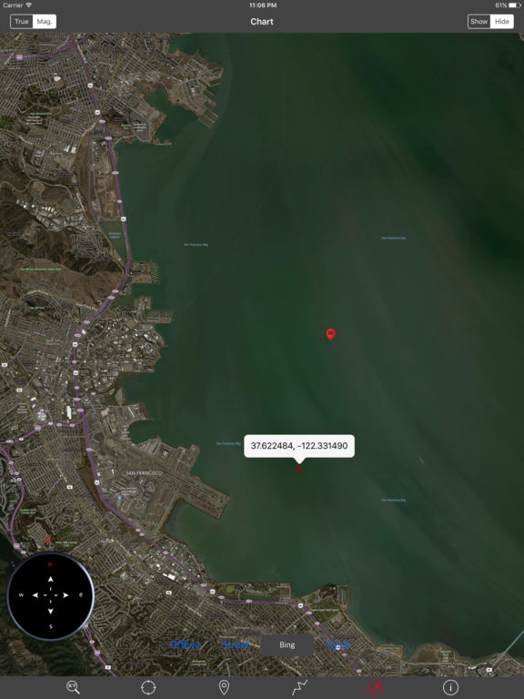
● HIDE AND SHOW CHART OVERLAY TO SEE DIFFERENCE IN AERIAL OR OTHER MAPS.
● INTERACTIVE COMPASS, MOVE AND PLACE ANYWHERE ON MAP SCREEN.
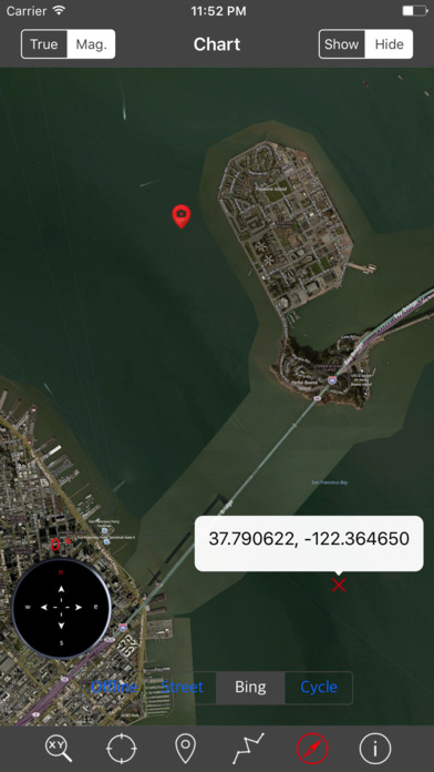
● KNOW ANY LOCATION COORDINATE WITH A SINGLE TAP.
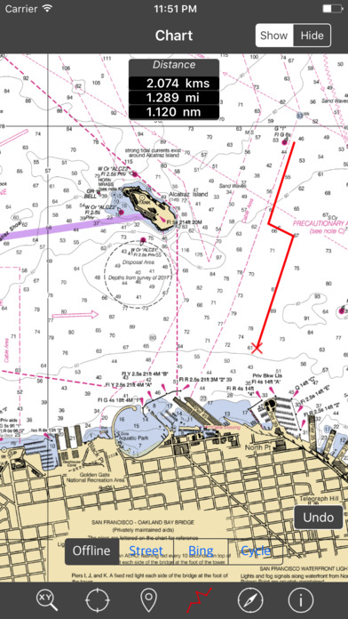
● FIND DISTANCES WITH ROUTE TOOL, DRAW ON MAP AND NAVIGATE ALONG THE ROUTE.
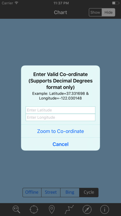
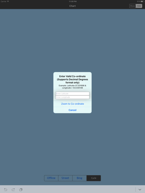
● GOTO MAP LOCATION BY ENTERING LATITUDE/LONGITUDE.
● INSERT UNLIMITED FAVOURITE MARKERS ON MAP. PHOTO TAGGED FACILITY FOR MARKERS WITH EMAIL OPTION. ADD MULTIPLE PHOTOS TO FAVOURITE MARKERS (MAX 3 ALLOWED). EMAIL FAVOURITE MARKERS AS KMZ FILE.
● MAP USER INFORMATION.
NOTE: All charts are Geo-positioned to match the exact location of features displayed on charts but there may be some difference between the positions of actual objects that are in the water or sea and charts because of the different chart scales.
Disclaimer: The Raster Nautical Charts data provided in all charts is from NOAA and is for reference purposes only and not for navigation.
We strive to provide the best products to the customers. Any suggestions from the users of this product are welcome to make the app more useful.
HAPPY BOATING AND SAILING ALL THE TIME!
iPhone Screenshots
(click to enlarge)
iPad Screenshots
(click to enlarge)
App Changes
- May 19, 2017 Initial release
- June 13, 2019 New version 3.0
- June 13, 2019 Price increase: $2.99 -> $3.99
- June 13, 2019 Price increase: $2.99 -> $3.99
- June 14, 2019 Price increase: $2.99 -> $3.99
- June 14, 2019 Price increase: $2.99 -> $3.99
- June 15, 2019 Price increase: $2.99 -> $3.99
- June 15, 2019 Price increase: $2.99 -> $3.99
- June 16, 2019 Price increase: $2.99 -> $3.99
- July 14, 2020 New version 3.5
Other Apps From Vishwam B