
What's New
What’s New:
• Added a disclaimer for SMS malfunctioning with certain carriers.
• Fixed bugs in the account registration process.
• Added the refresh time to the notifications tab when the last server sync occurred.
• Corrected the units error when drawing the watch radius.
Known Bugs/Issues:
• User accounts may periodically become disconnected from the server. In this case, the app fails to send watches to the server, resulting in users not receiving alerts. A weekly reinstallation is recommended.
• Work is underway to correct this issue in the next release.
App Description
Many firefighters have been entrapped due to rapid changes in weather causing unexpected fire behavior. These weather events are often predictable using local weather measurements and forecasts, but on-the-ground firefighters have historically lacked access to this information. The Fire Weather Alert System provides this access. It monitors nearby weather observations and forecasts to warn firefighters of dangerous incoming weather and provides convenient map-based access to fire-specific weather information (RAWS, NWS zone fire weather forecasts, NEXRAD radar data, etc.).
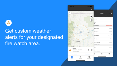
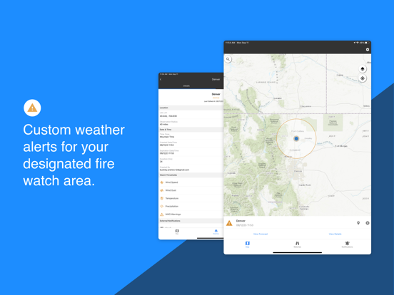
GET CUSTOM WEATHER ALERTS
• Get custom weather alerts when wind speed, wind gust, relative humidity, air temperature, and precipitation exceed your set thresholds.
• RAWS/ASOS stations and short-term forecasts (HRRR model) are monitored.
• Designate the watch area for your fire.
• Alerts broadcast using in-app messages, text, and/or email.
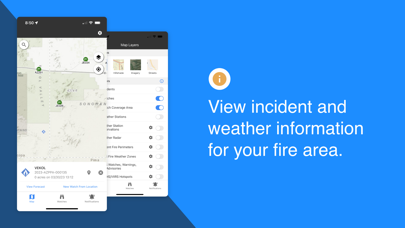
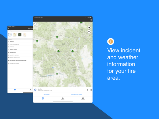
VIEW RAWS DATA
• Select weather stations from a map and view data in graph and tabular form.
• Access RAWS, iRAWS, ASOS, and other station networks.
VIEW SATELLITE HOTSPOTS
• Display VIIRS and MODIS hotspots on the map.
VIEW INCIDENT LOCATIONS AND FIRE PERIMETERS
• View incident name, type, size, and most recent perimeter (including smaller IA fires).
VIEW NWS WATCHES, WARNINGS AND ADVISORIES
• See National Weather Service Active Alerts on the map and read the text.
• Monitor Red Flag Warnings, Fire Weather Watches, Wind Advisories, Severe Thunderstorm Warnings, etc.
ACCESS ZONE FIRE WEATHER FORECASTS
• Access and read your local fire weather forecast.
• See fire weather zone names and boundaries on the map.
MONITOR APPROACHING STORMS WITH NEXRAD RADAR
• Display animated radar data on the map.
iPhone Screenshots
(click to enlarge)
iPad Screenshots
(click to enlarge)
App Changes
- October 03, 2023 Initial release
- March 27, 2024 New version 1.1.0.2
Other Apps From USDA Forest Service