
App Description
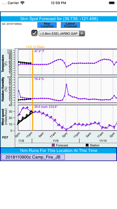
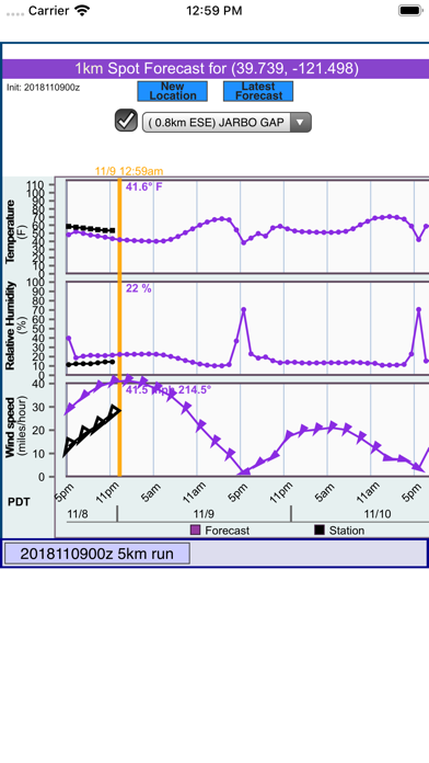
Your trip or field work in the California or Nevada wilderness may be ruined by disastrous natural events such as wildfires. In adverse conditions, having accurate weather information can become a decisive factor in saving property or even your own life. SpotForecast is the mobile app you will want at a moment like this. With only a couple taps on your mobile device, it provides 72-hour forecasts of surface wind, temperature and humidity at your location. Observed weather data from nearby surface stations, including Remote Area Weather Stations (RAWS), are also available during the first few hours of each forecast to display for reference purpose.
This app extracts forecast information from the experimental fire weather prediction project FireBuster (https://fwxfcst.us/firebuster), developed at the Pacific Southwest Research Station of the U.S. Forest Service. Forecasts are produced twice-daily from a regional weather model with a spatial resolution of up to 1-km – higher than any available forecast. High resolution forecasted information is particularly useful in the mountainous area of California and Nevada, which is the primary service area of this mobile app.
iPhone Screenshots
(click to enlarge)

iPad Screenshots
(click to enlarge)


App Changes
- October 28, 2019 Initial release
Other Apps From USDA Forest Service