
What's New
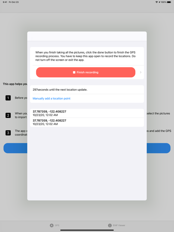
(New) You can now save recorded GPS coordinates. Then, you can add location information to photos later on.
App Description
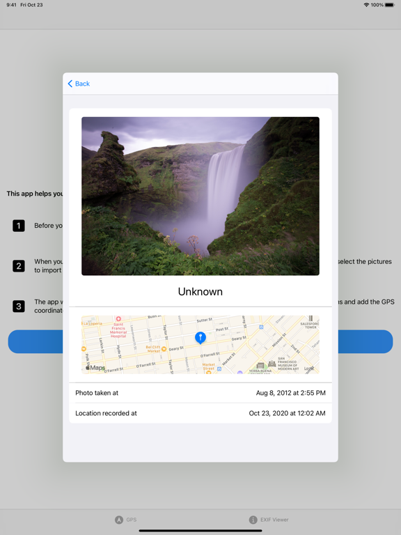
Using a SLR camera to take pictures and want to quickly add GPS location information to the images? GeoEXIF is the tool for you.
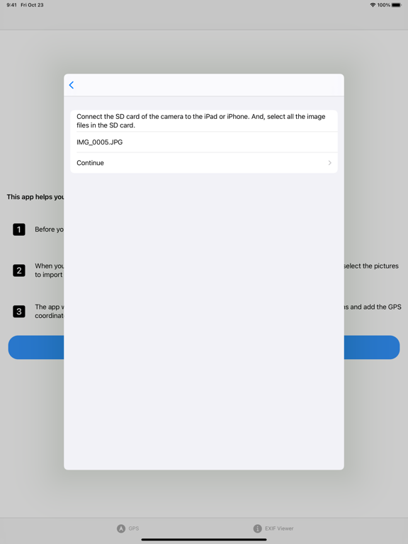
Just open the app, turn on location tracking; after taking the pictures with your SLR camera, connect the SD card to the iPhone (or iPad) running the app, and the app will automatically compare the timestamp of the picture to add GPS data.
3 simple steps:
1. Open the app and start location tracking. Put the phone in your pocket or the iPad in your bag with the app open.
2. Use your SLR camera as usual.
3. When you finish taking all the pictures, connect the SD card of your camera to your iPhone / iPad. Select the pictures with a file selector.
iPhone Screenshots
(click to enlarge)


iPad Screenshots
(click to enlarge)


App Changes
- November 12, 2020 Initial release
- August 06, 2021 New version 2.0
Other Apps From Shunzhe Ma