
What's New
Charts added:
Cape Fear
Delaware Bay
Florida North West
Los Angeles
Los Angeles to Sandiego
Lower Chesapeake
Matagorda Bay
Mississippi River Delta
Nantucket Sound
New Orleans
New Haven Sandy Hook
North Atlantic Canyon East
Outer Delmarva Peninsula
Pamlico Sound
App Description
Mapitech launches Atlas, a worldwide digital cartography that combines vector data with the best official up-to-date paper charts ie marinas, depth contours, wrecks, fishing spots, boat ramps, POI and many other features.
The beauty of paper charts enriched with digital cartography.
Chart details and performance of a professional GPS chart plotter in the palm of your hand.
Appealing appearance, easy to use, useful to have on board with you.
The app works without mobile coverage (offline).
The interactive menu is intuitive and allows you to purchase maps for offline use at an amazing price.
Free Features and Functions:
•Powerful search
•Multiple overlays for different use (fishing, sailing or cruising)
•KML data shareable
•Very detailed and updated charts
•Unlimited Waypoints
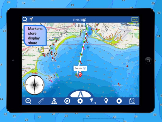
•Markers & Favorites
•Magnifying Lens for all info
•Multiple tracks: Record your track, instant speed time, COG - course over ground
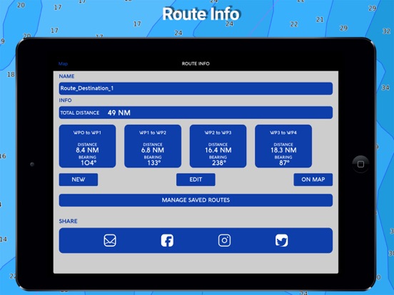
•Route planning, Waypoints - Insert the destination and see in real time your speed, distance and bearing
•Geo-tagged photo management, Share via email, visible on Google
•Distance Measurement Tool to easily calculate the distance
•Compass
•GPS window with very detailed info
•User friendly on latest IOS
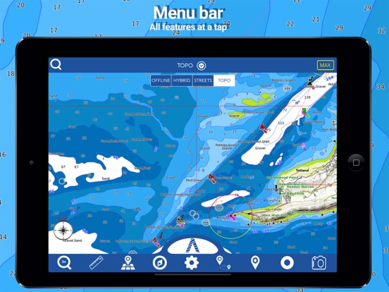
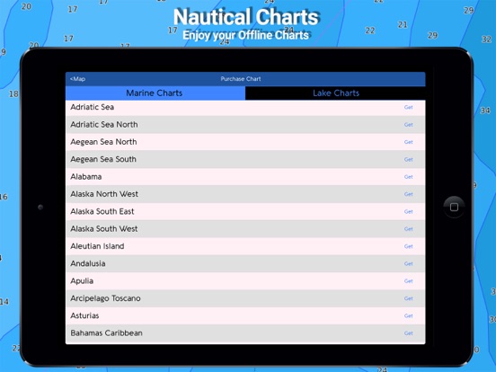
- MARINE MAPS
Detailed Electronic Nautical Charts (ENC) which include Coastline, Anchoring areas, Fishing areas, Restricted areas, Obstructions, Rocks, Buoys, Beacons, Lights, Depth contours, Spot Soundings and more.
- LAKE MAPS
High quality lake maps with detailed information and important features: Depth Contours, Boat Ramps, Fishing spots etc. Maps also include Trails, Roads and Railways information.
PURCHASING INCLUDES:
•Offline Chart: Choose your favorite area from our catalogue and get a detailed chart of your area
•Subscription for 1 year: Get a trial of all our charts and features and subscribe for one year
•Lifetime Purchase: Get all our charts and features for Lifetime
MORE INFO:
Terms of Use: https://mapitech.com/disclaimer/
Privacy Policy: https://mapitech.com/privacy-policy/
iPhone Screenshots
(click to enlarge)


iPad Screenshots
(click to enlarge)


App Changes
- August 17, 2019 Initial release
- August 29, 2019 New version 1.2
- September 11, 2019 New version 1.2.1
- September 26, 2019 New version 1.2.2
- September 30, 2019 New version 1.2.3
- October 22, 2019 New version 1.2.4
- December 03, 2019 New version 1.2.5
- December 17, 2019 New version 1.2.6
- December 24, 2019 New version 1.2.7
- January 22, 2020 New version 1.2.8
- January 28, 2020 New version 1.2.9
- July 15, 2020 New version 1.4.2
- October 23, 2020 New version 1.5.3
- November 12, 2020 New version 1.5.4
- September 16, 2023 New version 1.5.23
Other Apps From MAPITECH LTD