

App Description
YouHike - Yellowstone National Park offers 30 zoomable interactive trail maps of major hiking areas in and around Yellowstone National Park.
With YouHike Yellowstone you can:
* zoom in to present more detailed information.
* keep track of your location, even if you are out of cell phone range.
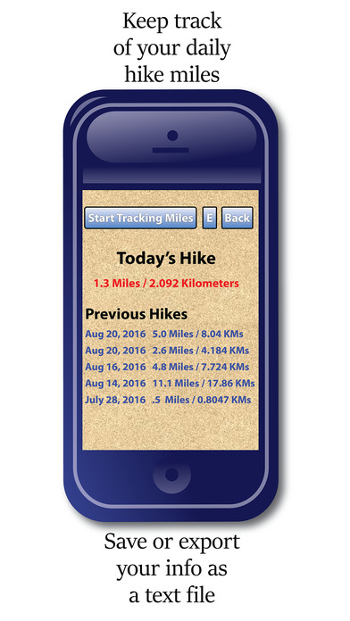
* record information about 'Points of Interest' (POIs) you find along your hike. You can save and export your 'POI' information as a text file, or send your 'POI's to other YouHike users.
* customize your location and 'POI' graphics with over 100 internal icons.
* download more icons from the youhikeapps.com website, or create and import your own icons.
* track your daily hike miles, save and email your stats.
* import your photos from your device's photolibrary and have them appear on-screen in the map location they were taken.
* send your location to other YouHike users.
* use iCloud to sync your 'POI' data between your iPhone and iPad.
YouHike Yellowstone covers over 150 miles of hiking and biking trails including:
Amhurst Mountain, Big Horn Peak, Black Canyon, Buffalo Lake, Buffalo Plateau, Canyon Village, Fishing Bridge, Gardner, Heart Lake, Lamar River, Lamar Valley, Lewis Lake, Lower Geyser Basin, Madison, Mamoth, Mount Washburn, Norris, Old Faithful, Parker Peak, Pitchstone Plateau, Roosevelt Juntion, Sportsman Lake, Summit Lake, Yellowstone Lake, The Trident, Trail Creek, West Thumb, & West Yellowstone.
**Continued use of GPS running in the background can dramatically decrease battery life.
iPhone Screenshots
(click to enlarge)


App Changes
- March 28, 2017 Initial release
Other Apps From John Gray