148 Apps on Facebook 148 Apps on Twitter

Tag: Gps »

Garmin Navigon Apps Getting Street View Upgrade

Posted by Brad Hilderbrand on February 28th, 2012
+ Universal & Apple Watch App - Designed for iPhone, iPad and Apple Watch
Our rating: starstarstarstarhalfstar :: YOU HAVE REACHED YOUR DESTINATION :: Read Review »

At this week's Mobile World Congress in Barcelona, Garmin has announced that it will be adding Google Street View to all Navigon apps later this Spring. This new addition will allow users to get a close-up view of their destinations before they depart, letting them zoom in on target buildings or cross streets so they can more easily spot a previously unvisited locale.A specific launch date for the update was not given, but it should be arriving soon.

This upgrade is a godsend to people like me who really want a street-level view of unvisited locations. It's just so much easier, in my opinion, to find the place you're looking for when you've seen the building, know what side of the street it is on and can see what other buildings and landmarks are nearby. This addition makes an already impressive GPS app even better, and it's getting really hard for just about everyone else out there to compete with Garmin's Navigon offerings.

iSpeedMeter Turns iPhone Into Speedometer

Posted by Greg Dawson on January 24th, 2012
iPhone App - Designed for iPhone, compatible with iPad

iSpeedMeter turns the iPhone into a speedometer enabling users to time themselves on the eighth and quarter mile as well as track how long it takes to go from 0-60 mph. The main tab sports a simply designed user interface that features a carbon fiber background as well as sleek silver incased speedometer.

To track distance versus time the user only needs to touch the second or third tabs to get to the distances mentioned above. Within these tabs, the app features a stoplight that signals down from red to yellow to green similar to that seen at the dragstrip only single lights and not double found on the light tree. The app then tracks the vehicle via the iPhone's built-in GPS feature and displays distance, current speed and percentage completed. As the vehicle passes the various distances the app then displays the splits in mph or k/hm. The app is available for iPhone on the App Store for $.99.

Abvio Offers iPhone Centric Workout Apps

Posted by Jason Wadsworth on January 20th, 2012

App developer, Abvio, has a robust offering of workout apps tailored specifically for the iPhone user. These apps, including Runmeter, Cyclemeter and Walkmeter which respectively track running, cycling, and walking workouts. Each of these apps track and store workout data on the iPhone itself so there is no need for users to connect to any online database to upload or download their data. This can save precious KB for the more data conscious users out there. Users can also post their workout activity to Facebook, Twitter, or dailymile.com and when friends reply to these posts, the apps will report those responses to the user in real time using text-to-speech technology. One voice is included free and other voices are available via in-app purchase for $0.99 each.

As an added bonus, Abvio has recently announced that their apps now support many of the Wahoo Fitness products. Using these monitoring device with their devices, users can track detailed stats on their heart rate and calories burned during their workouts.

CES 2012: TomTom Update Turns To Social Networking

Posted by Blake Grundman on January 12th, 2012
+ Universal App - Designed for iPhone and iPad
Our rating: starstarstarhalfstarblankstar :: TOO MUCH :: Read Review »

At this point it pretty much goes without saying that TomTom is one the most widely used GPS services on the market.  As part of this expansion, they brought their prowess in the navigation world to iOS.  As one might assume, this was a lucrative decision for the company that has paid off for consumers tenfold.

One thing that TomTom has been great about doing is updating their software with different and unique pieces of functionality, features lacking in the competition.  At CES they previewed their upcoming 1.10 update, and the name of the game is social networking.  The core software will now link up with Twitter and Facebook to share destinations and arrival times, all without ever having to leave the application.  Heck, they even made this data available for transfer via text message and email as well!

While this is not exactly in the realm of transportation directions, it certainly makes interesting uses of features already on iOS devices.  We will have more information on the update when it nears release sometime this quarter.  Until then, keep both hands on the wheel.

[gallery]

Parallel Universe Review

Posted by Rob Rich on November 15th, 2011
+ Universal App - Designed for iPhone and iPad

Developer: Incandescence Studios
Price: $0.99
Version: 1.0
App Reviewed on: iPhone 3GS
Graphics / Sound Rating: starstarstarblankstarblankstar
User Interface Rating: starstarstarblankstarblankstar
Gameplay Rating: starstarblankstarblankstarblankstar
Re-use / Replay Value Rating: starstarstarstarblankstar

[rating:overall]

Starting up Parallel Universe for the first time was rather confusing for me. It wasn't so much that it was a complicated process, but rather that I was lacking in a proper degree of understanding. At least initially. Even after rereading the press info document (repeatedly) and restarting my map once or twice in order to experiment I was still fairly lost. It wasn't until I'd messed around with it for a couple of days that things finally made sense. For better or worse.

I'll attempt to explain Parallel Universe to the best of my ability so that anyone else attempting to play around with it won't be quite as lost as I was: It's essentially a map-making "game" that utilizes location services and 8-bit graphics. When a map is created, it just sort of exists with the chosen player character (male or female) sitting in the middle of it. Sticking to a small area for a bit will result in the construction and upgrading of buildings, while wandering through the neighborhood will create roads. After a night on the town or even a day at school, portions of the map will start to appear significantly different.

Parallel Universe is most certainly a fascinating idea. The concept of creating a personalized pseudo-fantasy world through a kind of augmented reality is more than a little novel, and watching the world change and grow around my little character is pretty darn cool. I also have to admit, the looped chiptune music fits the tone quite well and manages to avoid becoming obnoxious. So kudos to the sound designer/composer.

The problem I'm running into is that Parallel Universe wasn't really designed with New York living in mind. It doesn't run in the background so as to save battery life, which is a noble gesture but it means that cities will only begin to pop up if it's left on. And walking around Manhattan while staring at my iPhone screen isn't particularly safe. Or smart. I could leave it running and just start walking, but it would still shut itself off after a minute or so. Even sticking to one spot to build cities is fairly unimpressive, as it still requires leaving the app running and constantly tapping the screen to keep it on.

I think Parallel Universe is a fantastic proof-of-concept, but it's going to need a lot of adjustments before it's really any fun. It's more framework than fleshed-out game. I could see things like RPG-style quests, the ability to link images to specific spots on the map (i.e. taking pictures while out for a walk) or even simple stat-tracking making a difference here. I really hope we see some content updates in the future because it shows immense promise.

Social Networking Based Navigational App Waze Is Updated To 3.0

Posted by Jennifer Allen on October 20th, 2011

What's the best way of knowing how to travel around an area? A satnav app like TomTom? That would be an easy thing to assume but it's actually the wrong answer. The best way to explore anywhere is via local knowledge, right down to knowing where the regular traffic hotspots are or a new set of roadworks, recently installed in the area.

Waze has done a pretty good job in the past of providing social mobile navigation that combines gaming and crowd-sourcing in order to provide real-time, live maps and data. We already covered how useful Waze was last year, but it's now even better thanks to a significant update in the form of 3.0.

Waze 3.0 has had its entire UI redesigned in order to implement a new and more minimalist interface. Two large buttons form the focus for much of the app, ensuring it's easy to use. It's also pretty glorious to look at with cutesy logos making for a much more attractive appearance than what we all know and are used to with navigational apps.

A new search engine means that Waze is fully integrated with Yelp, Foursquare and Bing. This means it's easy for users to search for, navigate to and check-in at numerous destinations they might not have already known about. Such functionality makes for exciting developments such as real-time POIs (Points of Interest) such as the recent OccupyWallStreet protests and other similar fast moving events.

A wall type communication system has been added to Waze Groups, enabling users to chat with others in the area. A Waze mood feature provides more social networking fun, also.

Full text to speech functionality has been added for US and Canadian users along with other minor but ever useful changes such as the speed boost that Waze has profited from.

All these features put together means that Waze is now a pretty intelligent and worthwhile alternative to other Sat Nav products, even more so given the fact that it costs absolutely nothing to download!


GPS Navigation 2 - skobbler (US/CAN) Review

+ Universal App - Designed for iPhone and iPad
By Greg Dawson on October 17th, 2011
Our rating: starstarstarstarhalfstar :: GPS NAV
GPS Navigation 2 offers street level turn-by-turn directions for $.99.
Read The Full Review »

Garmin StreetPilot onDemand Review

iPhone App - Designed for iPhone, compatible with iPad
By Phillip Levin on September 12th, 2011
Our rating: starstarstarstarblankstar :: AFFORDABLE
Affordable GPS navigation for iPhone.
Read The Full Review »

NAVIGON Announces Next Generation Navigation Apps

Posted by Rob LeFebvre on September 6th, 2011
+ Universal & Apple Watch App - Designed for iPhone, iPad and Apple Watch
Our rating: starstarstarstarhalfstar :: YOU HAVE REACHED YOUR DESTINATION :: Read Review »

NAVIGON AG, one of the big navigation companies out there, announced this past THursday not just an update, but a full re-definition of their smartphone navigation software, available for the iPhone and other smartphone platforms, including Android (now) and Windows Phone 7 (later this year).

“Over the last two years, we’ve continuously added new features to our navigation apps, transforming them into the most feature-rich smartphone GPS apps available,” said Gerhard Mayr, NAVIGON vice-president of worldwide mobile phones and new markets. “For our new generation of apps, we went back to the drawing board to see how we could elevate smartphone navigation to the next level. Feedback from our users suggests that a better way to manage and update maps and a more intuitive user interface are top priorities.”

Sounds good, right? What does it boil down to? Here's what we're seeing:

New map management and update abilities are in the update, allowing users to download regional maps on the fly. This could allow users to have, say, only the maps of the states they travel in most, rather than an entire United States or pre-defined region sitting on their iPhone taking up space better spent on new ringtones. The maps themselves will be updated from NAVTEQ on a quarterly basis, ensuring the freshest maps available to users for a one-time fee, good for the lifetime of the software. The user interface has also been updated to more easily match the iOS environment in which it is running (or the platform on which it is running, if not iOS). In addition, NAVIGON includes a speed camera warning feature and a cockpit function that displays real-time driving data, allowing those enthusiasts to monitor their driving behaviors right from the app.

NAVIGON AG was founded in 1991, and operates out of Hamburg, Germany. They were recently acquired by Garmin, and current offer smartphone apps for on-board navigation utility. The new update will be available free to current NAVIGON app users sometime this fall.

Direction Known: A Different Kind of GPS App

Posted by Rob Rich on September 6th, 2011
+ Universal App - Designed for iPhone and iPad

Know those corny signs that are up in just about any tourist-heavy area which show people which direction and how far another tourist-heavy attraction/city/state is? Something like an arrow sticking out of the ground in Maine, pointing West and proudly displaying "Hollywood: 'X' miles." Well Direction Known does something similar, only with customizable lists of things to point at and a readout that updates and syncs in real-time as the user moves around.

As someone living in a major metropolitan center, I can't exactly walk a straight line to wherever it is I need to go. However, anyone who's ever tried navigating anywhere on foot ever knows that even having a general idea of where their destination is can be a huge help. Of course, there's also the option to use the device's built-in GPS to check the map.

Direction Known does have plenty of practical uses, including finding a friend at the park, trying to figure out which direction to start walking in after getting off the subway or finding one's way out of the wilderness (if there's a signal). It also has some non-practical uses, like showing the kids how much farther until they reach grandma and grandpa's house or letting said grandparents watch their family getting closer. It can also be used for purely nostalgic purposes, such as having an arrow that always points to one's childhood home. Locations can be saved in separate groups, keeping things from getting too cluttered and giving users more control over what they're trying to find.

Upon first glance, Direction Known might look like nothing more than a colorful compass, but it can be much more than that. It can be incredibly helpful in the right situation, and it can illicit a nostalgic smile in others. Ultimately it's up to the individual user to decide. Regardless of how it's used, it's available in the App Store right now.


Garmin Releases StreetPilot onDemand App

Posted by Rob LeFebvre on September 6th, 2011
iPhone App - Designed for iPhone, compatible with iPad
Our rating: starstarstarstarblankstar :: AFFORDABLE :: Read Review »

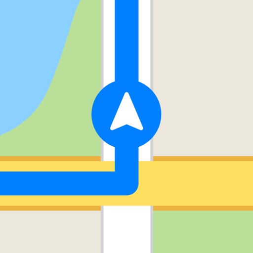
Garmin announced this past week that their new StreetPilot onDemand iPhone app was live in the App Store. Coming in at a very sweet initial price point of $0.99, StreetPilot onDemand may well be the new Freemium of GPS apps.

The app itself offers 30 days of premium features for that dollar, including multimodal pedestrian routing, bus/train schedules, spoken turn-by-turn guidance with street names, 3D representations of buildings, traffic rerouting, photoReal Junction View and Google Local Search. Once the free month is up, users can pay $2.99 monthly or $29.99 annually, with a special introductory $19.99 annual price for this first year.

“Our new StreetPilot onDemand app is the perfect solution for anyone who occasionally needs navigation but still is looking for a premium experience and precise directions. There is nothing comparable in the App Store today,” said Dan Bartel, Garmin’s vice president of worldwide sales. “By including multimodal pedestrian routing, our new app is especially helpful for users in urban areas. The app seamlessly provides directions in the car and integrates public transportation when getting directions by foot.”

Multimodal pedestrian routing allows users to integrate walking with public transportation options, giving them the option to navigate to destinations from their current, GPS-located position or from a different starting spot. The pedestrian navigation is also turn-by-turn spoken, with instructions for transit in cities that the service is available in. The 3D building and landmark symbols should make it even easier for pedestrians to get to where they need to go. It's great to see such attention to detail for folks who don't use a car as the primary mode of transportation.

For those that do, Garmin has them covered as well, including turn-by-turn spoken navigation instructions and a realistic depiction of road junctions (photoReal Junction view) and real time traffic info. Users can also find local business with integrated Google Local Search, or let the app suggest places to them based on previous local search history. The above mentioned subscription is required for turn-by-turn voice guidance with automatic off-route recalculation, real-time traffic information and multimodal pedestrian routing, however.

StreetPilot onDemand is available now in the App Store.


[gallery]

TomTom Adds New Traffic Service and Multi-Stop Routes

Posted by Kevin Stout on August 1st, 2011

One of the most popular (and expensive!) navigation apps on iOS, TomTom, has just released it’s newest update, 1.8, that includes a new add-on called TomTom Traffic HD. The add-on, available via in-app purchase, helps the driver find solutions to avoid traffic jams and delays. The traffic is advertised to update every two minutes, providing incredibly up-to-date traffic information. The in-app purchase for the TomTom Traffic HD service costs $19.99. The TomTom Traffic HD service is part of TomTom's recent mission to reduce traffic congestion everywhere. Read more about TomTom's traffic reduction plans here.

Also available with the 1.8 release of TomTom is multi-stop routes. Users can now add up to five planned stops for their trips. iOS navigation apps are getting closer and closer to rival their dedicated GPS system counterparts. And with the release of TomTom’s 1.8 release, it just got closer. I personally don’t use a dedicated GPS system; I use iPhone GPS apps like TomTom. The 1.8 release also updates the map including recent road changes.

IM+ Pro Update Adds Neighbours Feature

Posted by Jennifer Allen on May 10th, 2011
+ Universal App - Designed for iPhone and iPad

Consistently popular instant messaging app IM+ Pro has just had a new feature added in the latest update. It sounds like a great way of bridging the gap between virtual and 'real life' social networking too.

The Neighbors feature enables users to find people locally who have similar interests by locating them on the IM+ map. Besides being able to locate your friends on the map at any time (with appropriate privacy settings on offer), you can also get to know new people through the app.

Through the interface, you can post local announcements such as offering goods or services for sale locally as well as see other sellers and their products.

It's a pretty neat idea so it'll be interesting to see how it works out on a worldwide scale.

The update is available now for all IM+ Pro owners. For those interested in buying the app for the first time, it's an universal app and available for $7.99

Apple Issues Press Release Addressing Location Tracking Controversy

Posted by Carter Dotson on April 29th, 2011

Apple has released a press release addressing some of the issues that have arisen in the past week with the recent controversy over the location tracking controversy. First, Apple claims that the iPhone is not tracking users' locations - they're "maintaining a database of Wi-Fi hotspots and cell towers around [users'] current location," which is designed to "help your iPhone rapidly and accurately calculate its location when requested," as GPS satellite data can take up to several minutes to triangulate, and using information about nearby wireless networks and cell towers can speed up this process.

One of the big issues is that the iPhone is storing a large cache of data - according to Apple, this is not the actual user location, but a cache of the wifi/cell tower around you. The problem is that the cache isn't getting cleared out, and this is a bug that Apple is claiming will be fixed in a future software update. This is in line with what John Gruber has said recently, that the length of the history of this cache is a glitch. Apple claims that they cannot track you with this data - that it is sent to them "in an anonymous and encrypted form" and that "Apple cannot identify the source of this data." As well, this cache will no longer be backed up in iTunes, and that the file will be encrypted in the next major software update. Now, one of the other controversies is that this data was still being sent (approximately every 12 hours, according to research) even if Location Services were turned off. Apple is claiming that this too is a bug, and one that will be fixed in a software update in the near future.

Now, skeptics may claim that this is old information, and Apple are only addressing it now as the controversy has risen up. Alex Levinson and Sean Morrissey published a book about this in December 2010, after all. However, consider that very few people actually knew about this until the recent controversy that flared up, and it seems plausible that Apple could be telling the truth, especially as Apple is now largely adjusted their behavior to similar to what Android does. As well, Apple has mentioned that they're starting to collect traffic data in order to provide "iPhone users an improved traffic service in the next couple of years." Along with Apple dumping Skyhook for location services last year, Apple has plenty of reason to be collecting location data. At worst, at least Apple is now fixing these issues since people have been complaining about them.

Source: Engadget

GEO Hunters Review

iPhone App - Designed for iPhone, compatible with iPad
By Jennifer Allen on March 29th, 2011
Our rating: starstarstarstarblankstar :: AMBITIOUS
GEO Hunters is an ambitious location based role playing game that's pretty addictive.
Read The Full Review »