
What's New
New feature: Download waypoints from OpenStreetMap.
First launch: Authorization to use camera and notifications.
Map: Multiline distance: Colors based on visibility.
Preferences - Distance, Area: Visible/invisible distance line attributes.
Preferences - Send OkMap - New indicators.
Added indicators: Sent track points, sent waypoints and failed sends to server.
Minor bug fixes.
App Description
OkMap Mobile is easy to use and its features are similar to those of the most popular GPS handhelds.
Plan your routes on the map! OkMap calculates the height differences and travel times for you and produces statistics and graphics.
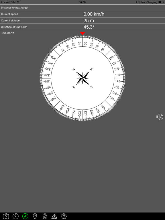
A compass shows you the direction and you will be warned if you are going off course.
OkMap is specially designed for those who do outdoor activities such as search and rescue, hiking, mountain biking, off road, boating, flying, hunting and fishing, mushroom hunting, geocaching, soft air and much more.
OkMap works with different online maps and offline custom maps in MbTiles format.
You can use your favorite digital maps both acquired and scanned!
Furthermore OkMap works with GPX files, the standard format for storing waypoints, tracks and routes.
These files can be copied to and from the PC via cable or via Google Drive.
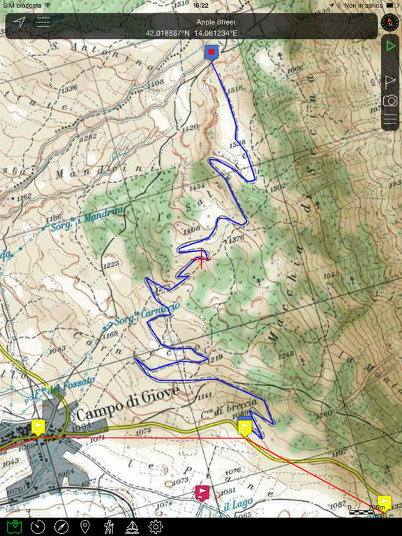
You can record the track while walking on a trail and/or follow a previously recorded or created track.
All waypoints, tracks and routes are displayed on the map; the recording track is drawn in real time.
OkMap records the tracks even in standby and with the app closed. A notification alerts you when the GPS is working.
You can create and edit waypoints, tracks and routes directly on the map.
It is also possible to produce different types of statistics and graphs on your own tracks.
FUNCTIONS
Maps
- Offline custom map in MbTiles format
- Online maps from different TMS and WMS web servers (Google, Apple, OpenStreetMap, ESRI, Nokia, etc ...)
- Addition of new custom web servers
- 6 customizable navigation and status indicators (from over 60)
- Coordinates in different datums and formats: Degrees, Degrees-Minutes, Degrees-Minutes-Seconds, UTM, ECEF, OLC, GeoRef, USNG, MGRS, BNG, IG, metrics according to many projections
- Zoom on: GPX data, copied coordinates
- Mode: follow the user's position, distance calculation
- Grids: geographic, metric and DEM data
- Find: waypoint, track, route, address, coordinates
- Reverse geocoding
- Waypoint generation
- Download and management of elevation data (DEM) from the SRTM project
- Integration with: Google Maps, Geocaching.com, Peakfinder.org
- Create and edit waypoints, tracks and routes on the map
Navigation
- GPS activation/deactivation
- Start, pause and stop recording of the track
- Stores waypoint at current location
- Navigate to a waypoint and follow a track or a route
- Waypoint proximity function
- Anchor alarm
- Off course alarm
- Sending values via email
- Sending the position to a remote OkMap server
Trip Computer
- On-board computer with over 60 navigation and status indicators
Compass
- 6 customizable navigation and status indicators (from over 60)
- Graphic compass with direction of north and destination
- Speech synthesizer when pointing the device
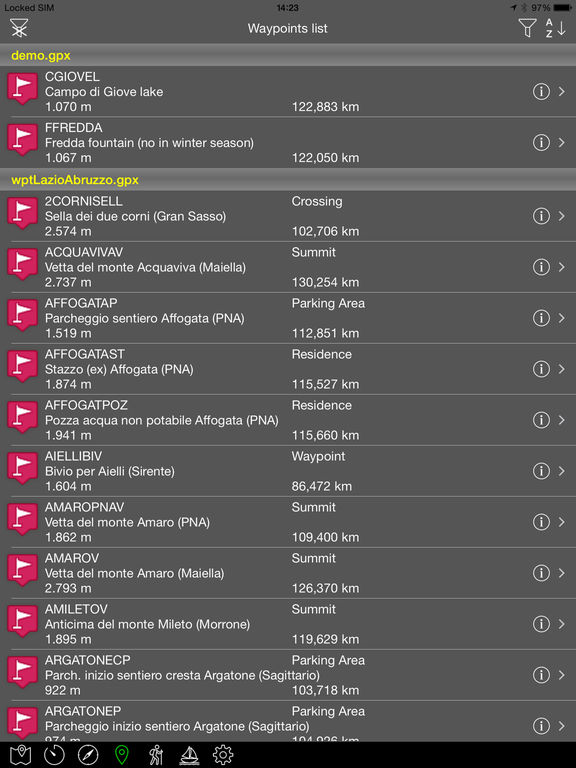
Waypoints, Tracks and Routes
- Lists of various kinds
- Edit and delete functions
- Sorting and filtering functions
- Information detail pages
- Track graphs
- Track statistics
- Track and route inversion
- Automatic attribution of altitudes
- Travel time estimation function
Utility
- List of GPX file
- List of custom maps
- List of downloaded DEM files
- List of web maps
- List of datum
- List of projections
- Preferences
- Reset to factory settings
- Information and links
- Download the online manual
iPhone Screenshots
(click to enlarge)


iPad Screenshots
(click to enlarge)


App Changes
- January 18, 2015 Initial release
- March 16, 2015 New version 1.1
- April 14, 2015 New version 1.2
- May 22, 2015 New version 1.3
- June 10, 2015 New version 2.0
- November 24, 2015 New version 2.1
- December 22, 2015 New version 2.2
- January 09, 2016 New version 2.3
- January 26, 2016 New version 2.4
- March 06, 2016 New version 2.5
- June 13, 2019 New version 3.3
- November 26, 2019 Price decrease: $3.99 -> FREE!
- July 14, 2020 New version 3.4
- September 16, 2023 New version 4.03
- September 16, 2023 Price increase: FREE! -> $3.99
- October 04, 2023 New version 4.04
Other Apps From Gian Paolo Saliola