

App Description
Les Trois Vallées Ski Map provides a detailed map of the Les Trois Vallées ski area. Ski Map contains the pistes and lifts, and shows where you are on the piste. The Ski Map works 100% without internet connection, no charges for data. The search engine lets you find thousands street names, towns, points of interest etc. in your ski area.
- Detailed map of the Les Trois Vallées ski area (Val Thorens, Les Menuires, La Tania, Méribel Mottaret, Méribel, Courchevel, Brides les Bains, Saint Martin de Belleville)
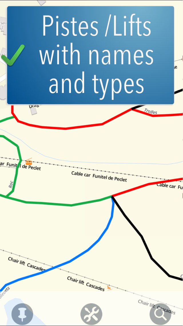
- Pistes with name and color (green, blue, red, black)
- Ski lifts with name and type (surface lift, chair lift, gondola)
- Your current location is shown on the map (also on the pistes!)
- No Internet connection needed, no data charges
- Easy to read
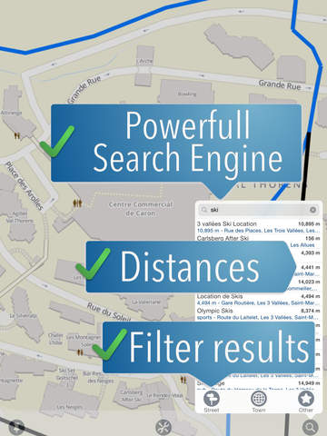
- Advanced search engine with thousands street names, towns, points of interest etc.
- "Nearby" feature shows restaurants, car parks, culture, shopping etc. in your vicinity.
- Create markers on the map
- No further costs, no in-app purchase.
iPhone Screenshots
(click to enlarge)


iPad Screenshots
(click to enlarge)


App Changes
- November 04, 2014 Initial release
Other Apps From travelmapp.com bv