
What's New
• Nice speed improvements.
• New PDF rendering engine that is significantly faster and properly displays the USGS USTopo map series.
• No google advertisements and no trackers.
App Description
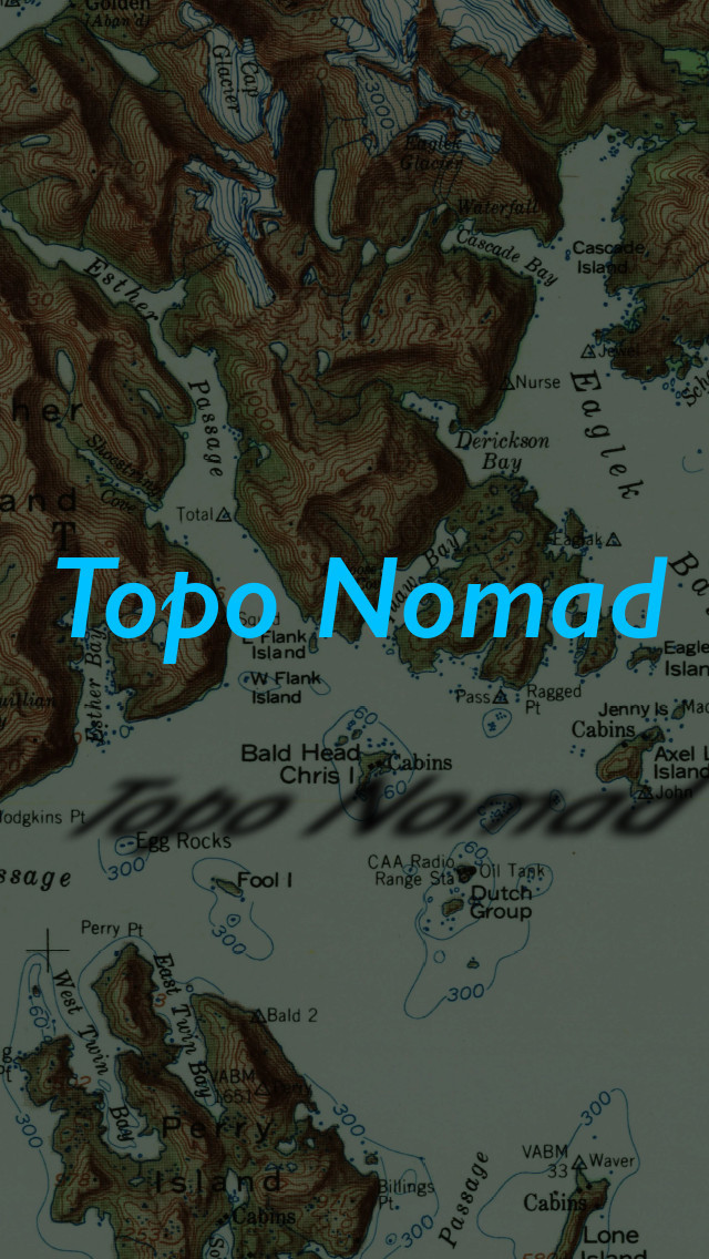
Download high resolution USGS topographical maps for offline GPS* use.
Topo Nomad is designed for road trips, camping, hiking, exploration and geographical history. Map images are accurately center aligned regardless of datum and placed on top of Apple's map kit for easy referencing and intuitive touch navigation.
This software utilizes the latest capabilities of IOS offering the highest performance with fast start up, map rotation, rendering and zoom with unbeatable details and undistorted resolution. Map downloads are dispatched in the background so you can continue using the app while new maps concurrently install.
Topo Nomad indexes of over 250,000+ U.S. Geological Survey current and historical topographic maps describing the topography of every region and island territories of the United States of America. Historical versions date as far back as year 1884. Install a map quad by pressing and holding a point on the reference map and discover the USGS historical maps available at that coordinate and the unique names given to every quad by the cartographers.**
The limits don't stop there with just USGS maps. Import "Geospatial PDF" maps from the web, iTunes and email. Many local and national park services offer PDF map downloads from their web sites which automatically install into the Topo Nomad app. And, if you reside outside the United States check with your government services for topographic and aeronautical sectional maps with embedded geospatial metadata.‡
Cannot find that map you downloaded but know where in the world it's located. Simply zoom out the reference map view and all the topo maps become a colorful violet and partially transparent so you can spot your map. Installed maps are managed in a table format which can be sorted by name, distance, and scale. Multiple versions of the same map can be stacked on top of one another and made visible or hidden using two finger swipes.
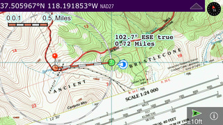
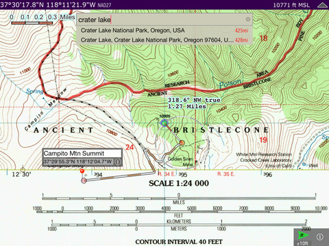
Planning a hike somewhere and want to know the distance of your jaunt. Download the map and use the dual mode ruler to measure the path distance and know the answer to "how much farther?"
Purchase a subscription for unlimited map downloading. A subscription stops ads and doesn't auto-renew. The first few map download are complementary.‡
Features:
• No need for cellular service to use maps
• GPS location on downloaded topo maps while offline
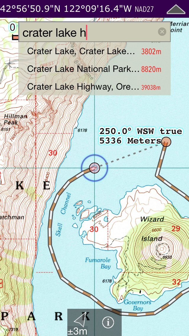
• Find geographic features with geocode search
• Track path GPS recording*
• Route paths and distance
• Dual mode ruler with orthographic line and path measuring
• Full app usability while maps download in the background
• Displays footprint grid and quadrangle names
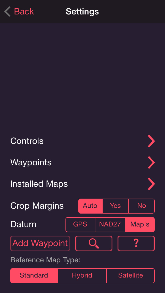
• Aligns all map datums to WGS84 GPS coordinates
• Dynamic map stitching
• Cropping of map margins for one big map grid
• Automatic map download for your current location
• Uses GPS location service to identify your location on a topo map
• Miles, Feet, Kilometers, Meters, Nautical Miles units
• MGRS, UTM and geodetic Latitude and Longitude decimal and minutes seconds coordinate display
• Import maps downloaded from the USGS in zip and PDF file formats
• Import Geospatial PDF map images via a the web, email attachment & iTunes
• MSL elevation for GPS location
• Waypoints with Augmented Reality finder
• Email and SMS text waypoints, tracks and routes as GPX files with subscription purchase
Not currently supported: geo-TIFF; PDF OCG Layers. Not all geospatial datums and metadata formats are supported, please email support with Geospatial PDF issues.
* Continued use of GPS running in the background can dramatically decrease battery life. Location feature may not function on iPod and wifi-only iPad devices without GPS hardware.
** Not preloaded with maps. WiFi recommended. Downloading queue caps to around 36 maps.
‡ After a subscription period expires, advertisement may resume from usage of the import features.
iPhone Screenshots
(click to enlarge)

iPad Screenshots
(click to enlarge)


App Changes
- August 24, 2014 Initial release
- August 29, 2014 Price decrease: $5.99 -> $3.99
- September 03, 2014 Price increase: $3.99 -> $5.99
- September 05, 2014 Price decrease: $5.99 -> $4.99
- September 27, 2014 Price decrease: $4.99 -> $3.99
- November 16, 2014 New version 1.1
- November 21, 2014 Price increase: $3.99 -> $4.99
- November 26, 2014 Price increase: $4.99 -> $5.99
- December 21, 2014 New version 1.2
- March 10, 2015 Price decrease: $5.99 -> $4.99
- April 14, 2015 New version 2.1
- April 27, 2015 Price increase: $4.99 -> $6.99
- July 01, 2015 Price decrease: $6.99 -> $3.99
- August 20, 2015 Price decrease: $3.99 -> $0.99
- August 25, 2015 Price increase: $0.99 -> $4.99
- August 28, 2015 Price decrease: $4.99 -> $3.99
- September 01, 2015 Price decrease: $3.99 -> $2.99
- September 02, 2015 Price increase: $2.99 -> $3.99
- September 03, 2015 Price decrease: $3.99 -> $0.99
- September 06, 2015 Price increase: $0.99 -> $4.99
- September 10, 2015 Price decrease: $4.99 -> $3.99
- February 02, 2016 New version 3.5
- February 02, 2016 Price increase: $3.99 -> $5.99
- February 20, 2016 New version 3.6
- February 20, 2016 Price increase: $5.99 -> $7.99
- March 05, 2016 New version 3.6.1
- March 05, 2016 Price increase: $7.99 -> $8.99
- June 21, 2016 New version 3.8
- June 21, 2016 Price decrease: $8.99 -> $7.99
- November 05, 2016 New version 5.0
- November 05, 2016 Price decrease: $7.99 -> FREE!
- June 14, 2019 New version 7.2
- September 16, 2023 New version 8.1
Other Apps From Delcartes LLC