
What's New
Removal of arm7 support to reduce app bundle size.
App Description
Recognised as one of "10 Of The Best Map Apps" as reviewed by TechWeekEurope UK.
As featured in Ordnance Survey's OS OpenData innovative application showcase.
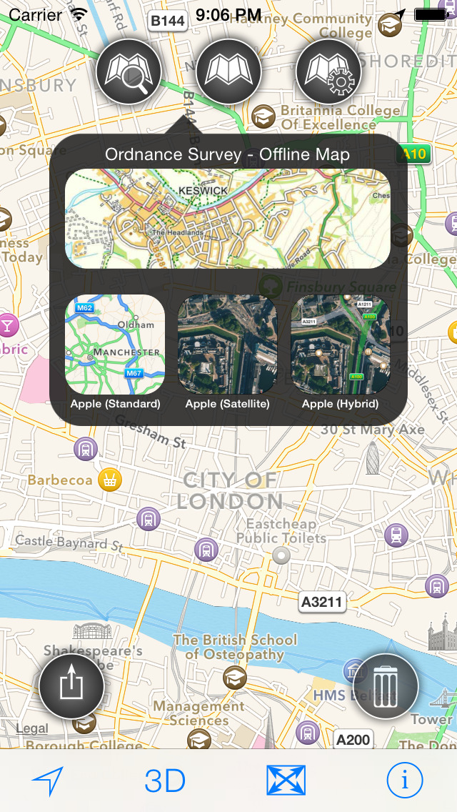
GB Maps LT provides a useful online and offline mapping reference and navigation aid whilst travelling by road, rail, canal, river, sea waters. A powerful offline search facility can locate over nearly 260,000 places within Great Britain. Many of the standard Apple maps features (e.g. User Tracking, 3D buildings, Points of interest) are available for use with Apple Standard, Satellite and Hybrid maps as well as Great Britain Ordnance Survey offline maps.
App features
- Offline access to Ordnance Survey (OS) Great Britain (GB) maps published in 2014/2015. (No data connection required)
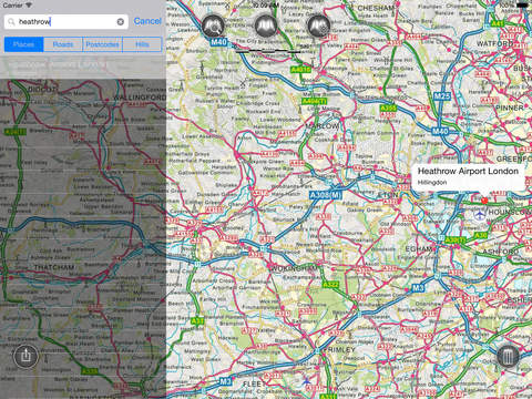
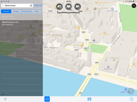
- Offline search functionality with nearly 260,000 GB searchable locations. No data connection required.
-258,418 place names
- Online access to worldwide Apple Standard, Satellite and Hybrid maps.
- Apple 3D Buildings are displayed on Apple Standard maps.
- Apple maps contain Points of Interest.
- Display of current location information (optionally as a GB Ordnance survey grid reference)
- User location can be tracked with or without heading on all online and offline maps (GPS capable devices only)
- Display of scale bar in either metric or imperial units.
- Display of current speed.
- Zoom, pan, rotation of all maps.
- Pitch of Apple standard and Ordnance Survey maps.
- Selection of current location annotation for display of speed and location data.
- User setting for speed display in Miles per Hour (mph) or Kilometers per Hour (kph)
- User setting for display of current GPS position as Ordnance Survey Grid Reference or WGS84 latitude and longitude.
- "Share My Location" User Interface preview.
- Selection of search result pin annotations to display location information.
- Collective deletion of search result annotation pins.
- A user guide is provided within the app information.
- Attributions to data suppliers are provided within the app.
- A convenient link to the App store review is provided within the app.
Further application details.
The place name data was published by Ordnance Survey in May/June 2014.
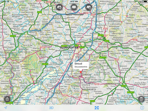
Four levels of Ordnance Survey map detail are accessible within the application relating to different zoom levels. At the lowest zoom levels an overview of Great Britain is provided.
At the third level of detail, the map clearly shows the landscape features relevant to its scale, including boundaries, settlements, main communications and physical features. The map data for this detail level was published by OS in January 2015.
The most detailed zoom levels features a 1:250 000 scale map published by OS in 2014. The map is a small-scale, mapping product giving a regional view, similar in content and appearance to a typical road atlas. It clearly shows the landscape features relevant to its scale, including cities, towns, many villages, motorways, A and B class roads, railways, rivers and some woodlands.
The OS search data was published by Ordnance Survey in 2014.
No warranty
The data is supplied by Apple and Ordnance Survey.
The Information is licensed 'as is' and the Information Provider and/or Licensor excludes all representations, warranties, obligations and liabilities in relation to the Information to the maximum extent permitted by law.
The Information Provider and/or Licensor are not liable for any errors or omissions in the Information and shall not be liable for any loss, injury or damage of any kind caused by its use.
This app is not a substitute for a paper map and compass.
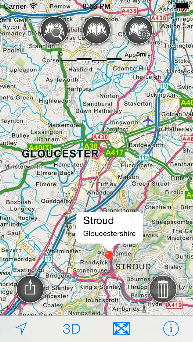
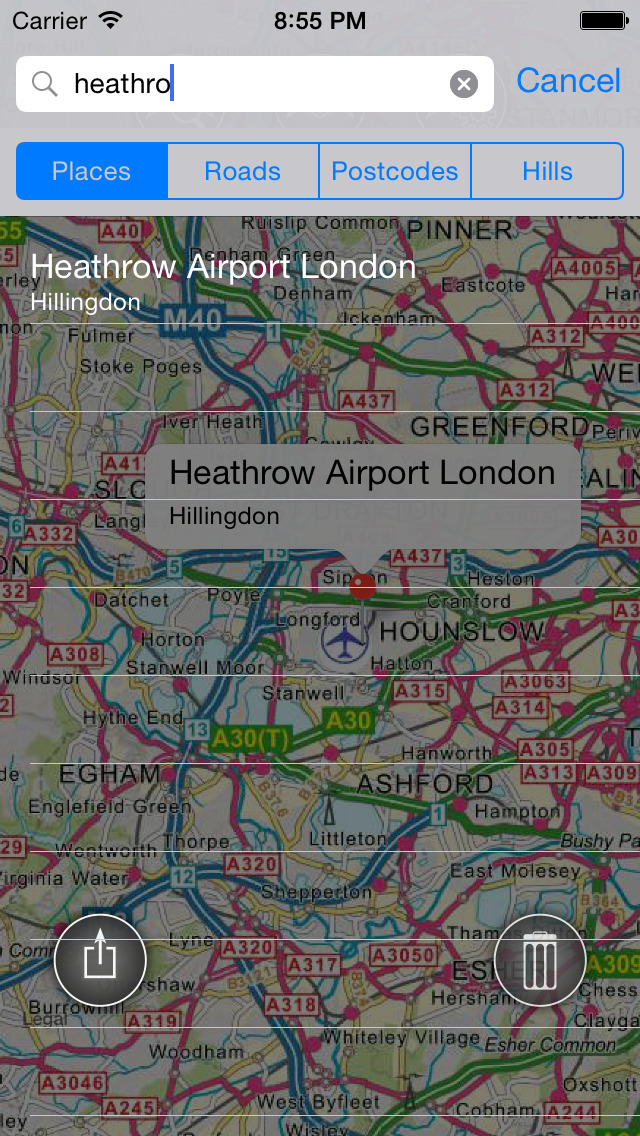
iPhone Screenshots
(click to enlarge)


iPad Screenshots
(click to enlarge)


App Changes
- August 30, 2014 Initial release
- October 08, 2014 New version 1.0.1
- November 06, 2014 New version 2.0.0
- November 13, 2014 New version 2.1.0
- November 22, 2014 New version 2.2.0
- January 24, 2015 New version 2.2.2
- February 03, 2015 New version 2.3.0
- March 01, 2015 New version 2.4.0
- March 07, 2015 New version 2.5.0
- May 05, 2015 New version 2.6.0
- August 02, 2016 New version 2.7.0
- November 07, 2016 New version 2.7.2
Other Apps From JOMO Solutions Ltd.