
What's New
- Improved app responsiveness
- Bug fixes
- Small changes to app layout
App Description
Lanzarote map provides a detailed and easy-to-use map based on data from OpenStreetMap project, a publicly available geographic database with global coverage.
The application has the following features:
* high detail map of the island
* street name search: you can search a street by municipality and street name (all streets covered by the map are included)
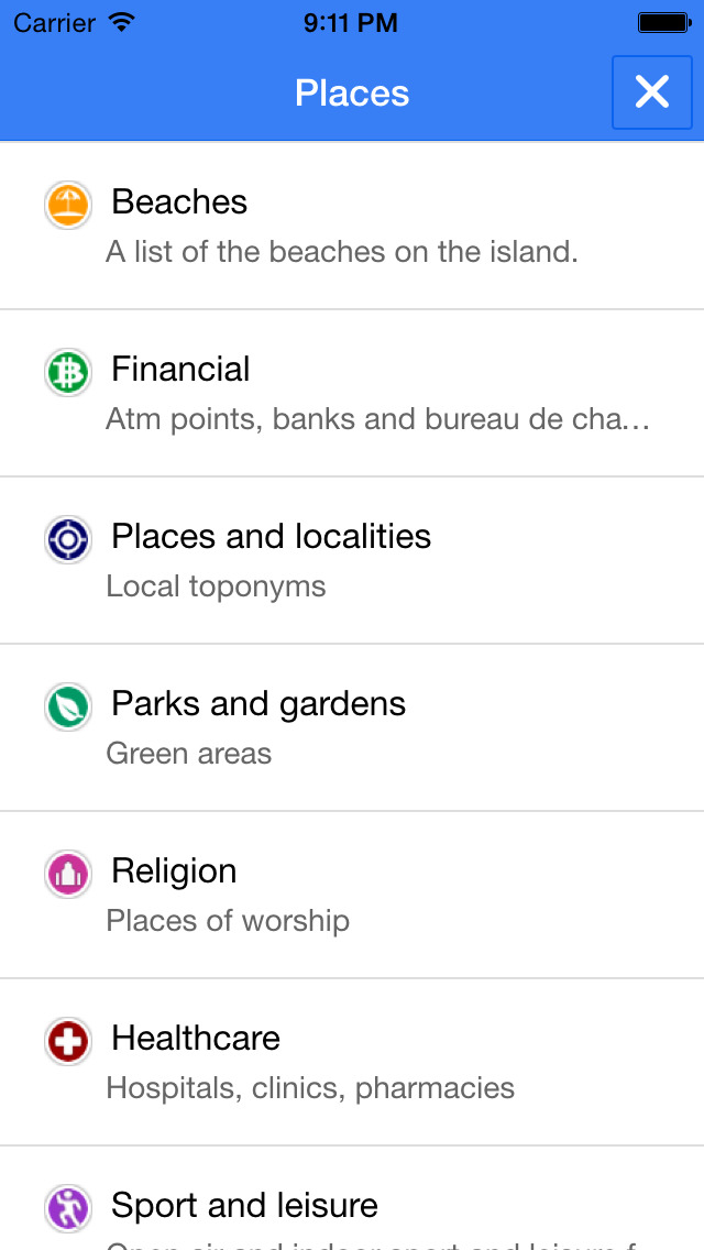
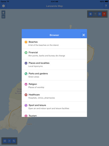
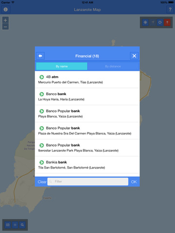
* beaches, places and localities, tourism related points of interest and many more useful categorized spots that you can easy show or hide on the map
* browsing of points of interest by category
* full offline browsing
* display of your current position
* the map can rotate and optionally auto-rotate to follow your current heading
Check out www.openstreetmap.org for more information and to contribute to the project.
The map covers the box ranging from (-13.93918687081251,28.821020627891983) to (-13.286873638390636,29.337697038101453) - WGS84 coordinate projection system.
The data displayed has been updated on 2015-03-17.
Map data © OpenStreetMap contributors.
OpenSteetMap data is available under the Open Database Licence: www.opendatacommons.org/licenses/odbl.
You can find the full information about OpenStretMap data licensing at this page: www.openstreetmap.org/copyright
iPhone Screenshots
(click to enlarge)


iPad Screenshots
(click to enlarge)


App Changes
- July 30, 2014 Initial release
- August 01, 2014 Price increase: $0.99 -> $2.99
- August 04, 2014 New version 1.2.0
- August 04, 2014 Price decrease: $2.99 -> $0.99
- August 21, 2014 Price decrease: $0.99 -> FREE!
- August 27, 2014 Price increase: FREE! -> $0.99
- February 03, 2015 Price increase: $0.99 -> $1.99
- March 27, 2015 New version 1.3.0
- April 15, 2015 New version 1.4
- May 16, 2015 Price decrease: $1.99 -> $0.99
Other Apps From INMAGIK SRL