
What's New
5.8.4: Fix of a critical bug that prevented closing a popup when not connected to Wi-Fi.
We have moved from Topo GPS Belgium to a new universal Topo GPS app.
Please install this update so that your data and purchases will be transferred automatically. If you start the updated app you will be guided to our new app.
Topo GPS Belgium can still be used, but will receive no more updates.
App Description
We have moved from Topo GPS Belgium to a new universal Topo GPS app.
Please search in the AppStore for 'Topo GPS' and download the universal Topo GPS app for free.
Topo GPS Belgium can still be used, but will receive no more updates.
Makes from your iPhone/iPad a complete GPS device including a route planner based on the detailed Cartoweb topographic map from Belgium. The maps can be saved on your iPhone/iPad, so that Topo GPS can also be used without an internet connection.
Why should you buy an expensive GPS device if you can install Topo GPS on your device? Topo GPS contains all functions of a regular GPS device for less money, has a much more detailed map, and is more convenient to operate. The accuracy of the position determination is in favorable conditions about 5 m.
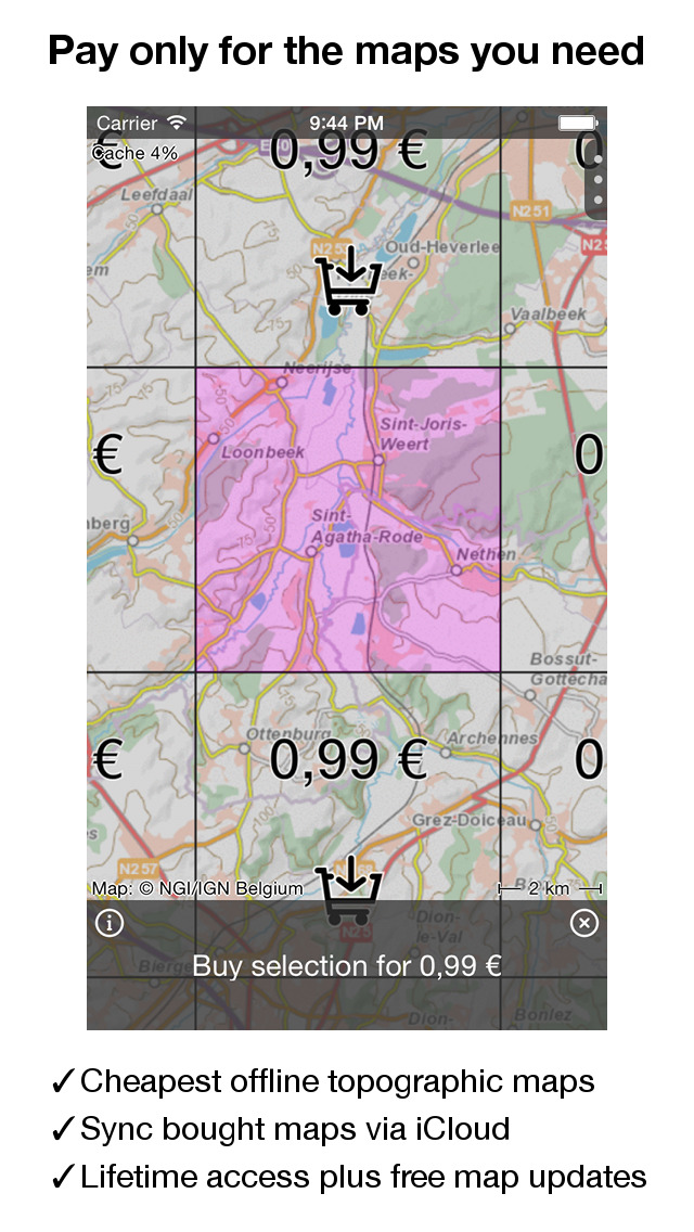
You can easily select the desired map parts from an overhead view. For larger sections discounts will be applied. Purchases are made available on all devices that share the same iCloud account.
It is also possible to buy a one-year subscription which gives access to the complete map of Belgium.
Ideal for walking, hiking, cycling, mountainbiking, sailing, horse-riding, geocaching, scouting, trail running and other outdoor activities. Can also be used by outdoor professionals such as biologists.
- Map
* Cartoweb, the best en most detailed map of Belgium available, from NGI.
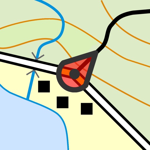
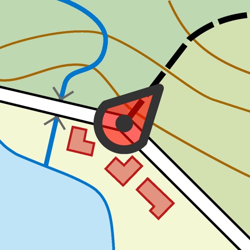
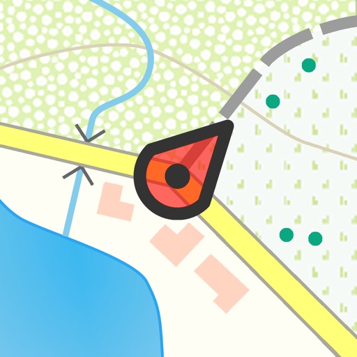
* Very detailed maps, with buildings, cultivation, all roads including the smallest forest trails, contour lines, and characteristic elements in the landscape.
* Map tiles are saved automatically on the iPhone/iPad and can be viewed off-line.
* Map can be oriented in your direction
- Intuitive interface
* Clear menu with most important functions (top right)
* Different dashboard panels (bottom) with distance, time, speed, altitude and coordinates.
* Clear manual on http://www.topo-gps.com/manual/html
- Current position
* Position and movement direction indicated by arrowed marker.
* Displayable in WGS84 decimal, WGS84 degree minutes (seconds), UTM, MGRS.
* Sharing via iMessage/E-mail/Facebook/Twitter.
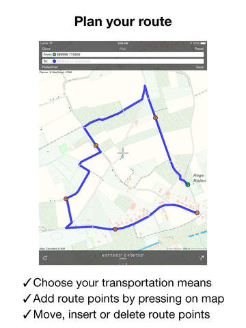
- Planning, loading and recording routes
* Easy recording routes via one-click on clock of dashboard, with pause and
restart possibility.
* Planning of routes via different route points using different means of transportation.
* Planned routes are automatically drawn over roads.
* Planned and recorded routes can be easily edited.
* Importing routes in .gpx format and zipped .gpx format from internet
and e-mail.
* Sharing recorded and downloaded routes in .gpx format via e-mail, Facebook, Twitter and with Topo GPS.
* Free access to route collection Topo GPS with lots of nice routes.
* All map tiles of a route can be saved on the iPhone/iPad with a single click.
* Routes can be organized into folders.
* Photos can be taken in the app and will be included in recorded routes.
- Waypoints
* Adding waypoint through address, current position or coordinates.
* Supported coordinate systems: WGS84 decimal, WGS84 degree minutes (seconds), UTM, MGRS.
* Waypoints can be used to plan a route.
* Waypoints can be organized into folders.
* Sharing via Message/E-Mail/Facebook/Twitter.
* Taken photos are automatically added to a waypoint.
- Cache
* Shown map tiles are saved automatically on the iPhone/iPad.
* All tiles of the current area or a route can be downloaded into the
cache with a single click.
- In app purchases
* Topographic maps of Denmark, Finland, France, Great Britain, the Netherlands, New Zealand and Norway.
* Detailed OpenStreetMap world map
If you are recording a route, the GPS will run in the background. Continued use of GPS running in the background can dramatically decrease battery life.
Rdzl, the company behind Topo GPS, does not obtain in any way the position of the user of Topo GPS. Rdzl does also not obtain the routes recorded by the user, and save the routes planned by the user, unless the route is shared with Topo GPS. We sell our product, not our user data.
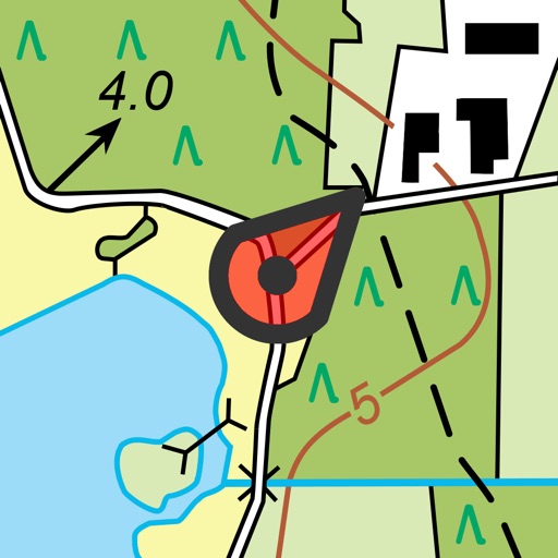
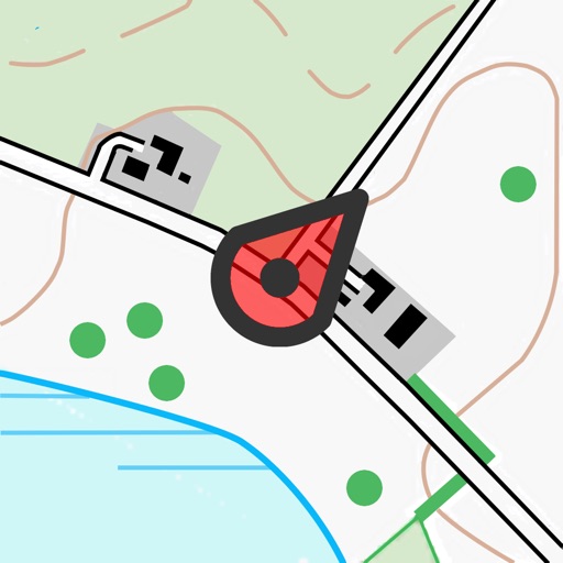
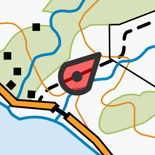
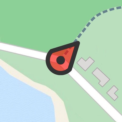
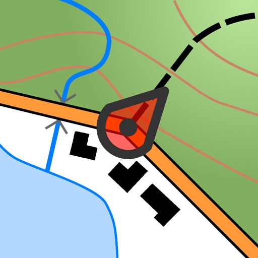
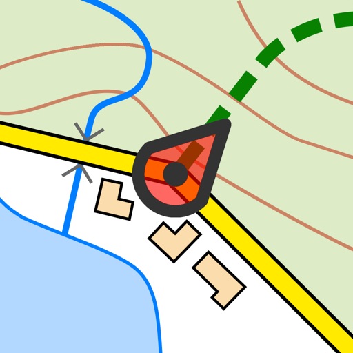
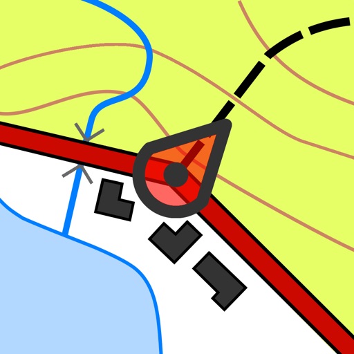
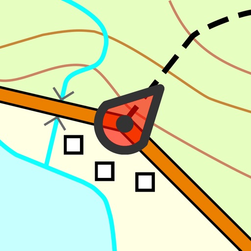
iPhone Screenshots
(click to enlarge)


iPad Screenshots
(click to enlarge)


App Changes
- June 10, 2014 Initial release
- July 23, 2014 New version 3.12
- August 27, 2014 New version 3.13
- September 11, 2014 New version 3.14
- November 03, 2014 New version 3.15
- November 11, 2014 New version 3.16
- June 02, 2015 New version 3.22
- November 17, 2015 New version 4.0
- June 23, 2016 New version 4.2
- July 15, 2016 New version 4.2.1
- June 13, 2019 New version 5.8.2
- June 29, 2019 New version 5.8.3
- July 02, 2019 New version 5.8.4
Other Apps From rdzl