What's New
We changed a number of important things in this version:
* Increased data coverage
* Ability to export ship tracks as csv or kml files
* Ability to monitor ship tracks further back
* Upload of multiple photos at once
* Ship list has improved layout
* Improved search function
* Improved location settings
If you like our app don't forget to put a great review on the Appstore as each new version clears out the old ones.
Do not hesitate to write if you own an AIS receiving station and want to share your data with us ([email protected])
App Description
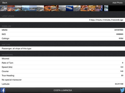
Ever wondered what ship it is you see passing a few miles off the beach?? This App gives you the ability to find out all the details of the ship, including size, speed, course, destination, estimated time of arrival and much more. All done with an easy to use and great looking App, which supports both iPhone and iPad.
What people are saying about our App: "Best user interface of any ship app I have tried" B. Colson, Maine. "Love the graphical design and the large icons that makes it easy to determine the ship type" R. Clark, London.
OpenSeaMap data is now accessible from within the app giving the possibility of showing the map data delivered by OpenSeaMap which includes seamarks, navigational rules and buoys in many areas of the world.
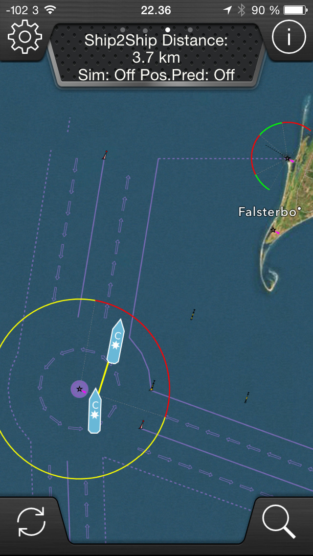
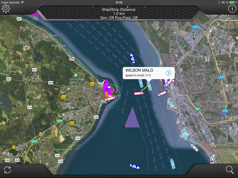
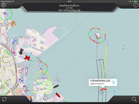
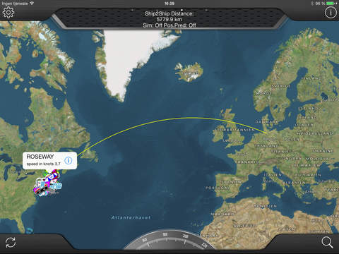
Furthermore, you may measure the distance to the ships from your position, as you may measure distance between any two ships. This will show you if they are really on collision course or if it's just an illusion.
See the ships displayed on the map with large and crystal clear icons.
Built-in compass and "direction" vector which helps find the direction of the ships and vessels.
Furthermore, images of the ships may be watched or uploaded directly from the app.
This version supports iOS split screen multitasking found on selected device.
Also we added the possibility to place user defined waypoints on the map (press and hold your finger on map). The waypoints can be used as measurement points from the user or between ships. Furthermore, by pressing the waypoint the position is copied to the clipboard, making it easy to paste positions into other applications. Pressing the callout of the waypoint will prepare a text message with the position ready to send to other users.Once the text message is received the user can press it and get the position up in various map apps. This functionality has been requested by search and rescue workers who would like a tool to help pin point positions to colleagues out at sea.
Make sure to check out our FREE version of the app (Trackaship Superlite) before buying if in doubt about the coverage of you local area. The free version will show the same ships, but not any details.
This app depends on the data received via the Internet and is dependent on the Internet for displaying data.
Data is collected on a voluntary basis and may change without notice. If you live in an area with poor or no coverage, you have possibility to improve the situation. Send an email to [email protected] and we will contact you.
Please note that the accuracy and reliability of data in this app are not covered by any guarantee and that, under no circumstances should be used for navigation. This app is no substitute for proper maritime instruments.
iPhone Screenshots
(click to enlarge)


iPad Screenshots
(click to enlarge)

App Changes
- February 26, 2014 Initial release
- March 23, 2014 New version 4.2.0
- May 16, 2014 Price increase: $8.99 -> $10.99
- September 08, 2014 New version 5.0.0
- September 10, 2014 Price decrease: $10.99 -> $7.99
- September 14, 2014 Price increase: $7.99 -> $10.99
- October 10, 2014 New version 5.1.2
- May 01, 2015 New version 5.2.0
- May 11, 2015 Price decrease: $10.99 -> $6.99
- May 27, 2015 Price increase: $6.99 -> $10.99
- May 28, 2015 Price decrease: $10.99 -> $8.99
- June 09, 2015 Price decrease: $8.99 -> $5.99
- June 22, 2015 New version 5.3.0
- July 01, 2015 Price increase: $5.99 -> $8.99
- July 06, 2015 Price decrease: $8.99 -> $5.99
- July 16, 2015 New version 5.4.0
- September 14, 2015 New version 5.5.0
- December 07, 2015 Price increase: $5.99 -> $10.99
- December 14, 2015 New version 5.6.0
- December 20, 2015 Price decrease: $10.99 -> $4.99
- February 24, 2016 New version 6.0.0
- July 13, 2016 Price increase: $4.99 -> $5.99
- November 26, 2016 Price decrease: $5.99 -> $2.99
- November 29, 2016 Price increase: $2.99 -> $5.99
- December 04, 2016 Price decrease: $5.99 -> $2.99
- December 12, 2016 Price increase: $2.99 -> $5.99
- June 15, 2019 New version 6.5.0
- June 15, 2019 Price decrease: $5.99 -> FREE!
- June 17, 2019 Price decrease: $5.99 -> FREE!
- August 17, 2019 New version 6.6.0
- September 16, 2023 New version 7.3.1
Other Apps From Brian Bach Mortensen