
App Description
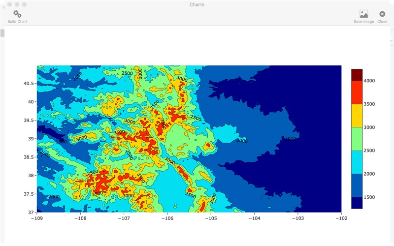
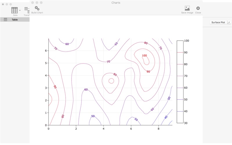
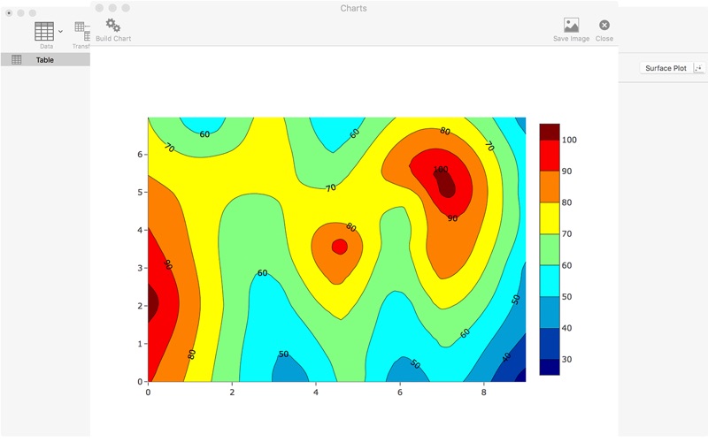
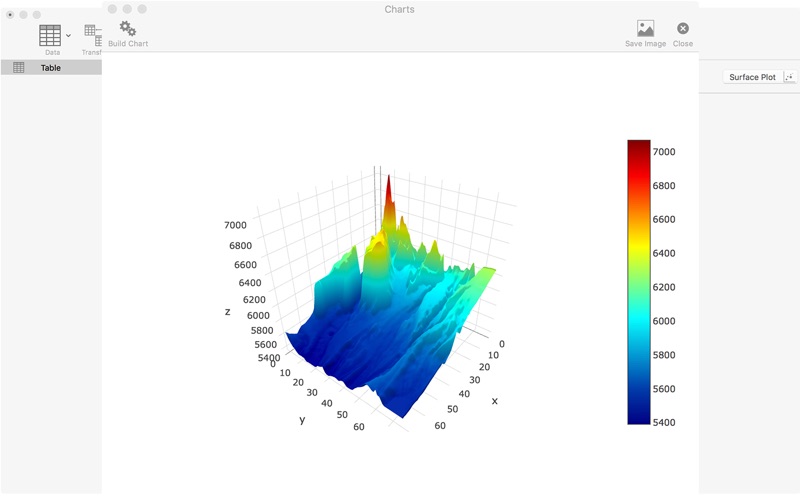
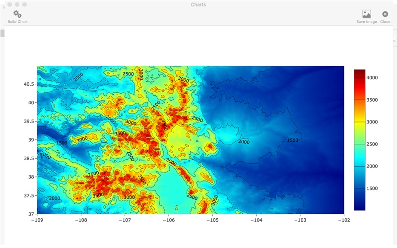
Kriging is a geostatistical and visualization software.Which can make contour mapping,3d surface, surface analysis and gridding form various interpolation methods.
Gridding :
• Interpolation methods:
(1) Inverse Distance (IDW)
(2) Modified shepard
(3) Nearest neighbours
(4)Nature neighbours
(4) RBF-QNN
(5) RBF-ML
(6)Ordinary Krigging
• Grid File formats (.asc .grd .dem format)
• Grid From function (javascript)
Visulization:
1.Contour mapping from points
2.Contour mapping from grid file
3.3D surface from grid file
iPhone Screenshots
(click to enlarge)
App Changes
- June 16, 2019 Initial release
Other Apps From YUANQUAN LI