
What's New
Updated: You can create a target position by typing in a decimal degrees like ( 52.6836N, 108.8364W ). Before that, you should set the Lat & Lon format to "DEG" in Settings view page.
Thanks for Brayden Vetter's feedback.
App Description
This App is a graceful, concise, powerful navigation tool based on the map, it allows you to quickly and accurately measure the distance between your current location and destination point, and make you arrive the destination very quickly.
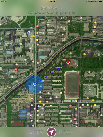
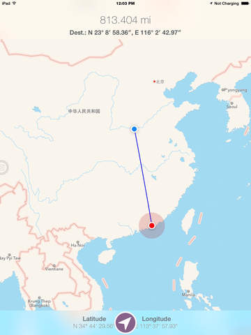
You can long tap on the map, can also manually enter coordinates, to set the target position.
[Features]
1. Simple: only need long tap on the map view to set the target point, also can input coordinates manually.
2. Data export: export the KML and CVS format point list file, KML files can be opened by Google Earth software.
3. comprehensive support: support all of the iPhone and iPad series products, and the iPod series products containing positioning sensor.
4. Distance units: including the meters, kilometers, feet, miles, nautical and other five units.
5. Clean: no ADS, no IAP, no background refresh.
[Save Electricity Design]
1. The positioning function whether open is completely determined by the user, provide switch button for operation, and use it every time you open the can.
2. The software automatically shut down into the background positioning function, shut down the background refresh function.
3. In both positioning function and display on the map function, optimization software made possible, make the minimum power consumption and the network flow.
4. Only in case of necessity, guiding users to use network traffic (on the left an anchor point too far, or unable to get WIFI around fingerprint).
[Instructions]
1. In the Settings page, select your commonly used options, such as distance units, coordinate display format, line style, and so on.
2. In the map view page, zoom in,long tap on the destination to add the target point, click on the “positioning” button to start monitoring the change of the distance.
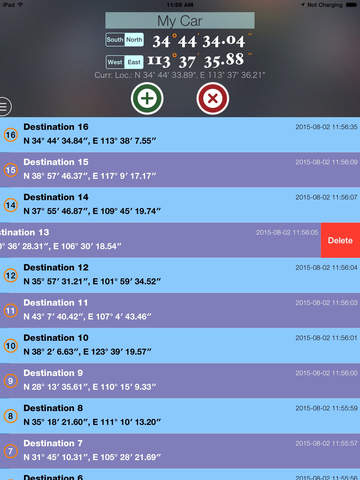
3. In the point list page, enter the target name and coordinates, and save them. Click in the table records, can be to find this point. In addition, click on the current location label, you can rapidly enter the coordinates.
4. The map page and point list page, you can click the export button on the menu, respectively export for the current searching progress and point list information.
[Updated]
Version 1.1
1. Fixed the coordinate offset on the map in the China region. All of the coordinate showed on the views (in the point list view and the map view) are REAL values, based on WGS84 system.
2. Add the more functions to the "Positioning" button, you can change four modes of positioning, such as "Tracking With Location", "Follow With Location", "Follow With Heading" and "Stop Positioning".
Version 1.2
Support draw the route between the target point and user's location on the map, and show the distance of the route. Add the correlative setting options.
If the App is helpful to you, would you please give a high rate to encourage our programer?
If you have any questions and suggestions, please email to [email protected] .
iPhone Screenshots
(click to enlarge)


iPad Screenshots
(click to enlarge)


App Changes
- August 09, 2015 Initial release
- August 14, 2015 New version 1.1
- August 27, 2015 New version 1.2
- November 01, 2015 New version 1.3
- March 05, 2016 New version 1.4
Other Apps From Jian Li