
What's New
Many new features
• Free app with a subscription option for unlimited map downloading
• Three(3) free map downloads
• For very low priced subscription period allows an unlimited map downloading. Keep all maps for full use after the subscription ends. Subscription is shared with other Delcartes map apps.
• Waypoints with grouping capabilities and serval new symbols
• Track path recording
• Route path creation
• Three taps hides controls to only show the map uncluttered (shake motion on iPhone)
• Performance improvements
Note for paid app upgrade (v3.2):
1) This app should have a grandfathered subscription if you purchased a v3.2 copy.
2) The six(6) built-in 24k scale topography maps for Yosemite NP were removed to reduce the app size for Apple over the air iTunes Store. These maps will loose the high resolution detail and if desired can be deleted and re-downloaded for the detailed PDF data.
App Description
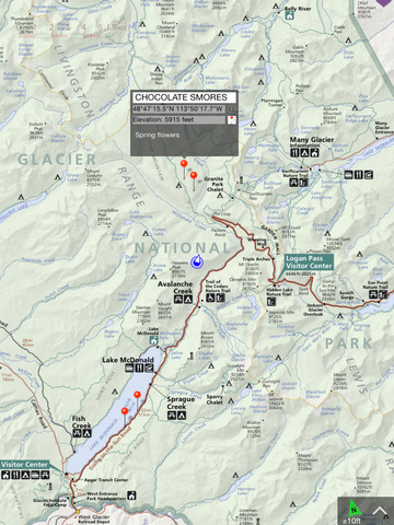
Get high resolution National Park Service maps of Montana on your iPhone and iPad for GPS** and offline use!
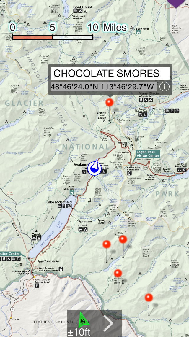
NP Maps Glacier app provides official National Park Service maps for Glacier National Park and Waterton Lakes National Park (Canada) which shows your location on them realtime without internet service. Plus, NP Maps-Glacier can download official United States Geological Survey topography maps displaying the geography of Montana.*
This app is priceless for road trips, hikes, camping, exploring, planning and much more!
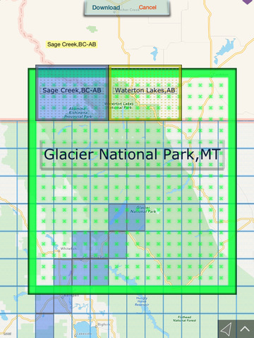
With a full download access subscription, you can download maps covering all your travels in Montana from where you start to and throughout Glacier and Waterton Lakes National park. Because many national park regions have no data service, select and download maps now or while online so you can enjoy using this app as it was intended: no internet connection. And, this app can detect internet service and automatically install USGS topography or NPS map for your current location if not already done.
All maps installed remain fully functional for use after the subscription period ends. There no requirement for a subscription to use this app.
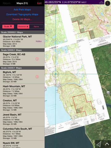
Logical and intuitive to use. Park and topography maps are geospatially integrated with Apple Maps for a familiar interface and for navigating a visual catalog of maps. A marvelous index into an extensive library covering all of Montana allows you to select maps for install all with a simple touch along your planned route of travel.
Features:
• Preloaded with NPS and topography map for Glacier NP.
• Access to a library of over 4,200 NPS and USGS maps
• Full rendering high resolution maps
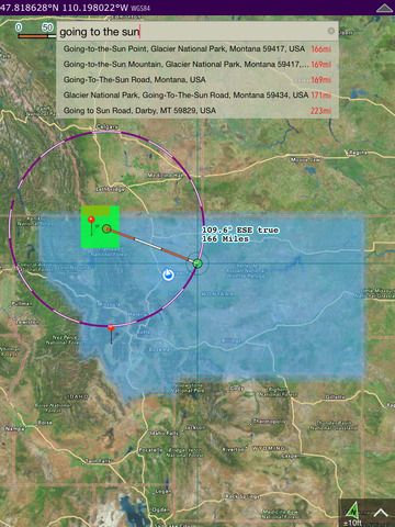
• Find geographic features worldwide with a powerful geo-code search
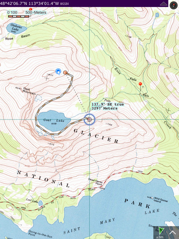
• Waypoints
• Route path creation
• Track/bread-crumb GPS path recording**
• Ruler with dual mode orthographic line and path measurements
• Shows your current GPS location and heading reference**
• Full app usability while maps download in the background
• Footprint grid index with quadrangle names for visual map selection
• Aligns differing map datums to the WGS84/GPS coordinates
• Automatic map download for your current location
• Miles, Feet, Kilometers, Meters, Nautical Miles units
• Latitude and Longitude coordinate display in decimal or arc minutes and seconds
• Import geospatial PDF map files via web, email attachment & iTunes
• Import and export waypoints using GPX format
• Detailed integrated help
• Supports rotation and follows heading map orientations
• No need for cellular service to use installed maps
• No advertisements
National Parks:
Glacier (built in /w topography maps)
Waterton Lake (built in /w two(2) Natural Resources Canada Topography maps)
Historical USGS topography maps scales:
24K : 1 7.5x7.5 arc minute quadrangles
48K : 1
62.5K : 1
100K : 1
125K : 1
250K : 1
• 4,222 total USGS maps covering all of Montana are available for download.
* Not preloaded with all maps. WiFi recommended.
** Continued use of GPS running in the background can dramatically decrease battery life.
iPhone Screenshots
(click to enlarge)


iPad Screenshots
(click to enlarge)
App Changes
- July 31, 2015 Initial release
- August 20, 2015 Price decrease: $1.99 -> $0.99
- August 25, 2015 New version 3.2
- August 25, 2015 Price increase: $0.99 -> $2.99
- September 01, 2015 Price decrease: $2.99 -> $0.99
- September 06, 2015 Price decrease: $0.99 -> FREE!
- September 10, 2015 Price increase: FREE! -> $1.99
- February 27, 2016 Price decrease: $1.99 -> $0.99
- March 05, 2016 New version 4.0
- March 05, 2016 Price decrease: $0.99 -> FREE!
Other Apps From Delcartes LLC