
What's New
This app has been updated by Apple to display the Apple Watch app icon.
• Now available for the iPhone! Completely redesigned and reformatted for iPhone users.
• Images have been updated with full screen views where applicable.
• Turn-by-turn directions have been added (Internet required).
• Map views have been updated with Google Earth imagery and additional icons & information.
App Description
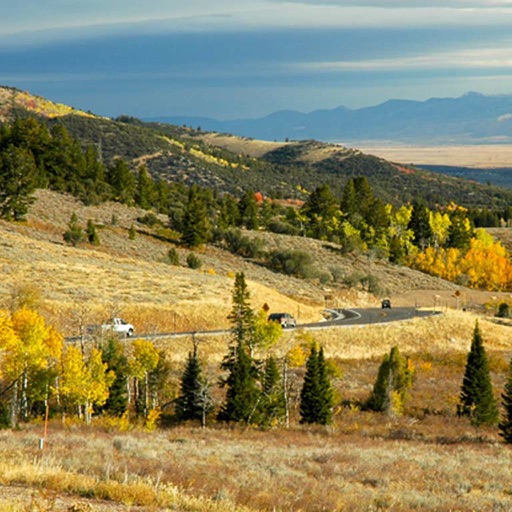
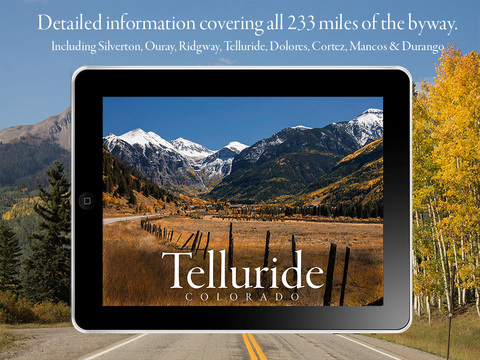
An All-American Road, a National Scenic Byway, a Colorado Scenic and Historic Byway, and a National Forest Scenic Byway ... these are just a few of the names and accolades given to the San Juan Skyway: a 233 mile road trip through some of the most beautiful scenery in the country.
This app will guide you along your journey through the towns of Silverton, Ouray, Ridgway, Telluride, Dolores, Cortez, Mancos, and Durango. Each segment highlights stops along the way that shouldn't be missed. Beautiful photographs (many of which have direct links for purchase), insightful descriptions & information, and maps & directions are displayed for all 31 highlights.
There's an FAQ section to help explain some of the oddities you'll find along the San Juan Skyway and even a map of the (seasonal) restrooms for those breaks along the way!
An elevation profile and maps & directions to each chamber of commerce/visitor center in each town are just a couple of additional helpful resources at your fingertips.
Enjoy the drive. It's an experience of a lifetime ... and this app will help make it an experience you'll never forget.
iPhone Screenshots
(click to enlarge)


iPad Screenshots
(click to enlarge)


App Changes
- September 16, 2014 Initial release
- June 13, 2019 New version 2.0
Other Apps From Touch Point Designs LLC