

What's New
- - Additional map & chart functionality
- - Faster map loading
- - General app updates
App Description
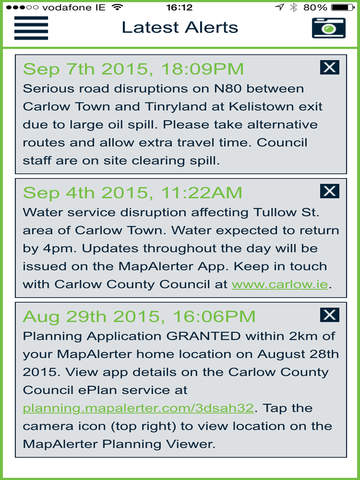
Launched in 2011, MapAlerter is a free alert service for people living in Ireland who want to receive important service notifications from their County or City Council. The alerts you receive are based on your preferred location (eg, Eircode) so you will only receive updates for issues and events that affect you.
-- Professional Mapping at your fingertips --
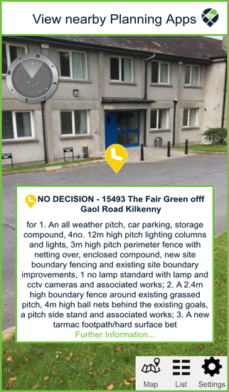
MapAlerter includes an interactive mapping system that allows you to browse various events and updates from your local area. Along with mapped Council alerts, you can view the property price register, road temperatures, river heights and commercial rates for your local area.
-- Councils --
MapAlerter is used by the majority of Irish local authorities. Councils issue alerts across a number of service areas on MapAlerter, including:
-- Water Service Alerts
-- Boil Water Notices
-- Road Closures & Diversion Alerts
-- Community Alerts & Notices
-- Flood Alerts & Severe Weather Warnings
-- Planning Application Activity
** Check on MapAlerter.com to see what categories are used by your Council. In some cases a Council may only alert for some of these categories.
iPhone Screenshots
(click to enlarge)


iPad Screenshots
(click to enlarge)


App Changes
- September 26, 2015 Initial release
- October 07, 2015 New version 4.6
- October 20, 2015 New version 4.82
- October 25, 2015 New version 4.84
- July 10, 2016 New version 5.1.2
- July 15, 2020 New version 11.6
Other Apps From Pin Point Alerts Limited