
What's New
This update contains several bug fixes and performance improvements. Enjoy the latest and greatest version of our app.
App Description
FlyGo Air Navigation is designed to make flights safer and navigation easier. It provides advanced yet easy-to-use aviation tools for all kinds of pilots, such as route planning, customizable moving maps, weather information, aeronautical charts, terrain awareness system, and much more.
Download for a 1-month free trial! *
Features:
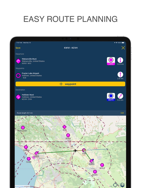
• Route planning
Create and save your routes quickly and efficiently with 50000+ airports, navaids, and waypoints.
• Maps and charts, connected to GPS
Navigate with continuously updated sectional or high/low altitude en-route charts in the US and the EU **.
Need more information on the screen? Customize the map to your preferences.
Select airport types, airspaces, navaids, METAR information, and others.
• Weather
Plan your flights with the weather in mind. Get the latest worldwide METAR and TAF reports anywhere.
• Offline use
Download maps, charts, and terrain information for any country to get the full functionality of the app even without an internet connection.
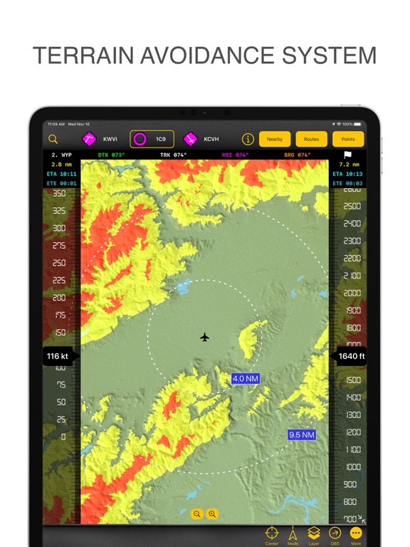
• Terrain avoidance system ***
Always be aware of the surroundings of your aircraft and pilot while avoiding dangerous terrain with a glance.
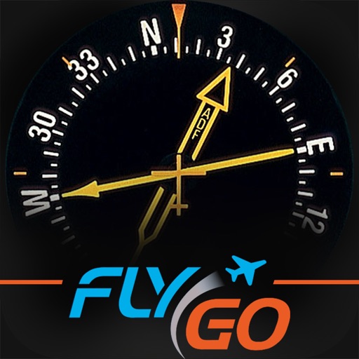
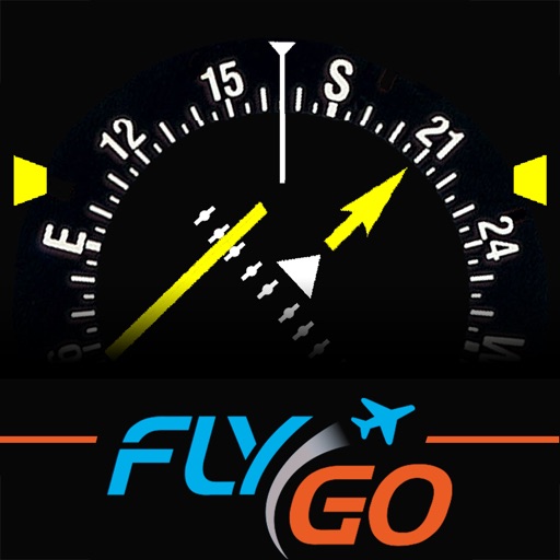
• EHSI / RMI
Navigate precisely and fly basic procedures with graphical and digital instruments.
• Nearby airports
Unexpected changes in your plan during a flight? Look at the airports nearby.
You can check the nearest airports' list, their distance, and relative direction at any time. Select airports from the database to immediately modify your route.
• Real-time flight information
Heading, track, bearing, distance, desired track, estimated time en route, estimated time of arrival, waypoints, and speed calculations.
• iCloud synchronization
Sync your data between multiple devices.
• Organized airport information
Get runway information (direction, traffic, length, slope, surface, lighting, etc.), frequencies, nearby navaids, METAR/TAF, and NOTAMs using the airport information screen.
• User points
Customize the app by creating user points. Add them by tapping on the map or entering their coordinates.
• Quick tap mode
Tap on an airport, navaid, or any location and receive airspace information, frequencies, SIGMETs, AIRMETs, and runway data.
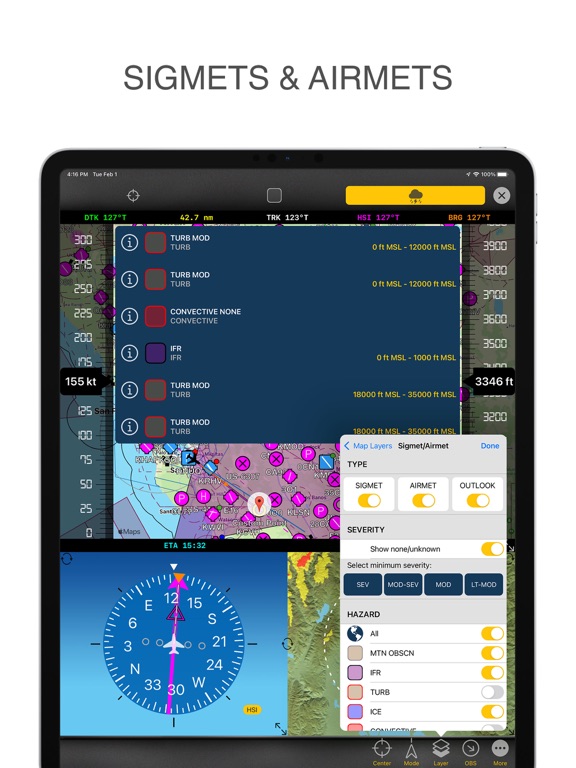
• SIGMETs & AIRMETs
View all the most important worldwide weather advisories on the map.
• Advanced search
Search by airport name, city, country, ICAO, and IATA.
• Magnetic and true north navigation modes
Select your preferred navigation method with the NAV angle switch.
• Support for imperial (US) and metric units
Change the default unit settings at any time.
• Flight history
See your previous routes in the flight history.
• Free trial
Try it for free. Get a 1-month trial. *
Manual: https://www.flygo-aviation.com/wp-content/uploads/2021/10/FlyGo-Air-Navigation-Quickstart-Guide.pdf
Terms of use: https://www.flygo-aviation.com/air-navigation-terms-of-use/
Privacy policy: https://www.flygo-aviation.com/air-navigation-privacy-policy/
* FlyGo Air Navigation has two subscriptions, BASIC, and PRO. Unlimited region downloads, terrain awareness system, charts, and the 1-month trial are only available in the PRO version. The BASIC version has a 2-week trial period.
** EU sectional charts are available in Belgium, Germany, Finland, the Netherlands, Denmark, Poland, Sweden, Bulgaria, Croatia, Greece, Hungary, Italy, Slovenia, the Czech Republic, Malta, Austria, Romania, Switzerland, and Slovakia. Additional charts are available in South Africa and Namibia. These charts are provided by Open Flight Maps.
*** Terrain data is available for land areas from 60 degrees north to 57 degrees south of the equator.
Note: Please keep in mind that this is not a certified flight instrument. Pilots should never fully rely on apps in any circumstances. Therefore, we do not take any responsibility for the potential harm or damages caused by using the app. Always pay attention to the avionics!
iPhone Screenshots
(click to enlarge)


iPad Screenshots
(click to enlarge)


App Changes
- September 15, 2023 Initial release
- November 03, 2023 New version 2.8
- January 26, 2024 New version 2.10
- March 27, 2024 New version 2.13
- April 25, 2024 New version 2.16
Other Apps From Flygo-Aviation Ltd