
What's New
Tab bar color issue has been fixed.
App Description
Monitor Seismic Activity with HeatMAP:
- Visualize seismic hotspots on an interactive HeatMap
- Updated every minute for accurate visualization
- Intuitive interface for easy navigation
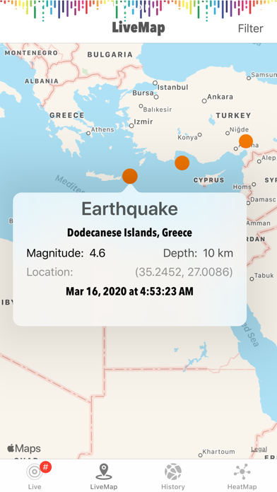
Discover Real-time Earthquakes with LiveMAP:
- Explore live seismic activity worldwide
- Real-time data updates from FDSN
- Dynamic maps and interactive interface
- Engage with the latest seismic events
Personalized Earthquake Experience:
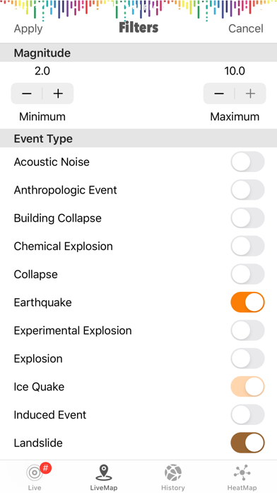
- Set filters based on magnitude, and event type
- Stay connected with real-time updates and information
- User-friendly interface for a seamless experience
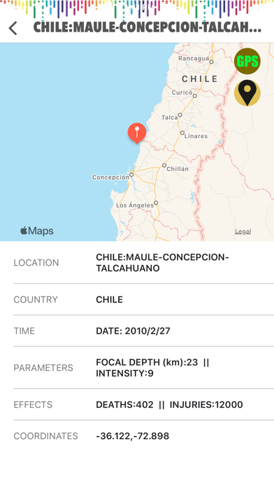
Uncover Earthquake History with History Section:
- Dive into centuries of earthquake records
- Access comprehensive data from 2150 B.C. to present
- Visualize historical earthquakes on an interactive map
- Learn about destructive earthquakes and their impact
Targeted for Researchers, Nature Enthusiasts, and Emergency Managers:
- Designed for earthquake researchers and scientists
- Perfect for nature enthusiasts interested in seismic activity
- Essential tool for emergency managers and preparedness
- Tailored features to meet professionals' needs
Visualize Earthquakes with Interactive Maps:
- Engage with captivating maps displaying earthquake data
- Zoom in and explore specific regions or cities
- Filter seismic activity by magnitude, event type
- Get a comprehensive view of global seismic activity
Reliable Data from Trusted Sources:
- Live data sourced directly from FDSN and USGS
- Accurate and up-to-date seismic information
- Extensive earthquake database with records and statistics
- Trustworthy source for researchers and professionals
- Dependable insights for decision-making
HEATMAP Section:
- Real-time data from USGS generates a dynamic HeatMap
- Instantly visualize seismic activity on the map
- Intuitive and up-to-date overview of earthquakes
- Continuous updates ensure the latest information availability
- Comprehensive overview of seismic activity in the past month
- Seismic activities with magnitude 1 or higher from the past month
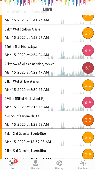
LIVE Section:
- Real-time data retrieval of seismic activities with magnitude 2.5 or higher from the past month (USGS)
- Continuous updates every 1 minute with dynamic lists and maps
- Detailed information on each earthquake, including distance, coordinates, magnitude, depth, and timing
- Direct link to USGS page for further information
- Magnitude filtering for customized earthquake display
LIVEMAP Section:
- Real-time retrieval and processing of event type data from the internet
- Categorized event types assigned by FDSN
- Selection and display of filtered activities on the real-time map
- Additional magnitude filtering with minimum and maximum values
- Automatic synchronization every minute with manual option
- Display of last synchronization time and event count
iPhone Screenshots
(click to enlarge)


App Changes
- July 14, 2020 Initial release
- October 04, 2023 New version 3.2
- April 25, 2024 New version 3.3
Other Apps From tamer bayramogullari