
What's New
* Visual improvements have been made.
* A bug that could cause the application to crash has been fixed.
App Description
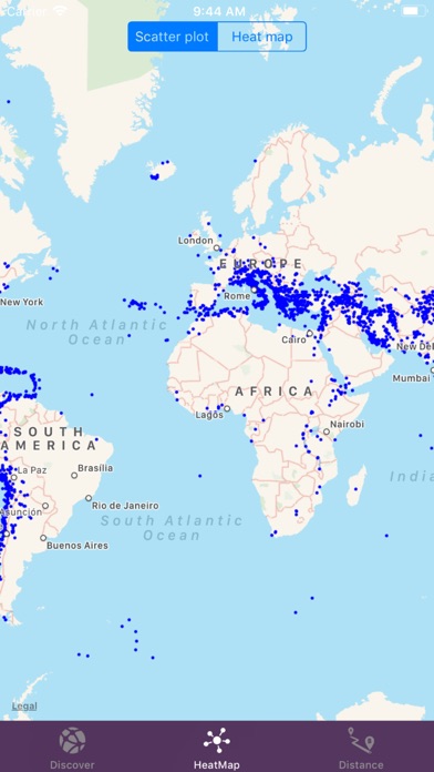
- Advanced filtering: The app enables users to visualize all seismic activities worldwide on a map, utilizing advanced filtering capabilities.
- Active fault lines: The app allows users to view active fault lines in real-time, providing a visual representation of these geological features.
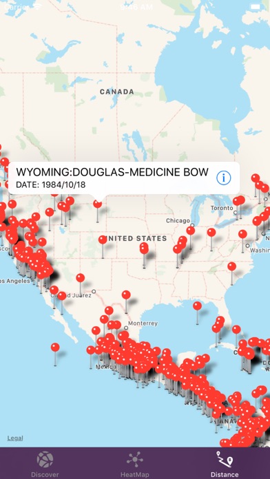
- Distance indication: The application also displays the distance between the user and the earthquakes, providing valuable information about their proximity.
- Earthquake tracking: Real-time tracking of earthquakes worldwide.
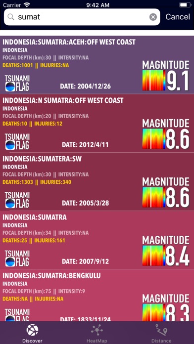
- Detailed information: Access detailed information about each earthquake, including magnitude, location, and depth.
- Interactive map: Explore earthquakes on an interactive map with zoom and pan functionality.
- Custom filters: Set personalized filters to receive earthquake alerts based on magnitude.
- Reliable data sources: Gather data from reputable sources to ensure accuracy and reliability.
- User-friendly interface: Enjoy an intuitive and user-friendly interface for effortless navigation.
- Personalization options: Customize the app's settings and preferences according to your needs.
iPhone Screenshots
(click to enlarge)


App Changes
- December 09, 2017 Initial release
- June 13, 2019 Price decrease: $2.99 -> $0.99
- June 13, 2019 Price decrease: $2.99 -> $0.99
- June 14, 2019 Price decrease: $2.99 -> $0.99
- June 14, 2019 Price decrease: $2.99 -> $0.99
- June 15, 2019 Price decrease: $2.99 -> $0.99
- June 15, 2019 Price decrease: $2.99 -> $0.99
- June 16, 2019 Price decrease: $2.99 -> $0.99
- October 09, 2019 New version 2.0
- September 16, 2023 New version 3.0
- September 16, 2023 Price increase: $0.99 -> $3.99
Other Apps From tamer bayramogullari