


App Description
Mt. Elikonas topoguide is a digital field guide for hikers and nature lovers. It includes routes, descriptions and photos for 25 hiking and mountaineering trails. Hiking routes include 6 sections of the National Trail O22.
The application offers detailed offline maps and an extensive introduction on geography, geology, the nature and the rich ancient history of Mt. Elikonas, including a comprehensive presentation of the Muses Valley, the secret spring of Ippokrini and the defensive system of this old Beotian hinterland.
The routes include easy and moderate hiking trails and long mountain traverses, with a total length of 215 km.
The app also offers a useful list of POIs with a search feature on the map screen.
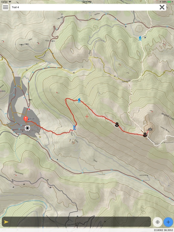
In the field, the app identifies the nearest adventure and provides active navigation on the path, displaying messages and warnings on every junction or other important location. On each Point of Interest, photos and texts are displayed on the map. If the hiker gets off-trail, the app indicates the shorter way to get back safely.
Also, a navigation feature allows to calculate routes and distances along roads and paths anywhere in the area.
The cartographic company AnaDigit, creator of the application, has previously issued detailed hiking maps at a scale of 1: 50,000 for Mt. Elikonas, as well as hundreds other hiking maps for Greece (eg. maps of Mt. Olympus, Crete, Zagori, Sifnos, Naxos and other Aegean islands). To build the application and ensure data accuracy, all paths of Mt. Elikonas have been revised during 2017 and 2018.
DISCLAIMER
During track recording, continued use of GPS can dramatically decrease battery life.
iPhone Screenshots
(click to enlarge)


iPad Screenshots
(click to enlarge)


App Changes
- August 04, 2018 Initial release
Other Apps From Topoguide - T ADAMAKOPOULOS - A ADAMAKOPOULOS O.E.


