
App Description
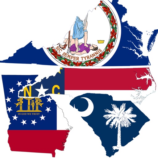
Accurate, simple to use Satellite Map based North Carolina tide charts of the all NOAA based North Carolina tide stations on a simple to use satellite map. Designed by North Carolina fishermen and Professional North Carolina Fishing Guides.
NO SPAM ADS, SIMPLE TO USE...100% AD FREE.
Other Features:
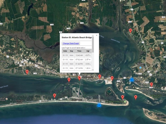
Ability to forecast North Carolina tides from NOAA by setting date and period for any of the tidal stations for the entire State of North Carolina tide tables.
Excellent support for any issues, questions or new features...simply email: [email protected] and we'll show you how Apple support is meant to be.
Auto-save last location for easy reference to your last tide station the next time you use the tide app.
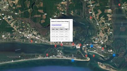
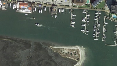
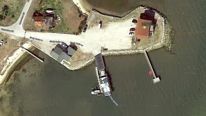
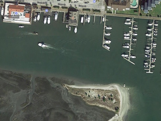
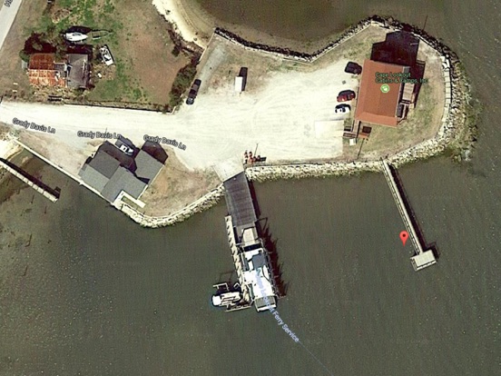
Included is the ability to zoom and view satellite imagery for fishing ground characteristics to compare with tide movement.
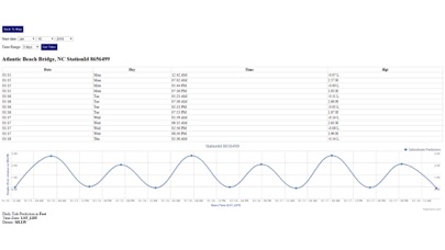
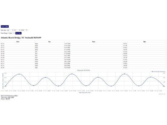
Advanced tide graphs allow for you to judge the level of water movement for optimal fishing between high and low tide in North Carolina between tide stations so you can follow the tide flow for the entire day.
Recent Feedback:
"NesTides ability to display tide predictions and actual tidal flow graphs allow me to extend fishing trips by following different tide station tide charts and moving with the tide flow. The satellite view allows me to explore and discover new fishing grounds I never knew existed. Absolutely the best fishing software tool I have ever used. ," said USCG Captain Mike K.
North Carolina Tide Chart stations include (partial list see website for full list):
Bald Head, Fort Caswell, Southport, Zekes Island, Federal Point, Sunny Point Army Base, Wharf no.1, Reaves Point, Sunny Point Army Base, Wharf no.3, Orton Point, WILMINGTON, Castle Hayne, Northeast River, Bannermans Branch, Northeast River, DUCK PIER, Kitty Hawk (ocean), Jennettes Pier, Nags Head (ocean), Roanoke Sound Channel, OREGON INLET MARINA, Oregon Inlet, Oregon Inlet (USCG Station), Oregon Inlet Bridge, Oregon Inlet Channel, Old House Channel, Davis Slough, Rodanthe, Pamlico Sound, Roanoke Marshes Light, Croatan Sound, Oyster Creek, Croatan Sound, Manns Harbor, Croatan Sound, Cape Hatteras, CAPE HATTERAS FISHING PIER, Hatteras (ocean), Peter's Ditch, Hatteras Inlet, Ocracoke Inlet, Ocracoke, Ocracoke Island, Cape Lookout Bight, Cape Lookout (ocean), Shell Point, Harkers Island, Harkers Island Bridge, Davis, Core Sound, Channel Marker Lt. 59, Lenoxville Point, North River Bridge, Beaufort Inlet Channel Range, Beaufort, Taylor Creek, Beaufort, Duke Marine Lab, Gallant Channel, Newport River (Yacht Club), Core Creek Bridge, Fort Macon, USCG Station, Morehead City, Morehead City Harbor, Atlantic Beach, Triple ESS Marina, Bogue Sd., Atlantic Beach Bridge, N.C. State Fisheries, SpoonersCreek, Coral Bay, Atlantic Beach, New River Inlet, Ocean City Beach (fishing pier), Wrightsville Beach, Wilmington Beach, Cape Fear, Oak Island, Yaupon Beach, Lockwoods Folly Inlet, Shallotte Inlet (Bowen Point), Sunset Beach Pier, Sunset Beach Bridge
iPhone Screenshots
(click to enlarge)
iPad Screenshots
(click to enlarge)
App Changes
- January 17, 2018 Initial release
- June 13, 2019 Price increase: $0.99 -> $9.99
- June 13, 2019 Price increase: $0.99 -> $9.99
- June 14, 2019 Price increase: $0.99 -> $9.99
- June 14, 2019 Price increase: $0.99 -> $9.99
- June 15, 2019 Price increase: $0.99 -> $9.99
- June 15, 2019 Price increase: $0.99 -> $9.99
- June 16, 2019 Price increase: $0.99 -> $9.99
Other Apps From Progress Technologies Inc