
What's New
This app has been updated by Apple to use the latest Apple signing certificate.
App Description
Accurate, simple to use Satellite Map based Oregon tide charts of all NOAA based Oregon tide stations. Designed by Oregon fishermen and Professional Oregon Fishing Guides.
NO SPAM ADS, SIMPLE TO USE...100% AD FREE.
Other Features:
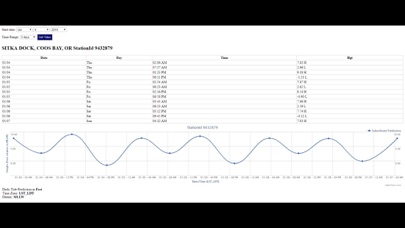
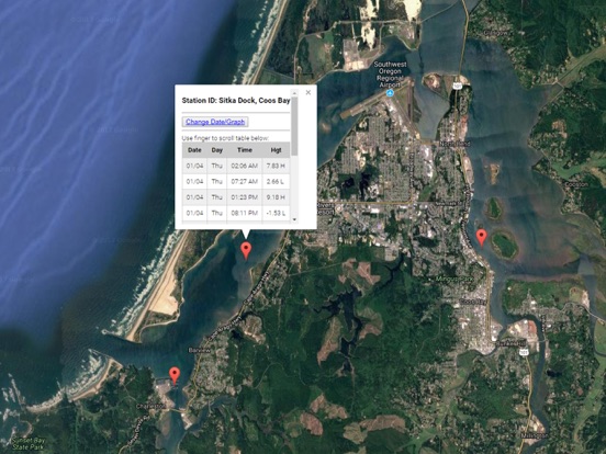
Ability to forecast Oregon tides from NOAA by setting date and period for any of the tidal stations for the entire State of Oregon tide tables.
Excellent support for any issues, questions or new features...simply email: [email protected] and we'll show you how Apple support is meant to be.
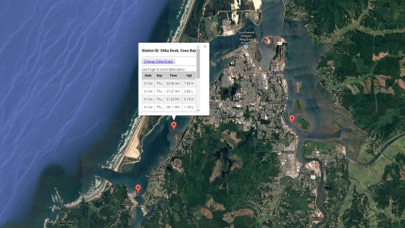
When GPS is available auto-locate your position and zoom to the map for surrounding NOAA Oregon tide charts.
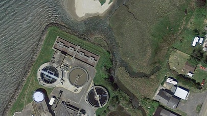
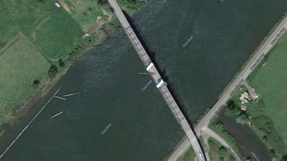
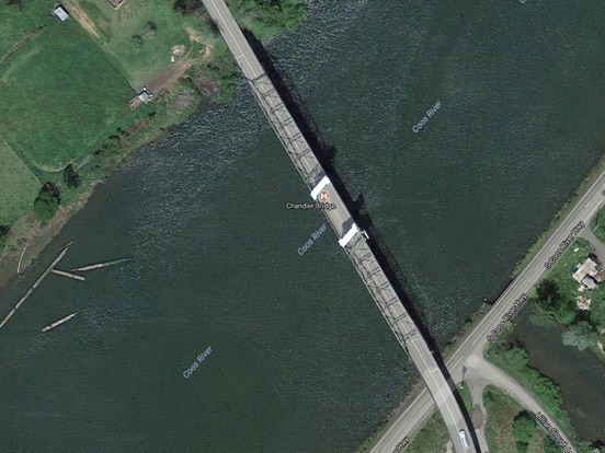
Included is the ability to zoom and view satellite imagery for fishing ground characteristics to compare with tide movement.
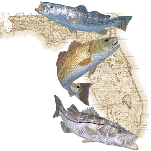
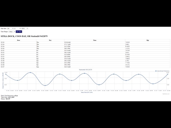
Advanced tide graphs allow for you to judge the level of water movement for optimal fishing between high and low tide in Florida between tide stations so you can follow the tide flow for the entire day.
Recent Feedback:
"NesTides ability to display tide predictions and actual tidal flow graphs allow me to extend fishing trips by following different tide station tide charts and moving with the tide flow. The satellite view allows me to explore and discover new fishing grounds I never knew existed. Absolutely the best fishing software tool I have ever used. ," said USCG Captain Mike K.
Tide Chart Stations Include:
Umpqua River Entrance, Half Moon Bay
Gardiner
Reedsport
Suislaw River Entrance
Florence USCG Pier
Florence
CHARLESTON
Sitka Dock, Coos Bay
Empire
Coos Bay
YAQUINA USCG STA, NEWPORT
Southbeach
Weiser Point, Yaquina River
TOLEDO
Brighton
Nehalem
North Jetty, Tillamook Bay
Barview
Garibaldi
Miami Cove
Bay City
Dick Point
Tillamook, Hoquarten Slough
Brookings, Chetco Cove
Gold Beach, Rogue River
Wedderburn, Rogue River
Port Orford
Bandon, Coquille River
Drift Creek, Alsea River
Waldport, Alsea Bay
Depoe Bay
Taft, Siletz Bay
Kernville, Siletz River
Cascade Head, Salmon River
Netarts, Netarts Bay
Nestucca Bay entrance
Columbia River entrance (N. Jetty)
CAPE DISAPPOINTMENT
Fort Canby, Jetty 'A', Wash.
Ilwaco, Baker Bay, Wash.
Chinook, Baker Bay, Wash.
Hungry Harbor, Wash.
Hammond, Oregon
Point Adams, Oreg.
Astoria (Youngs Bay), Oreg.
Cathcart Landing, Youngs River
Warrenton, Skipanon River, Oreg.
Astoria (Port Docks), Oreg.
ASTORIA (Tongue Point), Oreg.
Knappa, Knappa Slough
Settlers Point, Oreg.
Harrington Point, Wash.
Skamokawa
Wauna
Cape Horn
Barlow Point
Longview
Temco Kalama Terminal
Saint Helens
Knapp Landing, Willow Bar
Rocky Point
Portland Morrison Street Bridge
Vancouver
Washougal
Beacon Rock State Park
tide tables, oregon tide table, tide chart, seaside oregon, oregon tide chart, tides, oregon coast, tides for fishing, saltwater tides oregon, oregon coast tide chart
iPhone Screenshots
(click to enlarge)
iPad Screenshots
(click to enlarge)
App Changes
- January 05, 2018 Initial release
- June 13, 2019 Price increase: $0.99 -> $9.99
- June 13, 2019 Price increase: $0.99 -> $9.99
- June 14, 2019 Price increase: $0.99 -> $9.99
- June 14, 2019 Price increase: $0.99 -> $9.99
- June 15, 2019 Price increase: $0.99 -> $9.99
- June 15, 2019 Price increase: $0.99 -> $9.99
- June 16, 2019 Price increase: $0.99 -> $9.99
Other Apps From Progress Technologies Inc