
App Description
We present a digital version of the printed map of Fuerteventura, one of the Canary islands, which is brought to you by Berndtson cartographic publishing house.
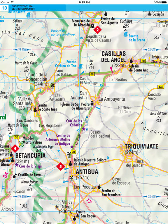
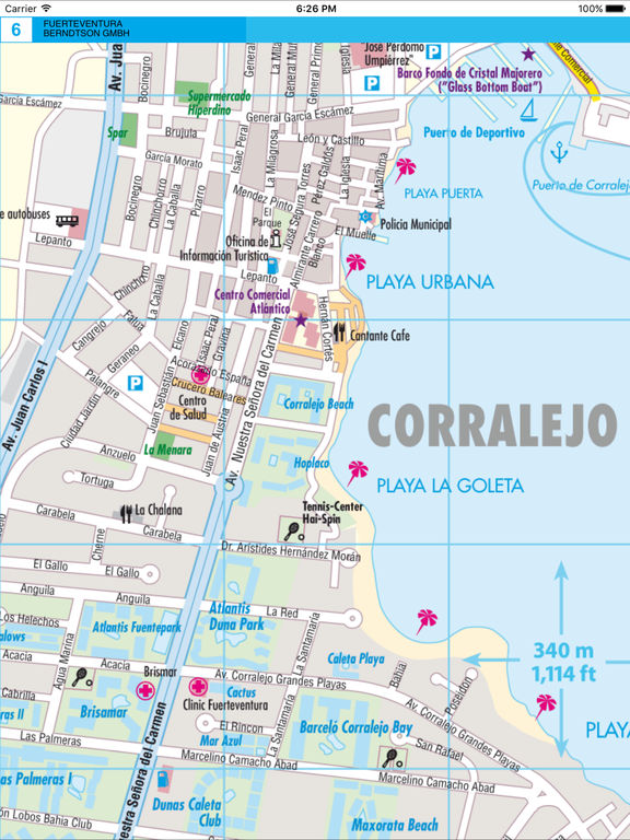
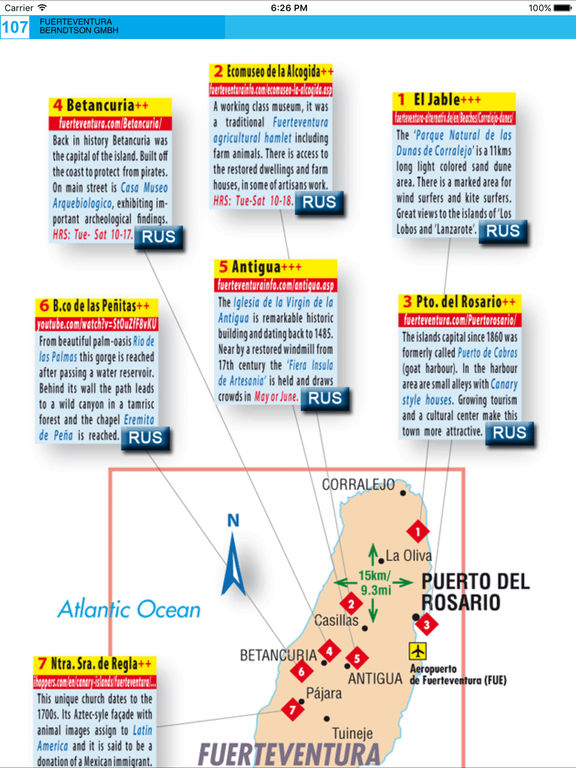
The edition presents a detailed map of the island. Roads and inhabited places, as well as main sights, museums, cinemas, hospitals, hotels and bus stops are indicated on the map. Such spots as national parks, camping and diving sites, beaches, waterfalls, caves and many other are also mapped here.
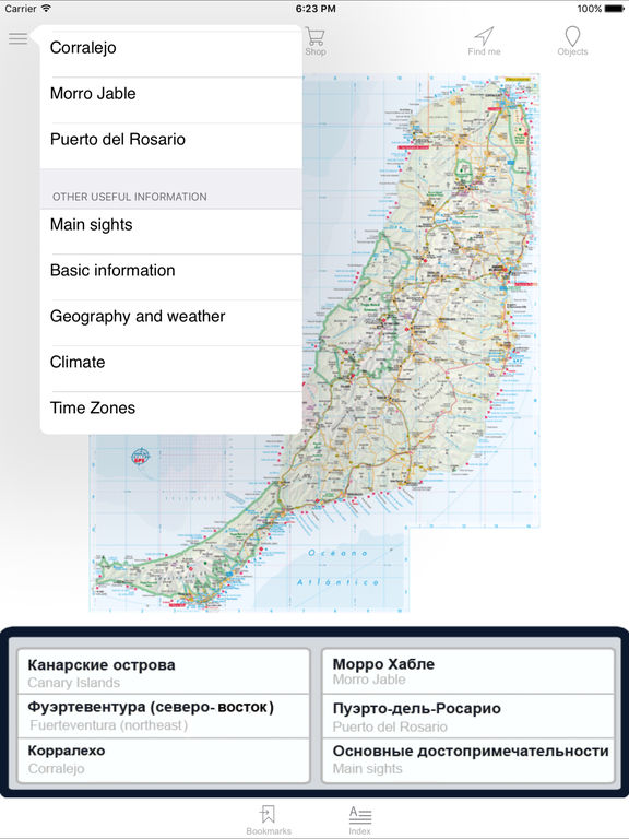
The edition contains additional maps of Canary islands, Corralejo, Morro Jable, Puerto del Rosario.
Information on the island, its sights and climate is also presented in this title.
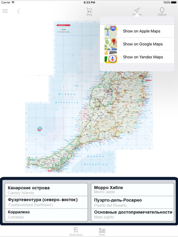
The edition provides search by such categories as inhabited places, streets, sights, beaches, hotels, malls, etc.
iPhone Screenshots
(click to enlarge)


iPad Screenshots
(click to enlarge)
App Changes
- November 06, 2016 Initial release
Other Apps From AGT Geocentre