
App Description
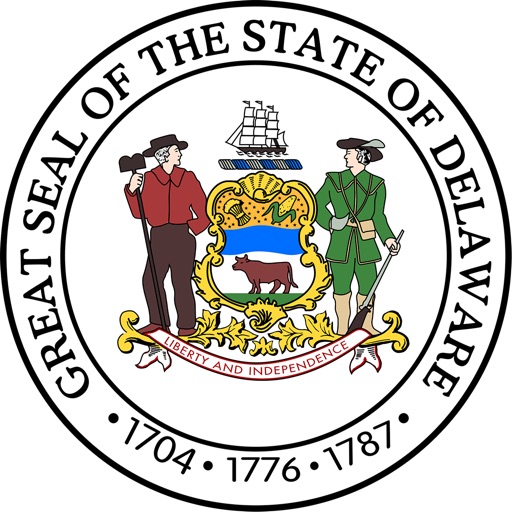
Accurate, simple to use Satellite Map based Delaware tide charts of the all NOAA based Delaware tide stations on a simple to use satellite map. Designed by Delaware fishermen and Professional Delaware Fishing Guides.
NO SPAM ADS, SIMPLE TO USE...100% AD FREE.
Other Features:
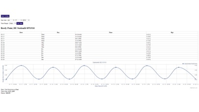
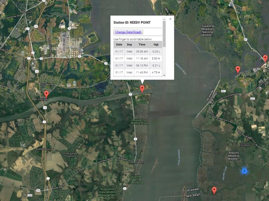
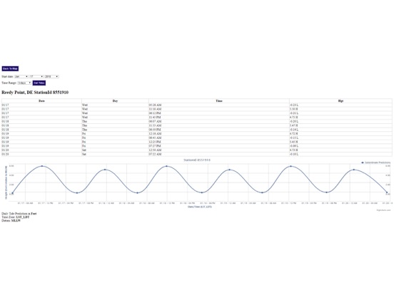
Ability to forecast Delaware tides from NOAA by setting date and period for any of the tidal stations for the entire State of Delaware tide tables.
Excellent support for any issues, questions or new features...simply email: [email protected] and we'll show you how Apple support is meant to be.
Auto-save last location for easy reference to your last tide station the next time you use the tide app.
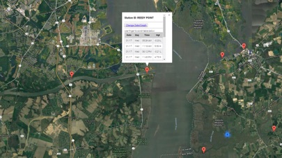
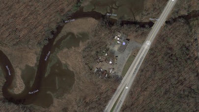
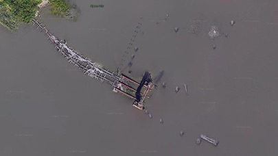
Included is the ability to zoom and view satellite imagery for fishing ground characteristics to compare with tide movement.
Advanced tide graphs allow for you to judge the level of water movement for optimal fishing between high and low tide in Delaware between tide stations so you can follow the tide flow for the entire day.
Recent Feedback:
"NesTides ability to display tide predictions and actual tidal flow graphs allow me to extend fishing trips by following different tide station tide charts and moving with the tide flow. The satellite view allows me to explore and discover new fishing grounds I never knew existed. Absolutely the best fishing software tool I have ever used. ," said USCG Captain Mike K.
Delaware Tide Chart stations include (partial list see website for full list):
LEWES (BREAKWATER HARBOR),Mispillion River entrance,Murderkill River entrance,Mahon River entrance,Leipsic, Leipsic River,Stathems Neck, Stow Creek, N.J.,Woodland Beach, Del.,Raccoon Ditch, Newport Meadows, Stow Creek, N.J.,Canton, Stow Creek, N.J.,1 n.mi. above entrance, N.J.,Pine Island, Malapartis Creek, N.J.,Hope Creek, 0.6 n.mi. above entrance, N.J.,Taylors Bridge, Blackbird Creek, Del.,Artificial Island, Salem Nuclear Plant, N.J.,Sinnickson Landing,Salem,0.8 n.mi. above entrance,Abbots Meadow,2.5 n.mi. above entrance,Coopers Creek bridge,Quinton,REEDY POINT,St. Georges, Delaware,Summit Bridge, Delaware,Chesapeake City, Maryland,Delaware City Branch Channel bridge,Delaware City,Pea Patch Island, Bulkhead Shoal Channel, Del.,New Castle, Delaware,Salem Canal entrance, N.J.,Wilmington Marine Terminal,Millside, RR. bridge,Edgemoor, Del.,Pedricktown, Oldmans Creek, N.J.,Auburn, Oldmans Creek, N.J.,Rehoboth Beach,Indian River Inlet (Coast Guard Station)
iPhone Screenshots
(click to enlarge)
iPad Screenshots
(click to enlarge)
App Changes
- January 20, 2018 Initial release
- January 20, 2018 Price increase: $0.99 -> $4.99
- June 14, 2019 Price increase: $4.99 -> $9.99
- June 14, 2019 Price increase: $4.99 -> $9.99
- June 15, 2019 Price increase: $4.99 -> $9.99
- June 15, 2019 Price increase: $4.99 -> $9.99
- June 15, 2019 Price increase: $4.99 -> $9.99
- June 16, 2019 Price increase: $4.99 -> $9.99
Other Apps From Progress Technologies Inc