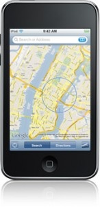
Tag: Maps »
CoPilot Live HD, turn-by-turn navigation available for iPad
With recent news of iPad's being fitted into car dashboards, this is particularly exciting news for those shopping for a new SatNav device for their vehicle.
Street maps are stored on the device and the app can display both 2D and 3D map views with turn instructions for the driver. The app automatically switches between portrait and landscape view and provides iPod controls from within the application, another bonus for those planning to dashboard-mount their new Apple tablet or connect it to their in-car sound system.
CoPilot Live HD offers a feature for users to plan trips offline and preview routes to find the most efficient journey before setting out.
“CoPilot Live HD provides an absolutely sensational GPS navigation and planning experience on iPad 3G,” said Michael Kornhauser, Managing Director at ALK Technologies. “Developing for iPad was a natural step following the tremendous popularity of our CoPilot Live iPhone app. It’s a really fantastic platform for navigation that allows us to fully exploit the many years of expertise we have gained from supporting tablet computers with our CoPilot Live Laptop products.”
CoPilot Live HD is priced at $29.99 for unlimited use with free quarterly map updates through 2010.
Find out more here
The iPod Touch, Location Services, and Skyhook: Let's Make This Work.
If you're one of the lucky ones, your iPod's Location Services will work the instant you connect to a WiFi network, like they're supposed to. But for the many of us, that nasty "Location cannot be determined" pop-up is a constant reminder of our device's limits. So why does this work for some people, and not for others? It all depends on where you live and what wireless networks your device finds. For example, my iPod's Location Services were absolutely useless at home, but when I drove two hours to the Apple Store to have them look at it (hey, I had other shopping to do, too!), suddenly there wasn't a problem.
The reason for the discrepancy is that the iPod relies on Skyhook for location information. Don't be surprised if you've never heard of it; the Apple "Geniuses" hadn't, either. Skyhook is essentially a database of known WiFi points and their addresses that supplies the technology behind non-GPS Location Services on the iDevices. (See the "how it works" page.) Here's the catch, though: if your WiFi access point isn't registered with Skyhook, Location Services simply won't work. Skyhook's coverage is far from comprehensive, focusing primarily on urban areas, so this isn't exactly an uncommon problem.To remedy the situation, you can register your router on their website by entering your email address, your physical address, and your router's MAC address. Instructions for finding your MAC address are available on their website, and after submitting the information it takes 1-3 weeks for Location Services to work.
And that's it! So, if you were wondering why Location Services just won't work on your iPod...here's the likely answer. :)
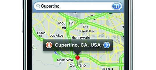
Let us know if you've had a similar experience, and/or if this works for you. As for me, I'll be enjoying my newfound ability to, you know, use Maps. What a relief!
Maps App Questionable In NYC
Not being from a large urban area with subway lines intermingled with rail lines, I have always trusted the Maps app to get me safely from point A to point B. Typically it finds the fastest route between two locations without a hitch. After spending the week in NY though, I have learned that Google does not have my back. No sir.
On this particular day, which just happened to be yesterday, my desired route was from Brooklyn to JFK Airport. Being one of the most trafficked airports in the country, I figured that this wouldn't be an issue. I popped right into the app, hit directions, and went from my current location to JFK Airport. Having a mass transit option in maps led me to believe that the route that was given to me would be the route that all the locals take. "No problem" I thought to myself. I jumped on the 3 to head to New Lots, and then I'd jump on the bus to JFK. By bus I figured that Google meant airport tram, and by New Lots I was hoping for some sort of airport shuttle hub.I was wrong. Google put me... suitcase, laptop, iPhone carrying Chris... on a city bus driving by the Louis H. Pink Houses on Linden Blvd with people certainly wondering what I was doing. After I made it to JFK, I realized that there is this great light rail hub that I could've transferred to, and all that I would have to do is walk a street over from my starting location.
The moral of the story is that the Maps app really needs to show alternate routes like its computer based Google Maps counterpart. Lesson 2 is that if you are ever in E. Brooklyn and Maps tells you that you are getting on a bus... it is a city bus. Lesson 3 is that you should never take the route I took from Brooklyn to JFK. Find your way to the Jamaica station, it's much more pleasant.
Apple Buys a Maps Company, Intends to Use It
Let's face it. We all love Google Maps on our iPhone's. The convenience of swiping here, and flicking there to get directions to where we want to go is all too .. convenient. But, it's been like that for some time now, and it may just be about to change.
Remember when Apple and Google used to be such real good pals? Well, I'm afraid to say that sadly those days seem to be over. After the recent Google Voice saga earlier last month, which managed to generate huge media attention and even managed to get the FCC involved, Google and Apple seem to have been slowly drifting apart from each other.
Today, Gizmodo reports that another recent rumored purchase of Apple's may confirm that this is the case. Uncovered via a tweet posted back in July from the founder of Placebase - Fred Lalonde, it's now rumored Apple have bought Placebase, outright. The acquisition of the company took place in July of this year, but is only coming to light now, due to recent events involving both Google and Apple.
So, what exactly separates Placebase from Google Maps? Well, from this post published on Gigaom in early 2008, we can see Placebase has a few things Google Maps doesn't. For a start, the service allows users to overlay layers upon layers of data on top of each other, to provide an overall richer, fuller experience. On top of this, it's said that Placebase's API is smarter and easier than Google's claiming easier integration into third party products.
But, if Apple now has a maps company which is deemed superior to Google Maps, Why do they need Google? Now, that said I can't see them just dropping Google and the arrangement they currently have for 'native' iPhone maps functionality, after all - it's now one of the iPhone's most prominent features. But you have to wonder. With a maps company under it's belt, Apple could be gearing to compete with Google in this area, in a very big way.
Accuterra Maps by Intermaps
Accuterra maps include some interesting features you won't find in Google Maps. For one, you can use them offline. That is huge if you are and enjoy going on hikes. Anyone who has ever gone to a National Park knows that the cell phone coverage is bad and you're lucky if you can get data service at all. All levels of zoom of the topographic maps are available instantly.
There's something very satisfying about zooming in and out, and scrolling around all without waiting for the images to load. It is completely instant. Fantastic.
Other great features include recording your tracks, creating walking tours (combinations of your tracks and photos), mark waypoints and points of interest, save and share your trails, and view a profile of a hike to gauge the elevation changes.
Here's a quick introduction to the app from the developers.
[youtube hv_yWW9SnhE]
OS 3.0 In-App Purchasing
Versions of the maps updated for OS 3.0 will also include some great in-app purchasing functionality. You'll be able to buy small map regions for areas you are visiting for as little as $0.99. Think of a trip to Lake Tahoe and the ability to add the detailed map for that area with just a couple touches. Should be very powerful. The versions that take advantage of OS 3.0 should be hitting the app store soon.
Currently there are two free versions available in the app store. These include the Bay Area and Yosemite example applications.
More screen shots after the jump.
G-Map U.S. West
Lux DLX
Yelp
Google Releases Google Earth for iPhone
Google, strangely quiet on the iPhone thus far, has finally released an application that provides a little interest, Google Earth for the iPhone. Oddly, Google Earth has yet to be released for Google's own Android platform.
Google Earth for the iPhone is a pretty well rounded application including geo-tagged photos and wikipedia article integration, a cool tilt your phone to change the 3D view interface called auto-tilt, and uses the same imagery as the desktop application. In quick testing we found Google Earth to be a little slower than Earthscape but a little more finished feeling.
Previously the only application offered by Google for the iPhone was their Google Mobile App. This application was little more than a dedicated search engine front end.
This release also marks some competition to one of our favorite apps, Earthscape. It will be interesting to see what happens with this app now that it has competition.
Our suggestion is to just try both and use the one you like best.