148 Apps on Facebook 148 Apps on Twitter

Tag: Gps »

Localerts Review

iPhone App - Designed for iPhone, compatible with iPad
By Chantelle Joy Duxbury on March 29th, 2011
Our rating: starstarstarstarblankstar :: GPS BASED ALERTS
A location based notification and reminder system that really works!
Read The Full Review »

Localscope Review

iPhone App - Designed for iPhone, compatible with iPad
By Kyle Flanigan on March 8th, 2011
Our rating: starstarstarstarhalfstar :: ESSENTIAL
Localscope crosses social networking with global positioning, creating an application that provides useful information about nearby surroundings or specific places.
Read The Full Review »

Runmeter 5.0 Review

+ Universal & Apple Watch App - Designed for iPhone, iPad and Apple Watch
By Chris Hall on February 11th, 2011
Our rating: starstarstarstarhalfstar :: GOOD RUN
Runmeter is like Rocky to Nike's Ivan Drago. It won't oversex you with slick interfaces and pro voice actors, but it'll certainly track your run with the best of 'em.
Read The Full Review »

New MotionX GPS Update Adds Traffic Tracking

Posted by Blake Grundman on February 8th, 2011
+ Universal App - Designed for iPhone and iPad
Our rating: starstarstarstarhalfstar :: NICE NAVIGATION :: Read Review »

Way back in September of 2009 MotionX GPS Drive landed on the iOS and took the navigation software world by storm.  In the subsequent year and a half since then, the product has grown from a fledgling app into one of the strongest GPS titles in the App Store.  In another show of how far the tool has came, it managed to earn a four and a half star rating earlier this year in its official 148Apps review.  This doesn't mean that the updates are over though, in fact, that was only the beginning.

We received word from the development team over at MotionX that a new update just hit, adding in the heavily requested street level traffic monitoring.  They shined a bit more light on the upgrade, stating:

MotionX-GPS Drive delivers an unparalleled door-to-door navigation solution for those who want to avoid traffic congestion and reduce driving times. The live traffic overlays cover expressways and major arterials serving all the major markets in the U.S. The traffic options are included as part of the core application, so there are no additional fees for traffic data.

Just in case you missed that last line, this new and extremely useful feature will come at no cost to the consumer.  In a market where GPS customers have to pay fees for everything new that comes along, it is nice to see that someone is willing to actually give something away.  Hopefully other iOS GPS providers are taking notes, because with MotionX's eight million customers, they could very well end up out of business.  Plus, with the app on sale as part of the Verizon iPhone 4 launch, you would be crazy not to pick it up.  Trust us, you won't regret it.

Honk Review

+ Universal App - Designed for iPhone and iPad
By Chris Hall on January 26th, 2011
Our rating: starstarstarstarhalfstar :: FOUND IT!
Beat the ongoing struggle to remember where your car is and how much time is left on your meter with Honk. It's a life saver.
Read The Full Review »

Task Ave Review

iPhone App - Designed for iPhone, compatible with iPad
By Chris Hall on January 26th, 2011
Our rating: starstarstarstarblankstar :: NEAT IDEA
Task Ave is a great app with a great looking interface, but a complete to do list it is not.
Read The Full Review »

Magic Measure Calculates Distances with 21st Century Bread Crumbs

Posted by Bonnie Eisenman on January 25th, 2011
iPhone App - Designed for iPhone, compatible with iPad

We all know the story of Hansel and Gretel, the fairytale children who trailed bread crumbs behind them to mark their path in a confusing forest. Thankfully, we have more reliable methods of tracking our paths—and Magic Measure is a new iPhone app that aims to do so using your iPhone. Magic Measure drops digital breadcrumbs in your wake and "magically" measures the distance you've traveled. It's certainly more convenient than trying to hunt down a trail of real crumbs.

To determine the distance between two or more locations, you simply have to open the app and tap a button when you reach each marker. Magic Measure pulls data from the iPhone's well-known location feature, which allows your iPhone (or internet-connected iPod Touch) to determine your location using GPS. It then calculates the distance between each point, overall distance, and the latitude and longitude of each point.

The real "magic" of Magic Measure, however, relies on multitasking. Set Magic Measure to gather "breadcrumbs" in the background, and it will periodically check your location. When you're done with your hike, jog, commute, or other journey, you can view your path, which is represented as a series of red pushpins ("breadcrumbs") stuck into a map. Your path also includes data such as distance between each "breadcrumb" and total distance traveled. Best of all, you have to put in truly minimal effort (a button push) to have Magic Measure do the heavy lifting of tracking your journey for you.

The developers of Magic Measure note that the app can only be as accurate as the information it's given, and therefore recommend treating Magic Measure's distance estimates as, well, estimates. Nevertheless, the estimates are close enough to provide some interesting data.

Magic Measure is available on the App Store for $0.99.

NAVV USA Review

iPhone App - Designed for iPhone, compatible with iPad
By Chris Hall on January 25th, 2011
Our rating: starstarstarhalfstarblankstar :: MIXED FEELINGS
NAVV USA gets the job done, but the clunky UI and the bizarre use of a non-standard keyboard baffle me.
Read The Full Review »

Christmas at the Magic Kingdom – Via iPhone 4

Posted by Chris Kirby on December 30th, 2010

My wife and I decided to eschew family Christmas traditions and make our own this year by visiting Disney's Magic Kingdom in Orlando. The experience itself was wonderful, in spite of surprisingly large crowds when we visited on Christmas Eve (no fault to Disney there, but even THEY seemed overwhelmed by the numbers that visited the park). But what amazed me the most about our trip is how essential our iPhones have become to every aspect of our travel. From navigation to photography to even Disney park preparation, our iPhone 4(s) had us covered every step of the way.

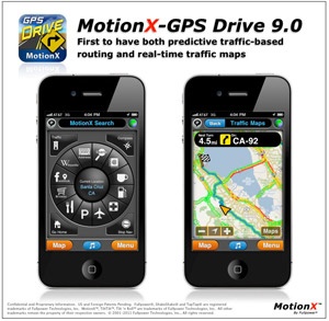
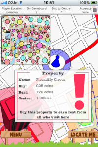
Our single-purpose GPS is way out of date (I'm the cheapskate and can just never bring myself to pay for map upgrades) so we decided to try out MotionX GPS Drive on this trip and the results could not have been better. MotionX GPS Drive has recently received a much-requested upgrade adding full-voice support for street names, so this new feature was added just in time for our trip. Mind you, neither the app nor the full-voice is perfect. "Exit 83-A" was commonly referred to as "Exit 83uh" and other street names were mangled from time to time, but as a whole the new voice functions worked well. And then there was the time when we needed to travel to the Animal Kingdom Lodge for dinner at African restaurant Boma. When I selected "Boma's at Animal Kingdom Lodge" from the app, it began navigating us, but our destination ended up at the main gate of some Orlando resident's palatial estate. A little fine-tuning was needed, but the app finally got us where we needed to go. MotionX GPS Drive is also a steal from a financial perspective - $0.99 for the app with guided navigation for $2.99 for 30 days. MotionX wisely does not auto-renew, so you only need to pay the navigation fee when you really need it, which is a very nice touch.

Once in the park, we had two go-to apps - 
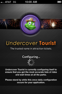
Undercover Tourist and Hipstamatic. If you're unfamiliar with Undercover Tourist, it's an app designed to give you information about anticipated crowds at the various Disney parks and queue wait times at rides within the parks. Unfortunately, Undercover Tourist pushed an update right before our trip and it broke the app on my iPhone 4. I was hopeful when I saw a new update released, but mine still crashes. My wife, ever reluctant to update apps, still had an older version on her phone, so we were able to use it. The crowd forecast for December 24th (color coded: red for heavy, yellow for moderate and green for light) showed green so we thought we had it made. Like I said earlier, the crowds seemed to surprise even Disney, so I can't really blame Undercover Tourist for a mistake in its data. The good news is that the queue estimates were generally accurate and helped us, particularly early on, decide where to go and what to do. And since the app is free (there is a paid ad-free version) there isn't much I can complain about.

Finally, what would a trip to the Magic Kingdom be without lots and lots of pictures? Sure, the iPhone 4 has a much-improved camera, but I'm a sucker for the retro surprises generated by Apple's iPhone App of the Year Hipstamatic. I suppose it's because my first trip to the Magic Kingdom happened only a year or so after the park opened, but I love the washed-out, 1970s style prints that Hipstamatic generates on the fly. Changing virtual lenses and films was a great way to while away the time spent in long, long lines (the Haunted Mansion line was longer than I have ever experienced), and the photos the app took are some of my favorites from this trip. There's a reason Apple selected Hipstamatic, and it's primarily because of its easy of use, versatility and overall fun-factor.

So, we're back home now, but there's no mistaking that the iPhone 4 changed our Disney experience for the better. For one thing, it was the first time we didn't have to lug around a heavy, cumbersome camera throughout the park; but beyond that, it made the day more pleasant, more organized and a lot more fun to remember.

TomTom Update Brings Map Share

Posted by Brad Hilderbrand on December 20th, 2010
+ Universal App - Designed for iPhone and iPad

Navigation has just got a bit easier as TomTom has announced that it has released version 1.6 of its GPS app. The new update brings Map Share technology to your iPhone, which allows users to easily alter and update their own personal maps, as well as instantly download new maps with updated information approved by TomTom.

“We are pleased to bring TomTom’s exclusive Map Share technology already enjoyed by millions of TomTom GPS users everyday to our iPhone App,” said Tom Murray, senior vice president of market development for TomTom Inc. “With the addition of Map Share, TomTom App users will get free, verified updates via Map Share anytime on top of the most accurate map available on-board.”

The basic idea behind Map Share is that it allows users to instantly know about any changes in road conditions in between major map updates. So if a road is closed off or the lane structure changes, users with Map Share can download the information immediately, instead of continuing to rely on outdated maps until the next major map upgrade arrives. The hope is that access to this technology will lead to fewer lost and confused drivers who are forced to rely on inaccurate information when they're out and about. The app will update automatically every week, or can also be manually updated on-demand by owners.

It's particularly nice that the update is landing right now, as this marks a week when a lot of folks will be on the roads and, given the volatile nature of the weather this time of year, constantly in need of the most recent route information. Hopefully this new TomTom update will allow users to see road closures or other issues in advance and work their way around any potential problems.

TomTom also offers traffic updates separately, as an in-app purchase. Put the pieces all together and you can definitely go forth confident in the knowledge that you have all the travel info you could ever need right at your fingertips. Hooray for removing a little bit of the stress from holiday travel!

Navigon Launching Series of Free Apps

Posted by Brad Hilderbrand on December 17th, 2010
iPhone App - Designed for iPhone, compatible with iPad

Navigon, the company behind the extremely useful MobileNavigator app, has announced that they will be releasing a series of free, single-purpose apps in 2011. The first up is help2park, which is available right now.

Help2park does exactly what its name implies, specifically it allows users to find all available parking lots and structures within a preset radius. Users first set the radius in which they'd like to search and with a simple tap help2park will track down and display every potential parking place within that radius. Results can be displayed in either list or map form, so you can find your place either by looking for the specific address or checking your current location against the map. Those who also have MobileNavigator installed can set the GPS to take them directly to the parking location of their choice, circumventing any potential navigation issues.

Of course what the app can't do is tell you if any spots are available in the lot you've chosen, so it might be a bit more useful for day-to-day errands and shopping than trying to find a spot at a major sporting event or concert. Yes, the stadium does indeed have several parking lots, but unless you're there early they're likely all full, so you'll have to keep looking. The app might also be helpful for those who are traveling in a new city and don't really know where to park their car in a strange metropolis. As someone who lives near Washington, DC I can tell you that this app will be a godsend next time I try and drive downtown. The city's already confusing enough as it is, but when you factor in trying to find a parking space it becomes a downright nightmare.

We're looking forward to seeing what other apps Navigon comes up with over the next several months to make our travels a bit easier. If help2park is any indication then we're in for some real treats.

MobileNavigator Gets Native iPad Support, Major Updates

Posted by Brad Hilderbrand on December 17th, 2010
+ Universal & Apple Watch App - Designed for iPhone, iPad and Apple Watch

NAVIGON has announced today that its MobileNavigator app is receiving a major update, most important among them the fact that MobileNavigator will feature native iPad support. The update also includes numerous other new features including Zagat ratings and reviews, a map reporter to update new road information and in-app user notifications and newsletters.

One other new feature deserves special mention because it's particularly cool. MobileNavigator's new Active Lane Assist feature will help users more fluidly navigate the roadways by providing optional directions on which lane to merge into at any given time. The feature creates a map of the road ahead and demonstrates when and where users should merge so as to have the safest and easiest trip possible. No more having to dive across five lanes of traffic to make an exit or work through multiple lanes of congestion just to find out that the lane you're in will die out in a quarter mile and now you have to merge back into the mess you just got yourself out of. For those who prefer to not be told what to do the lane assist is an optional feature which can be turned on or off whenever you please.

We're also excited about the Zagat integration which offers over reviews 40,000 restaurants, hotels, attractions, golf courses, nightspots and other leisure activities. All users have to do is tap on an applicable location to see its Zagat rating, and we assume more ratings will pop up for new locations in future updates.

The MobileNavigator update is currently available for all US MyRegion apps, and the new version should be hitting the USA and North America editions very soon. What is already one of the best GPS apps out there just got even better, so enjoy all the fancy new features aimed at making your life easier.

Google Latitude Now Available

Posted by Brad Hilderbrand on December 13th, 2010
iPhone App - Designed for iPhone, compatible with iPad

After a bit of a false start last week, Google has officially launched its Latitude app for the iPhone. The free app allows users to continuously broadcast their location to friends and family as well as see where other contacts are on a map at any time. The app also allows for background updating, allowing Latitude to continue to track where you are even when the app is closed.

For those concerned about privacy issues Google reminds you that the app is 100 percent opt-in, and your current location will only be shared with friends who you have added and approved to your account. Furthermore, users are free to turn off both the background tracking at any time, and you can also hide your current location or log out entirely if you aren't feeling particularly social. It may not be enough to persuade the truly paranoid to try Latitude, but for the Foursquare crowd this is just about the perfect app.

It's also worth noting that Latitude has been available to iOS users as a web application for quite a while now, but this is the first time it's been presented as a native app. Thus, Google has built the app with the iPhone 4 in mind so users will need a device such as an iPhone 4 or 3GS which is running iOS 4 or above to support the service. If you're still clinging to an original iPhone or iPod Touch then sorry, but it's not going to work. The app will also work with the iPad, but considering it's more of a mobile geolocating service it might not be terribly useful for tablet owners. In any event, Latitude is now officially here for iPhone users, so get out there and continue oversharing all the details of your life, including where you're standing at any given second.

[via Google Mobile]

Loopt Is Still Plugging Away

Posted by Chris Hall on December 7th, 2010
iPhone App - Designed for iPhone, compatible with iPad

Before anyone knew what location aware apps were, before Foursquare, MyTown, and the like were house brands, there was Loopt. Everyone on the planet (maybe a slight exaggeration) had Loopt, but nobody really knew what to do with it. After a few weeks of use, Loopt eventually became a personal stalking app for the willing, allowing you to knowingly let your friends GPS track you as you go about your day. Years later, Loopt has hit 4.0 and is still trying to show its 4+ million users why it is relevant. Now though, it really is pretty neat.

Like before, Loopt works by connecting you to your Loopt friends (who I'd hope are your real friends) by showing you where everyone is on a map. Instead of just tracking people, Loopt is now socially aware, allowing you to not only check in to places, but also invite friends to where you are at. Let's say that you go to your favorite burger place and want your friend(s) to join. Instead of leaving the app to send some texts, Loopt allows you to punch in a message (called a Ping) that instantly alerts the other users mobile device (allowing them to send a "Pong" with their location and reply).

Working nice with Facebook Places, Loopt is now a fully operational check-in service too. You can't become the mayor of every place you walk to, but it does have a really cool area that shows you what is going on around town and which places your friends like the best. With the location aware feature, Loopt also tells you when and where rewards are around you that companies may have left for people checking into certain places, just to add something tangible to your check-in experience.

Also nice, and of interest, is the ability to toggle and edit the auto update feature. Instead of just blasting out your location for everyone you know to see, you can choose who sees you and where. If you want everyone still tracking you, you can do that, but if you want certain people to only see you if they are within a certain range, or not at all, you can do that too.

As always, Loopt is a completely free app and can be downloaded right now in the App Store. Getting users to download it years after it was all the rage could be an issue, but the new features just may make it worthy of a second (or third, or fourth) look.

iRule London Available, Location Based Boardgame

Posted by Chantelle Joy Duxbury on October 6th, 2010
iPhone App - Designed for iPhone, compatible with iPad

If you're looking to have a bit of location based fun with your iPhone and happen to be in the great city of London, England, you should check out the new iRule London app. It brings together all the fun of location-based social sharing and includes a game element that will have you buying land, owning property, setting up tolls, and much more - all using your iPhone as the game piece, and the city of London as the game board.

Think of it, if you want, as a real-life Monopoly. The goal is to amass a fortune in 'money' and 'land.' You start with a daily allowance and you use these points in many ways. Or you can claim your turf by setting three place markers; once claimed, this area is under your control and visitors have to pay to pass through your area. All of this is controlled by the app using your GPS location. There are even daily awards for some of the best players based on different criteria, including a special weekly challenge!

Set up your home location and earn extra points for checking in every day! Set up secret 'Jails' to trap others when they accidentally stumble into one, and have to pay you to get out! There's lots of different situations and scenarios that will come about when you use actual geography as the playing field for a massive online game!

Location based and augmented reality apps are quickly becoming some of the most popular new attractions on the App Store, and this will definitely be one to watch out for. As the iRule team builds their series of apps we should all hope that they'll be creating options for the USA or other European cities soon enough!

Until then, if you live in London (or perhaps are just heading for a visit -- how great would it be to spend a day sightseeing with this in your pocket too?), you should check out iRule London, created by Eric McKinley. Find out more about the games on their official site!