


App Description
Zagori topoguide is a digital field guide for hikers and nature lovers covering the famous Zagori region, located in NW Greece. It includes hiking routes, descriptions and photos for 45 hiking and mountaineering trails. Hiking routes include 6 sections of the National Trail O3.
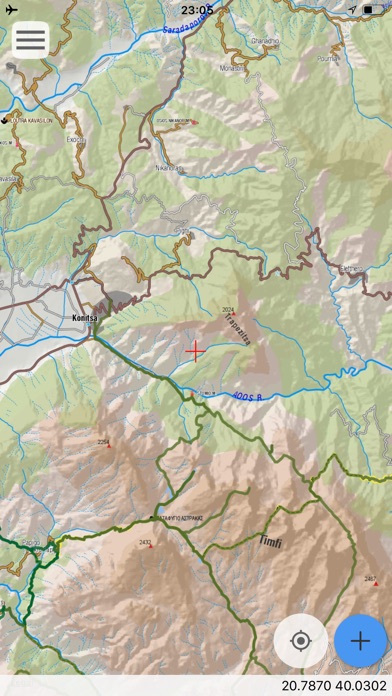
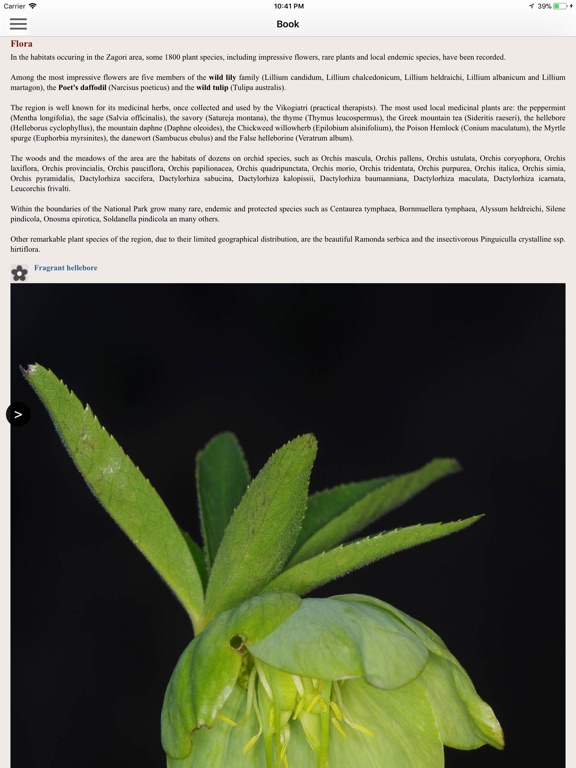
The application offers detailed offline maps and an extensive introduction on geography, geology, the nature and the rich human history of Zagori area, including a complete guide for some 70 old stone bridges, 40 traditional villages, dozen of caves and potholes and all the natural monuments of the region.
The app offers also a useful list of more than 300 POIs. The trails list includes easy and moderate hiking trails as well as long mountain traverses, with a total length of 300 km.
In the field, the app identifies the nearest adventure, guides you to it and then along it by displaying messages and warnings on every junction or other important location. On each Point of Interest, photos and texts are displayed on the map. If the hiker gets off-trail, the app indicates the shorter way to get back safely.
The cartographic company AnaDigit, creator of the application, has issued previously detailed hiking maps at a scale of 1: 50,000 for Zagori area, as well as hundreds other hiking maps for Greece (eg. maps of Mt. Olympus, Crete, Zagori, Sifnos, Naxos and other Aegean islands). To build the application and ensuring data accuracy, all paths of Zagori area have been revised during 2016 and 2017.
iPhone Screenshots
(click to enlarge)


iPad Screenshots
(click to enlarge)


App Changes
- March 24, 2018 Initial release
- June 13, 2019 Price increase: $5.99 -> $6.99
- June 13, 2019 Price increase: $5.99 -> $6.99
- June 14, 2019 Price increase: $5.99 -> $6.99
- June 14, 2019 Price increase: $5.99 -> $6.99
- June 15, 2019 Price increase: $5.99 -> $6.99
- June 15, 2019 Price increase: $5.99 -> $6.99
- June 16, 2019 Price increase: $5.99 -> $6.99
Other Apps From Topoguide - T ADAMAKOPOULOS - A ADAMAKOPOULOS O.E.


