What's New
Added sounding unit to speed display (e.g. DEPTH IN FEET)
App Description
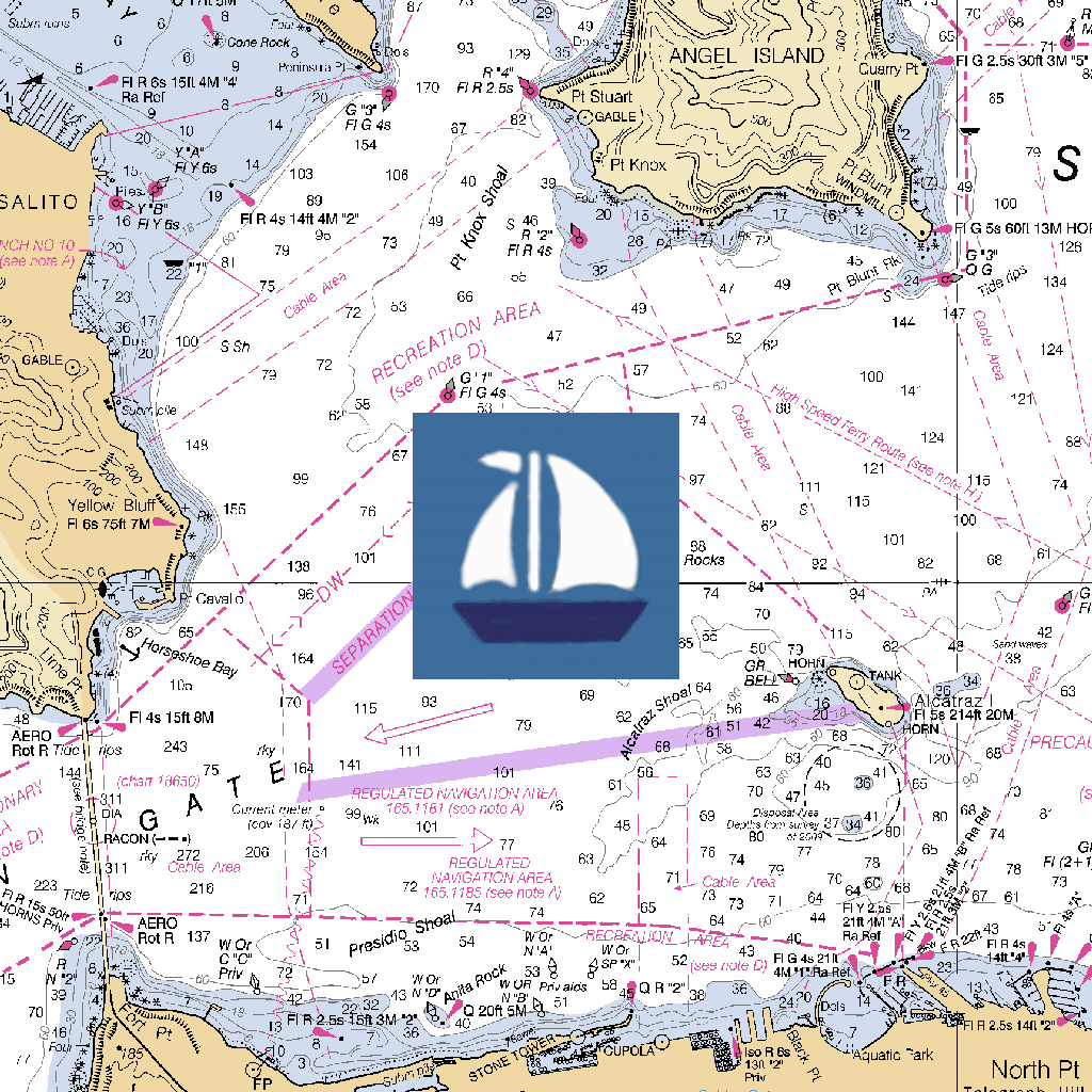
Sail Bay Area displays high-resolution marine navigation charts for sailors and boaters in the San Francisco Bay Area. The application uses NOAA vector charts that have been converted into huge, high-resolution images. The images have been highly optimized for fast, efficient panning and zooming. When viewing charts, the application will obtain GPS coordinates from your iPhone or iPad (if available) and will plot your location on the chart. Your speed and bearing will also be shown.
The charts are based on NOAA data as of November 2012. The following charts are included:
1. 18640 - San Francisco to Point Arena
2. 18645 - Gulf of the Farallones
3. 18649 - San Francisco Entrance
4. 18650 - Candlestick Point to Angel Island
5. 18651 - San Francisco Bay Southern Part
6. 18653 - Angel Island to Point San Pedro
7. 18654 - San Pablo Bay
8. 18656 - Suisun Bay
9. 18680 - Point Sur to San Francisco
10. 18682 - Half Moon Bay
11. 18685 - Monterey Bay
12. 18686 - Pfeiffer Point to Cypress Point
The charts are stored on your device for off-line viewing.
While the charts are based on NOAA data they should only be used as a navigational aid and not as a substitute for navigational equipment required under law or marine regulations.
Special thanks to Bob Webster for converting the charts to PNG format.
iPhone Screenshots
(click to enlarge)


iPad Screenshots
(click to enlarge)


App Changes
- June 15, 2014 Initial release
Other Apps From Peter Easton