
What's New
- Fixed a bug in iOS14.
- The altitude of the facilities on the disaster prevention map has been changed from the average altitude of the surrounding area to the lowest altitude of the surrounding area.
* With Ver.1.2.0, end of support for less than iOS12.
App Description
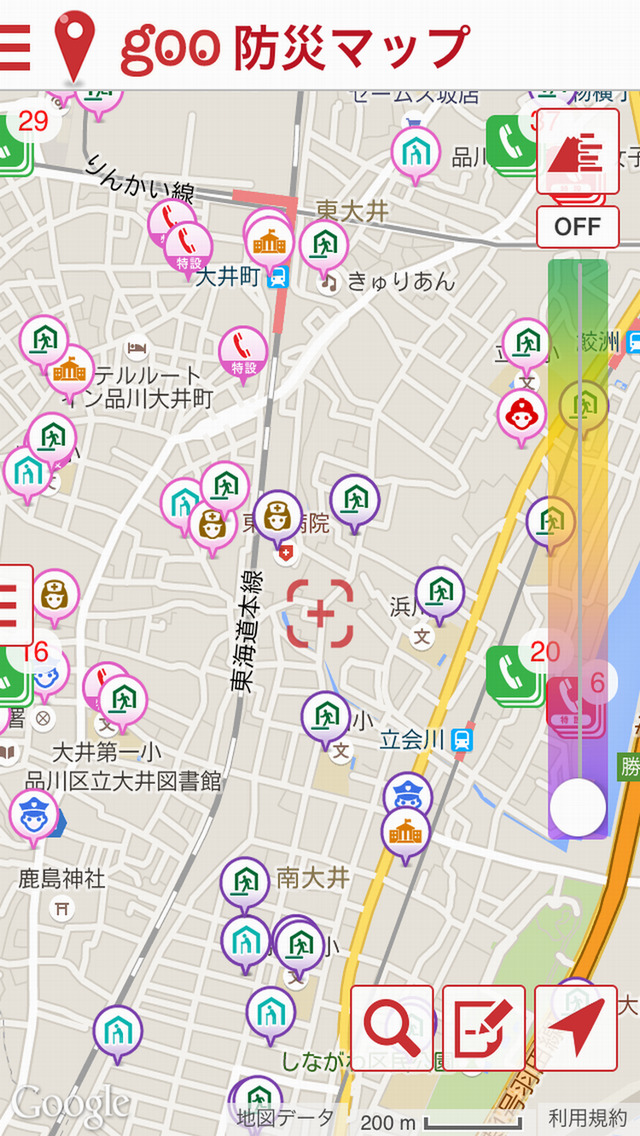
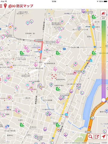
"goo disaster prevention map" is a disaster prevention map application provided by NTT Resonant.
Open data such as evacuation centers, public facilities and hospitals provided by the Ministry of Land, Infrastructure and Transport, and public telephone data provided by NTT East and NTT West are displayed on the map.
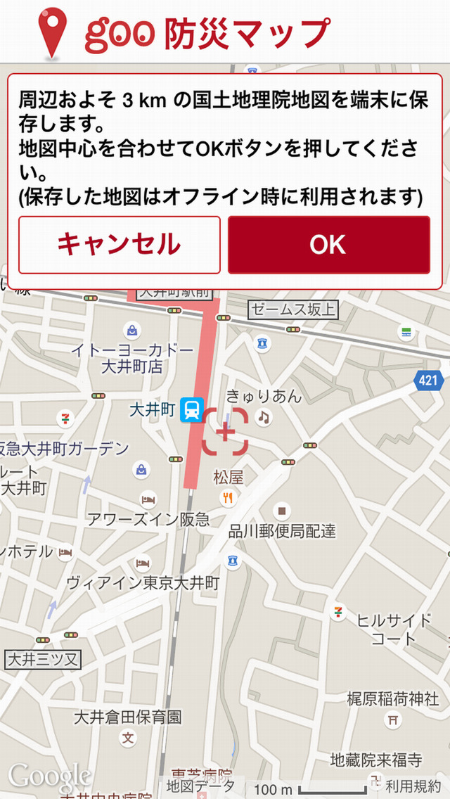
In addition, about 3 km around the center from the center of the map can be preserved in the terminal in advance, you can use the map of the saved range even when the radio wave status is offline.
Information on evacuation centers and facilities, public phones, etc. displayed on the map can be switched according to the altitude data of the place. In addition, there are functions such as evacuation route search at evacuation drilling and the ability to save footprints and memorandums during evacuation drills.
-----
* This application will notify important information in conjunction with current position information.
In order to distribute notifications properly based on highly accurate location information, GPS is used by default.
Since GPS is used in the background to acquire the position, if you continue to use continuously, there is a danger that the battery will be drastically reduced.
In addition, it is possible to set the battery consumption less (GPS not used) from the setting menu.
iPhone Screenshots
(click to enlarge)


iPad Screenshots
(click to enlarge)


App Changes
- June 09, 2015 Initial release
- December 05, 2015 New version 1.1.0
- June 14, 2019 New version 1.1.2
- December 09, 2020 New version 1.2.0
Other Apps From NTT Resonant Inc.