
What's New
- bug fixes
App Description
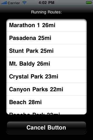
Maps designed for Runners and Cyclists, showing more than 500 miles running routes with elevation profile in Los Angeles
FEATURES:
- showing running route locations
- elevation profile of the route
- display a Map in different styles (Standard, Satellite, Hybrid)
- sharing map location and information
- sharing map routes
- showing user's location
- more than 500 miles running routes
iPhone Screenshots
(click to enlarge)


iPad Screenshots
(click to enlarge)


App Changes
- June 14, 2014 Initial release
- November 06, 2016 New version 1.1
Other Apps From Martin Bovan