
What's New
- Fixes an issue with Pacific Satellites not loading correctly do to a change on NOAA's servers
- *If you currently have a Pacific Satellite selected, you will have to reselect the Satellite for it to load again, you only have to do this once*
- Updated to latest Google Ads SDK
App Description
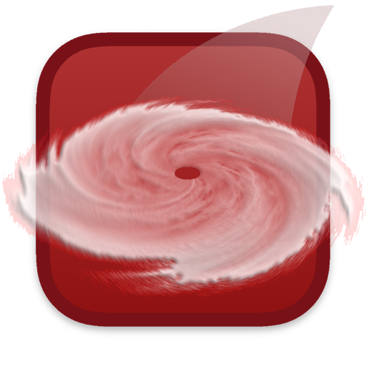
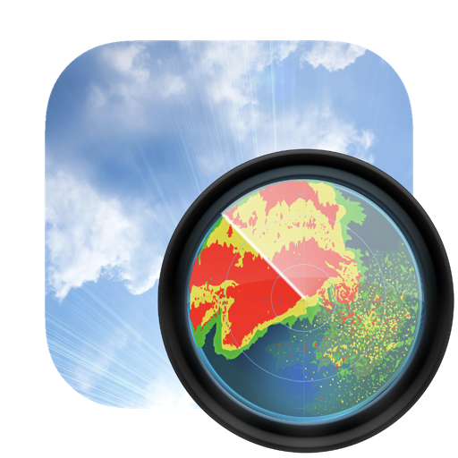
Hurricane Track 3.0 is the most advanced, modern, and easiest to use Hurricane Tracking and Radar application! Hurricane Track 3.0 features incredible new features such as 18 World Radars featuring the newly launched GOES-16 Satellite, a new customizable dynamic Local Radar using NEXRAD "next-generation radar" technology, Forecast and Hazard warnings, future projected tropical cyclone paths, Lightning Intensity Radars, Sea Temperatures, Cloud Formations that can potentially turn into tropical cyclones, Maps, an interactive 3D Earth, detailed tropical storm information and discussion, and much much more! Hurricane Track 3.0 brings the most advanced hurricane tracking technology to your fingertips, and the best part is Hurricane Track is Free!
Innovative Features!
- 300+ World Radars: 18 Radar Locations around the globe with 17 Radars per Location
- Customizable Advanced Local Radar using NEXRAD technology (U.S. only)
- Projected Tropical Storm paths: Future tropical storm paths for the next five days
- Forecast and Hazards give you detailed forecasts for different periods of the day, and hazards that you should look out for (Tornado Watch, Flood Warning, High Tide, etc.) (U.S. only, Updated hourly)
- Innovative Lightning Intensity Radars
- Interactive Map with Tropical Cyclones, Live Clouds, and Earthquakes
- Sea Surface Temperatures for the past two months
- Graphical outlines of cloud formations that can turn into potential Tropical Storms
- 3D Earth with Live Clouds, Tropical Storms, and Earthquakes
- Tropical Storm and Weather Information, Summaries, Discussions, and Outlooks
8 World Radars for 12 different Locations around the Globe!
- Visible - Unenhanced visible imagery that transitions to IR2 overnight
- Shortwave - Channel 2 Shortwave Infrared imagery - Shortwave, sometimes considered "night visible"
- Water Vapor - IR Channel 3
- Aviation - Aviation color enhancement
- Dvorak - Used for tropical classifications with the Dvorak technique
- JSL - Used to bring out low level and high level clouds in tropical cyclones
- Funktop - Higlights intense areas of precipitation
- Rainbow - Rainbow enhancement curve, colorful enhancement
iPhone Screenshots
(click to enlarge)


iPad Screenshots
(click to enlarge)


App Changes
- August 24, 2011 Initial release
- August 31, 2011 New version 1.03
- July 31, 2012 New version 1.5
- August 18, 2012 New version 1.51
- June 11, 2013 New version 1.52
- July 03, 2013 New version 2.0
- December 01, 2013 New version 2.01
- December 06, 2013 New version 2.02
- July 28, 2014 New version 2.03
- August 07, 2014 New version 2.31
- October 01, 2014 New version 2.52
- June 28, 2015 New version 3.0
- October 24, 2015 New version 3.0.1
- June 23, 2016 New version 3.0.2
- July 07, 2016 New version 3.0.3
- June 13, 2019 New version 3.2.6
- June 21, 2019 New version 3.2.7
- June 27, 2019 New version 3.2.8
- August 16, 2019 New version 3.3.0
- September 24, 2019 New version 3.3.1
- October 23, 2020 New version 3.3.2
- August 05, 2021 New version 3.3.3
- September 16, 2023 New version 3.3.5
Other Apps From Mach Software Design