
What's New
Latest Map Files.
App Description
NEW: 5G maps & integrated speed testing!
Directly overlay and compare cellular carrier coverage maps! Perfect for travelers - research where you're covered across the USA (and now Canada!!)
** Follow our Facebook page to get update alerts: http://www.facebook.com/CoverageMapApp, or check our support page**
Coverage? focuses on helping mobile bandwidth junkies find cell signal as they roam. Save time looking up coverage on the carrier's websites, compare their claims head to head and better plan your travels to stay connected.
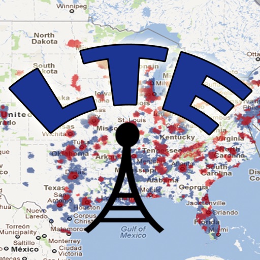
** The carrier's maps in your pocket: This app contains regional level maps based off of each major carrier's data map - as found on their website as of our last update. Quickly overlay the carriers you use to create your own personalized coverage map on your device.
** No internet needed: Our proprietary coverage maps are stored within the app on your device - no downloading needed! Quickly access where you're supposed to get a signal, even when you have none.
** Urban and rural areas: Maps are at a regional level, and cover the entire continental USA, Canada, Alaska, Hawaii, Puerto Rico, and the US Virgin Islands.
** Carriers included: AT&T, Verizon, T-Mobile, US Cellular.
** Canadian Carriers: Bell, Telus, Rogers (optional unlock)
** Know where to roam: view 5G, LTE, and roaming areas as overlays, focus on finding the coverage type you desire.
Check http://www.twostepsbeyond.com/apps/coverage for a quick video demo.
We created this app because we are full time 'technomads' ourselves who rely on mobile data to work remotely. Keeping this app updated is a priority for us, as we depend on it ourselves!
--------------
Coverage FAQ:
Q: Why aren't the maps more detailed or released more often?
A: Our map updates require a lot of meticulous labor intensive processing. There's just no practical way to issue a new update every time a new tower is turned on. We monitor new coverage and try to find balance between effort & staying current. This generally means at least a couple updates a year.
Q: What makes 'Coverage?' unique?
A: There are great apps out there that collect user submitted signal reports - we recommend them and use them ourselves. However, those apps are only useful in markets with an active user base. We took a different approach with Coverage? - we needed a tool to at least give us an idea of where signal should be - urban, rural, and out in the boonies.
--------------
Named 'Essential Tool' by Wired Magazine
** Winner - 'Most Useful App' - iOSDevCamp
"this app can be indispensable" - Lifehacker.com
--------------
The maps in 'Coverage?' are provided in partnership with Ookla, and represent proprietary interpretations of the coverage reported by each carrier. You should not rely on the maps in Coverage to be perfectly precise or absolutely timely.
Ongoing map updates have been free - but to support the ongoing development costs, we now allow customers to subscribe to higher resolution maps that will be updated more frequently.
Coverage does not report or predict signal strength (there are great apps out there for that!). We can make no promises as to where you'll *actually* get signal.. there are too many variables - towers, device, terrain, weather, etc.
So… Got Coverage?
Additional information about The HD Maps Subscription:
This is an auto-renewable subscription, with a duration of one year.
The subscription fee will be charged to your iTunes account upon confirmation of purchase, and will automatically renew each year unless auto-renew is turned off at least 24 hours prior to the end of the current subscription period.
Current subscriptions may not be canceled during the active subscription period; however, you can manage your subscription and/or turn off auto-renewal by visiting your iTunes Account Settings after purchase.
Terms of Use and Privacy Policy: http://www.twostepsbeyond.com/privacy/
iPhone Screenshots
(click to enlarge)


iPad Screenshots
(click to enlarge)


App Changes
- December 07, 2011 New version 1.1
- March 22, 2012 New version 2012.3
- June 18, 2012 New version 2012.6
- August 11, 2012 New version 2012.7
- November 06, 2012 New version 2012.10.2
- December 05, 2012 New version 2012.11
- January 17, 2013 New version 2013.1
- March 26, 2013 New version 2013.3
- April 04, 2013 New version 2013.4
- May 31, 2013 New version 2013.5
- July 26, 2013 New version 2013.7
- October 06, 2013 New version 2013.9.1
- January 13, 2014 New version 2013.11
- January 30, 2014 New version 2014.1
- June 14, 2019 New version 2019.2
- September 04, 2019 New version 2019.8
- July 14, 2020 New version 2020.4
- October 23, 2020 New version 2020.7
- May 06, 2021 New version 2021.2
- August 05, 2021 New version 2021.5
- September 16, 2023 New version 2023.7
Other Apps From Two Steps Beyond