
What's New
Nothing is new except the version number!
App Description
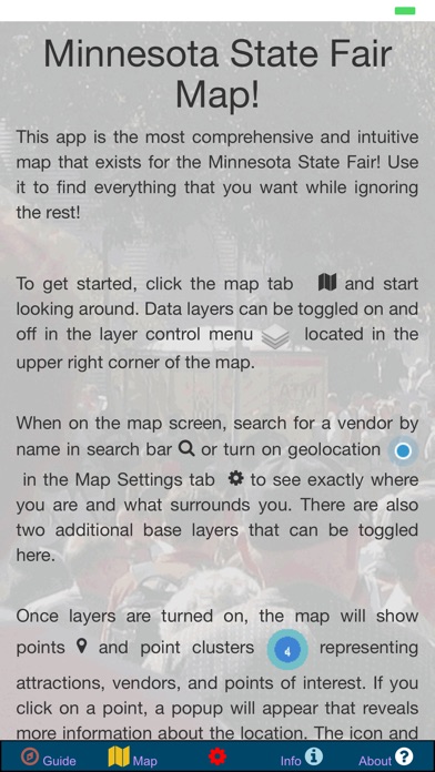
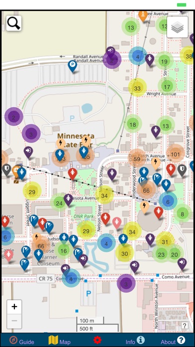
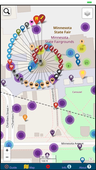
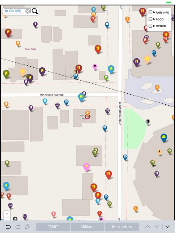
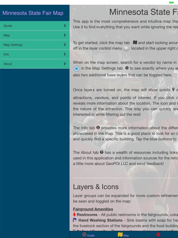
This is your ticket to navigating the chaos of the Minnesota State Fair with ease! It allows users to see the locations and details of over 1000 food and merchandise vendors in an intuitive map that can seamlessly zoom and track your position with GPS. All attractions are displayed on the map by default so that you can always find what is nearby.
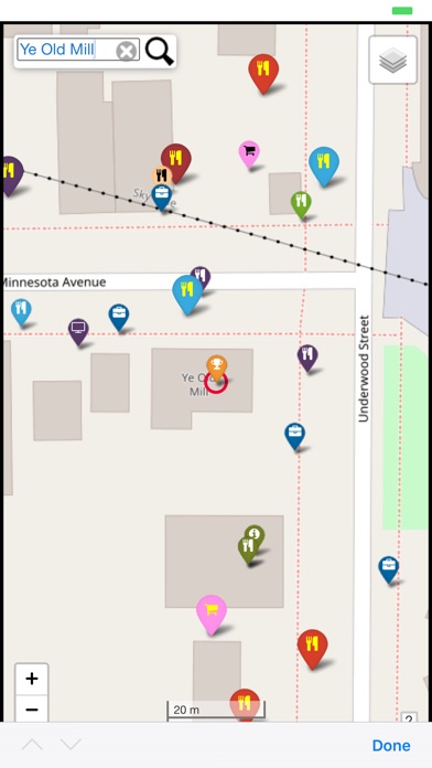
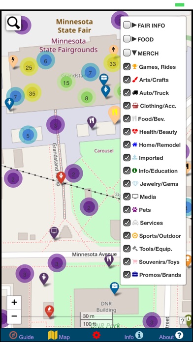
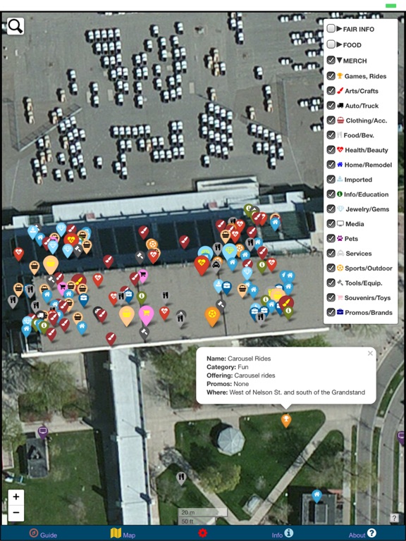
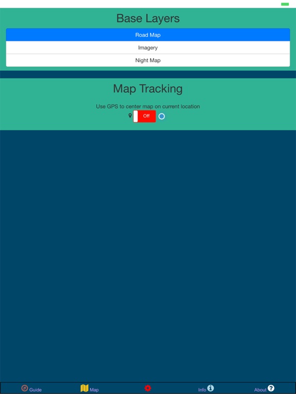
The data can also be filtered by category so that the map shows only what you want to see! You can search for a vendor by name and locate their position on the map relative to where you are. The dynamic zooming display with native app controls has three base layers to choose from including a day map, a night map, and satellite imagery. Compare this to the single-vendor low-quality PDF maps that other state fair apps use!
This app has been designed to work completely offline and in airplane mode. It includes 20 megabytes of bundled tile layers so that the map dynamically changes as you zoom without needing to use 4G cellular data. This is also useful as wireless towers are often overloaded during the fair, making offline mode essential! GPS location will still function in airplane mode, so never worry about getting lost!
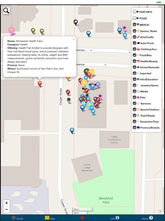
Points and point clusters are labeled with unique icons and/or marker colors based on their attributes so that they can be effortlessly identified at a glance. Vendors offering promotional items as part of the Blue Ribbon Bargain Book deals are listed with a larger icon that is bright yellow to help you quickly locate the deals and make the most of your money at the fair! The money that this feature can save you will easily offset the cost of this app!
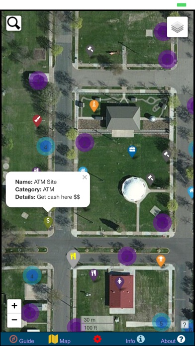
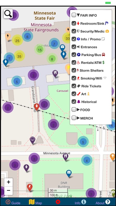
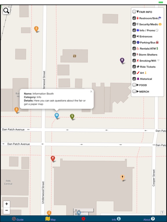
When any point is clicked, it will display a popup that gives a summary of information regarding the vendor, what they are selling, and where they are located. The map includes 9 categories of food vendors, 18 categories of merchandise vendors, and a wealth of practical data such as the locations of restrooms, ATM machines, security, artistic points of interest, parking lots, smoking areas, hand-washing stations, storm shelters, rides, games, WiFi hotspots, and more!
Use GPS with your smartphone to locate yourself in the jungle of the fairgrounds and clearly see everything that is nearby. Prevent unnecessary stress and effort by displaying only the vendors that you want while getting the best deals and promotions!
Always know where amenities such as restrooms, storm shelters, and exit gates are at as these points will not cluster on distant zooms like the food and merchandise vendor points! Unclustered points can still be turned off if you prefer not to use these layers.
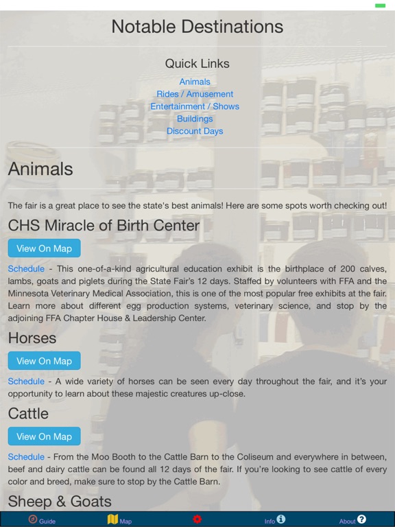
All of the events are outlined and summarized on the info page with links to display the locations on the map and a weblink to the official State Fair schedule. This includes concerts and other stage performances, fun attractions like rides, games, and other amusements, all of the major fair buildings such as the Grandstand, 4H, etc., and animals such as rabbits, sheep, goats, horses, birds, steer, pigs, etc. This is the easiest way to quickly find the things that interest you and make the most out of your time at the fair!
You may remember our app from 2017, where we had thousands of downloads and a great amount of useful feedback. We listened to your input and have improved this app in a number of ways! We paid close attention to what the other related apps lack and have made every effort to provide the best and most comprehensive State Fair App available! If you have new features you would like to see next year, feel free to contact us using the form inside the app with any suggestions, comments, or ideas!
By purchasing this app, you are supporting a promising cartography business headquartered right here in Saint Paul, MN. Thank you for contributing to the success of small businesses in our great state and supporting the initiatives of GeoPOI LLC! Your encouragement, feedback, ratings, and reviews are greatly appreciated!
iPhone Screenshots
(click to enlarge)


iPad Screenshots
(click to enlarge)


App Changes
- August 15, 2018 Initial release
- June 15, 2019 New version 1.1.1
- August 17, 2019 Price decrease: $1.99 -> $0.99
- October 28, 2020 Price increase: $0.99 -> $1.99
Other Apps From GeoPOI LLC