
What's New
Updated for IOS 15 compatibility
Updated UI
Updated Launch Screen
App Description
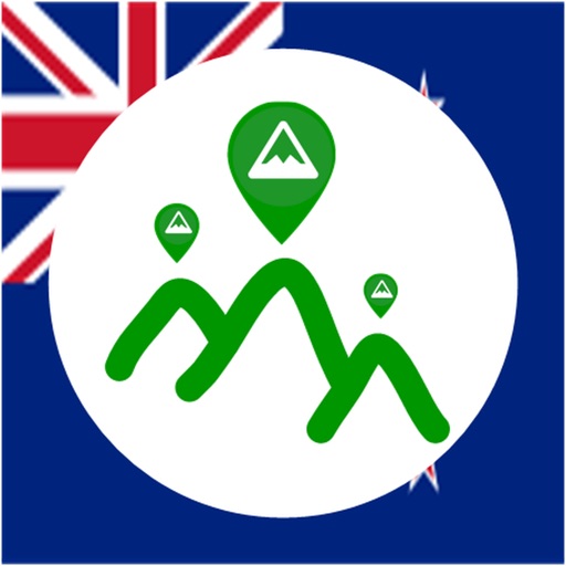
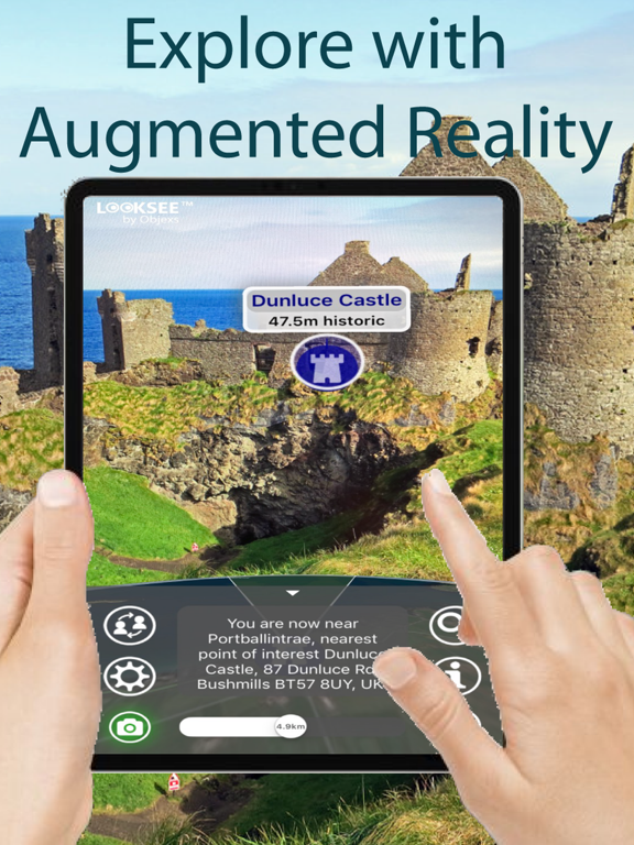
Looksee AR for Northern Ireland is an Augmented Reality (AR) viewer that you can use to find places of interest directly within your phone's camera view and add fun, knowledge and interest to your adventures and tours.
Ideal for both tourists and locals wishing to explore and find out more about their surroundings and beyond: whether by foot, bicycle, car, taxi or Uber!
It's simple to use - you just point and go! It includes a choice of interactive Map or Satellite Image in view, and a Search function to help locate things. You can use it to explore, navigate or as a travel guide companion.
Once downloaded no wi-fi or cellular network is necessary, so you can use when out and about in Northern Ireland when there is no or poor signal coverage.
Northern Ireland is known for its Norman castles, glacial valleys and mountains, Celtic and Christian monuments, and coastal links golf courses. Capital city Belfast is home to the political murals of the 20th-century ‘Troubles’ conflict, and the Titanic Quarter, showcasing the redeveloped dockyards where the famous ship was built and a contemporary museum, Titanic Belfast. This App encompasses the entire region with Ballycastle at its northern most edge, Crossmaglen in the south, east past Portavogie and west to Belleek. In total this is an area of around 25,000km2.
All areas within the Northern Ireland region are covered including the Belfast City Centre, Ballymena, Coleraine, Craigavon, Derry, Dungannon, Lisburn, Newry, and Omagh
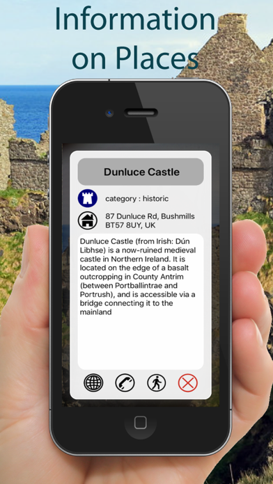
In fact there are around 8,000 places of interest viewable within the Looksee App including The Giant's Causeway, The Causeway Coast and Carrick-a-Rede Rope Bridge, The Titanic Belfast, The Glens of Antrim, Carrickfergus Castle, Mount Stewart House and Gardens and historic Londonderry.
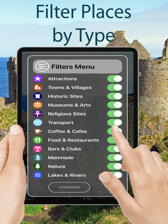
Categories that can be viewed and selected include Tourist Attractions, Hills, Lakes, Parks & Woodlands, Cities, Towns, Suburban Areas, Villages & Hamlets, Cafes, Restaurants, Bars, Airports, Train & Major Bus Stations, Municipal Buildings, Places of Worship, Historic Sites and Museums & Arts.
Some of the helpful Looksee features include:
- Interactive objects (that you can touch for more information on them)
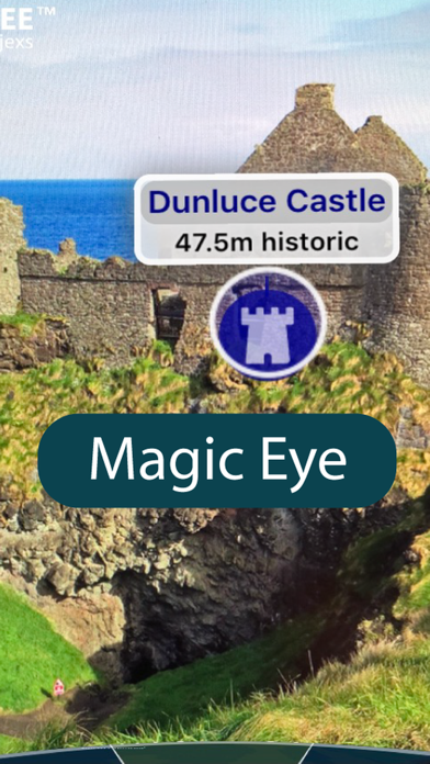
- Magic EYE (to declutter the visuals and select only objects within)
- Satellite or Map image in view (can select which or disable completely)
- Search menu (with on-screen directional arrow and indicator graphics)
- Filters menu (using which the categories of points of interest you wish to display can be easily filtered out or selected)
- Distance slider (for an interactive depth of view filter up to 10km)
- Zoom (using an on screen pinch to zoom gesture)
- Snap-shot camera (for annotating your photos)
- Video recorder for saving and sharing interesting places on social media (accessed by holding the camera icon for 1 second)
- Radar view of everything around you on map (hold face down)
So please enjoy adding interest to your Northern Ireland outdoor adventures!
Apple Maps AR
iPhone Screenshots
(click to enlarge)


iPad Screenshots
(click to enlarge)


App Changes
- June 16, 2019 Initial release
- November 26, 2019 New version 8.5
- August 06, 2021 New version 9.1
- September 16, 2023 New version 9.3
Other Apps From OBJEXS LIMITED