
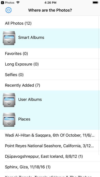
App Description
This app is a great utility which adds professional location information to the pictures in your Photo library.
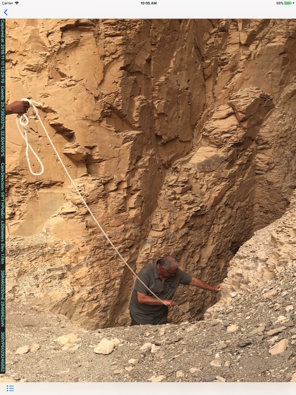
People who work in the field often need to document their work and their findings with pictures. Many kinds of professionals prefer to use the Universal Transverse Mercator system (UTM), or the Military Grid Reference system (MGRS) to identify their location rather than latitude and longitude.
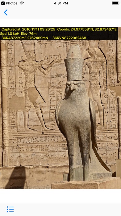
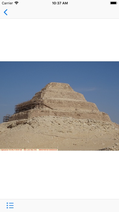
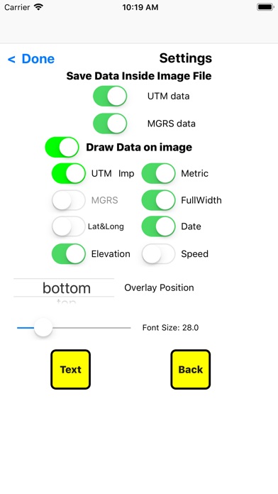
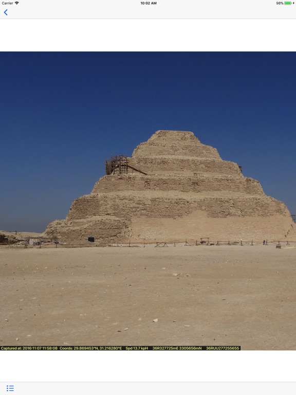
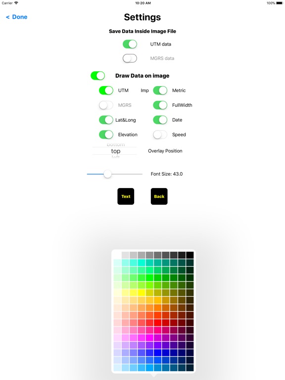
Mercator Pro adds UTM and MGRS data to your selected pictures both graphically and digital at your option from the latitude / longitude which your iPhone or iPad normally embeds in your pictures. Many other digital camera like compact camera and DSLRs also have built-in GPS and digitally embed the latitude and longitude. If you transfer these pictures to your iOS Photo library, Mercator Pro can add the UTM and MGRS data and graphical tags to these pictures too.
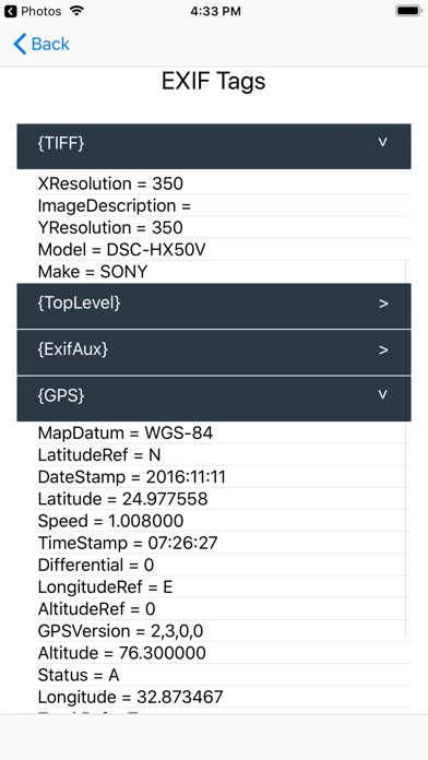
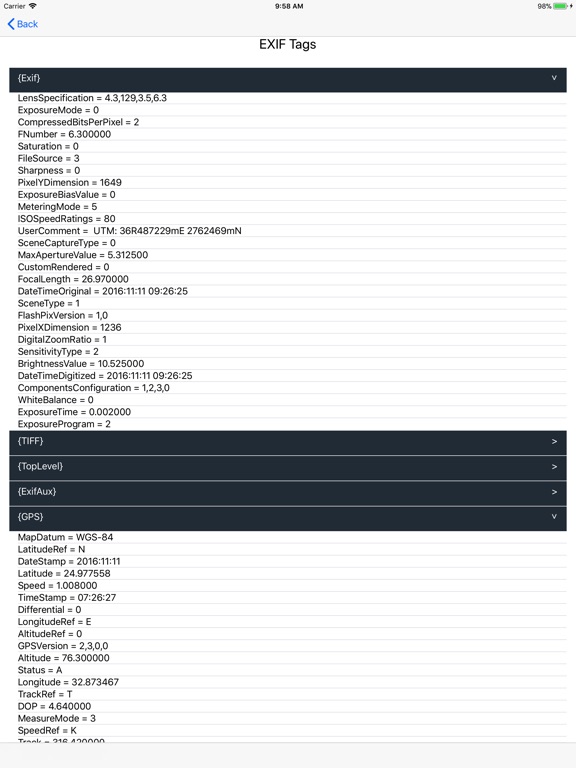
As an extra bonus, Mercator Pro can show you all the internal information in each photo as recorded by your camera - data like the Shutter Speed, ISO rating, Flash setting, etc.
Mercator Pro is Internationalized to Arabic, French, German, Hebrew, Spanish
iPhone Screenshots
(click to enlarge)
iPad Screenshots
(click to enlarge)

App Changes
- January 19, 2018 Initial release
Other Apps From Aviametrix, LLC