

What's New
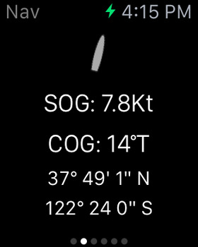
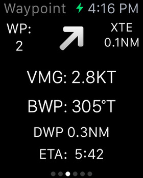
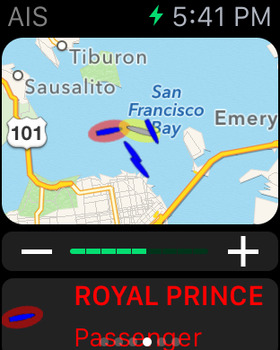
Apple Watch App greatly improved Nav, Waypoint, Map ,CPA Alerts & new real time wind display
Realtime local wind instrument using SeaNav's Weather feed (IAP) or NMEA over Wifi
Improved Instruments for Nav (inc. Depth), Waypoints & Wind
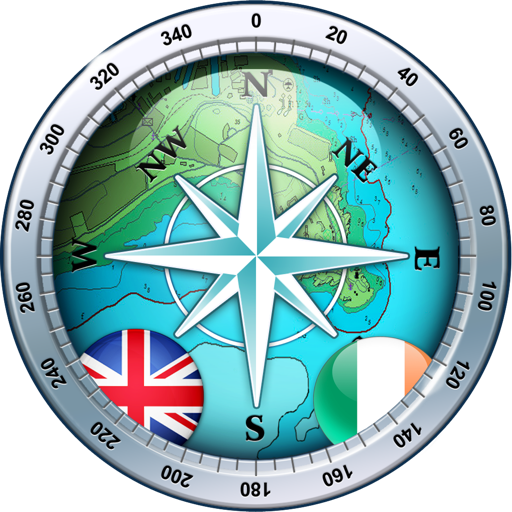
Live and predicted Tidal Streams for the UK & IE
Export tracks and routes as GPX (e.g to MFDs, Chart plotters and Navionics)
Export and import all POIs
Settings for Auto/Day/Night mode display
User guide and FAQ now available in multiple languages.
My Boat Details now lets you set the type - e.g. Sail, Pleasure, Fishing.
Own boat icon now bigger so more easily viewed and colour shows boat type.
Bridges, Shoreline and Traffic zones UI improvements
Flashing light patterns updated for South Cardinals
iOS16 ready
App Description
Explore, Plan and Navigate in real time and outstanding high-resolution with the latest Digital Vector Marine charts and powerful route planning and navigation tools.
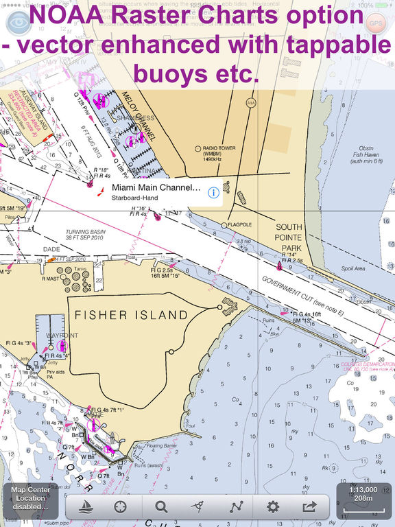
Our free version includes all our navigation and trip planning tools. High resolution vector charts derived from official NOAA and UKHO ENC chart data (including US,CA,UK,IE,NL,BE,DE,FI,NZ) and live AIS and Augmented Reality views (AR) are available by In App Purchase (IAP). Each chart purchase provides free updates for a 12 month period.
Free features:-
- Instruments
- Normal, satellite and hybrid view maps
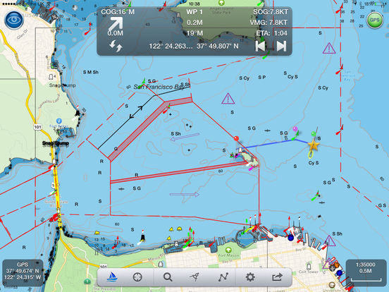
- Route Planning and real-time tracking
- North up and course up displays
- Charts work offline
- Route export, import and sharing
- Share routes via Dropbox
- Built-in tutorial mode including demo charts.
- NMEA GPS, AIS, Wind Speed and Direction gauges
- Tide, moon and sun times
- Weather including wave height and period
- Apple Watch App
- Favourite Places
Additional features available via In App Purchases (auto-renewing subscriptions):-
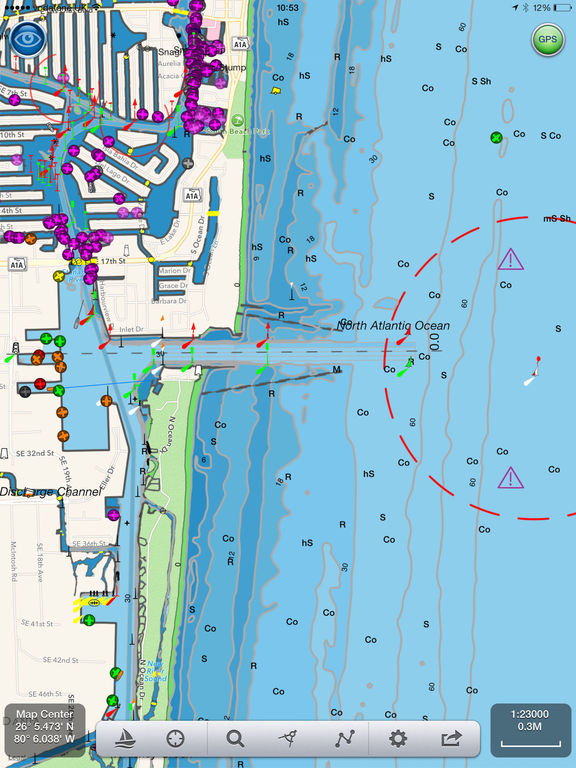
- Marine Vector charts - all buoys, lights etc. are tappable
- Live AIS Ship positions
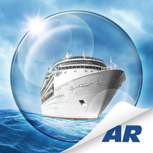
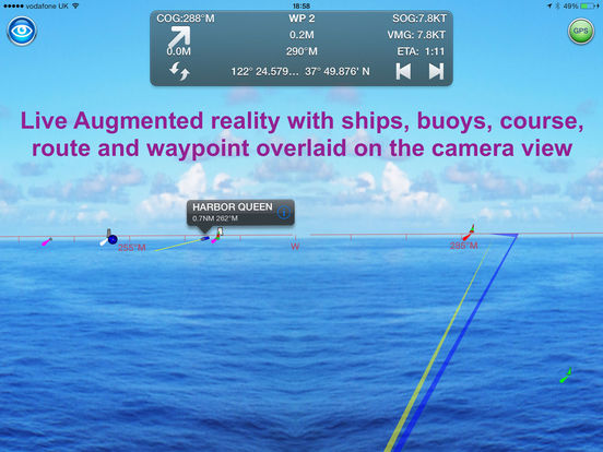
- Live Augmented Reality camera view plus support for the FLIR ONE Infra-red camera.
- Air Draft: Check your boat's clearance under bridges and cables
- Real time local wind feed and 7 day forecast (IAP)
Our unique AR view mode allows you to view buoys, lights, ships, waypoints and track overlaid on your iPhone or iPad live camera view. With "AR LockOn" you can select a target on the chart and then be guided to it in the AR camera view. See ships and MOBs at night and in the fog too with our world leading AR FLIR ONE camera support.
The app’s HUD shows your position on route, Course (COG), Speed(SOG), Vector Made Good (VMG), Estimated Time of Arrival (ETA), Distance and bearing to next Waypoint. Waypoint reached alerts, auto-routing to the next waypoint and flashing AIS collision alerts.
All our in-app purchases are 1 year subscriptions, which automatically renew at the end of the subscription period unless auto-renew is turned off at least 24-hours before the end of the current period. Payment will be charged to your iTunes Account at confirmation of purchase, and will be charged for renewal within 24-hours prior to the end of the current period. Subscriptions may be managed by the iTunes account holder and auto-renewal may be turned off by going to Account Settings after purchase.
No cancellation of the current subscription is allowed during active subscription period.
Our privacy policy and terms and conditions may be viewed here:-
Terms of Use: http://seanav.net/termsofuse.php
Privacy Policy: http://seanav.net/privacy.php
Support: [email protected]
Requirements:
iPhone or iPad. GPS only required for real time route navigation. Optional Real time AIS, Tides and Weather information require an active internet connection.
Real-time route navigation requires a GPS location. iPhone devices and iPads with a cellular modem already have a built-in GPS, even if they do not have an active service plan.
If you have a WiFi-only iPad or iPod you will need an external GPS receiver to enable navigation. Inexpensive 3rd Party units are available to add these accurate location capabilities to your device via bluetooth.
Please note that continued use of GPS running in the background can dramatically decrease battery life.
Third Party Licenses and Notices
NOTICE: US Marine Charts are derived from official NOAA Electronic Navigational Charts.
“THIS PRODUCT IS NOT TO BE USED FOR NAVIGATION” The use of this product for the planning and execution of passages will not meet the requirements of SOLAS
“NOTICE: Instituto Hidrográfico de la Marina (IHM) and the UK Hydrographic Office (UKHO) make no warranties or representations, express or implied, with respect to this product. The Instituto Hidrográfico de la Marina (IHM) and the UKHO have not verified the information within this product or quality assured it.”
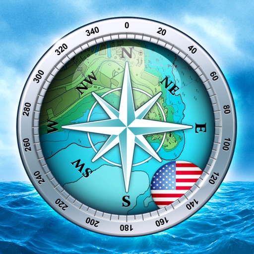
iPhone Screenshots
(click to enlarge)


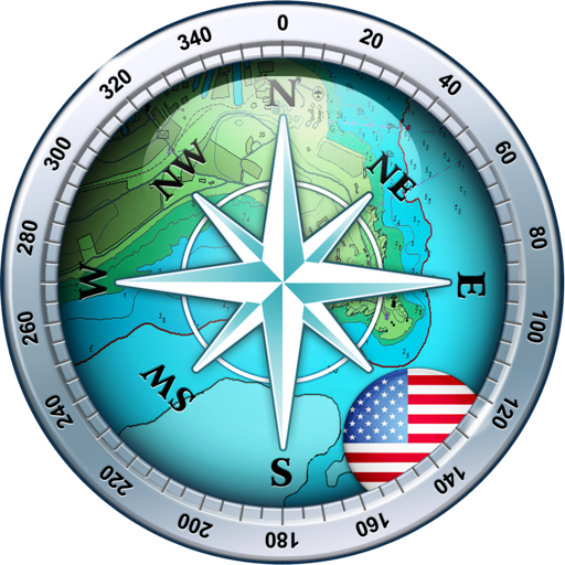
iPad Screenshots
(click to enlarge)
Apple Watch Screenshots
(click to enlarge)


App Changes
- April 18, 2017 Initial release
- June 15, 2019 New version 4.7.1
- December 03, 2019 New version 5.2
- September 16, 2023 New version 5.4.3
- September 16, 2023 Price increase: FREE! -> $27.99
Other Apps From Pocket Mariner Ltd.