
What's New
Improved performance
Software update
Flat interface
New icons
App Description
Going hiking on the John Muir Trail?
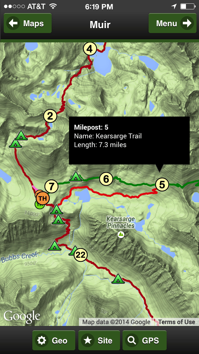
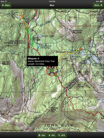
The app has trails with mile markers for all 10 trails in the system.
Agate Creek, Bishop Pass Trail, JMT Alternate, John Muir Trail, Kearsarge Trail, Mammoth Pass Trail, Panorama Trail, Whitney Trail, Whitney Portal Trail and Yosemite Valley Trail.
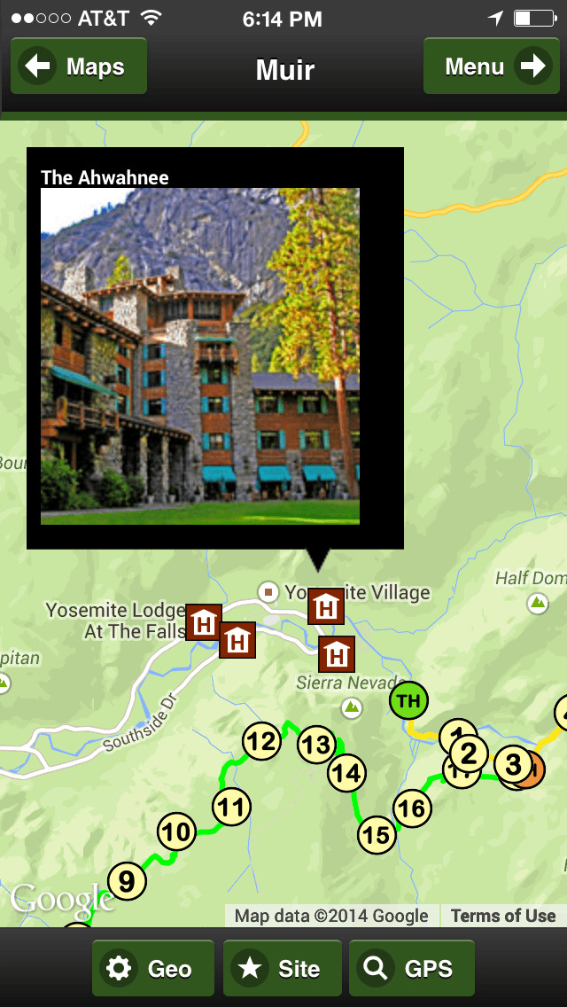
The app has all 70 campsites along the John Muir Trail.
Arrowhead Lake, Aspen Meadow, Bear Creek, Big Pete Meadow, Selden Pass, Bubbs Creek, Campground Soda Springs, Crabtree Meadow, Crabtree Ranger, Crater Creek, Deer Creek, Dollar Lake, Evolution Creek Ford, Evolution Creek, Evolution Lake, Fish Creek, Forester Pass, Garnet Lake, Gladys Lake, Glen Aulin, Grouse Meadow, Guitar Lake, Lake Marjorie, Lake Virginia, Little Yosemite Valley, Lone Pine Creek, Lower Palisade Lake, Lower Rae Lake, Lyell Fork Ford, Lyell Fork, Marie Lake, McClure Meadow, Middle Fork Kings River, Middle Rae Lake, Middle Vidette Meadow, Mono Creek, Mono Pass Trail, Muir Ranch, No Camping 4 miles N of Tuolumne Meadows, No Camping Lone Pine Creek, No Camping Mirror Lake, No Camping South Fork Kings River, No Camping Timberline Lake, North Fork Mono Creek, Palisade Creek, Piute Creek, Purple Lake, Reds Meadow Store, Rosalie Lake, Ruby Lake, Rush Creek Ford, Sallie Keyes Lake, Shadow Creek, Shadow Lake, Silver Pass Creek, Silver Pass, South Fork of Kings River, South Fork San Joaquin River, Sunrise Creek, Sunrise High Sierra Trail, Trinity Lakes Campsite, Tuolumne Meadows, Tyndall Creek, Tyndall Frog Ponds, Upper Vidette Meadow Campsite, Wallace Creek Ford, Wanda Lake, West Fork Bear Creek, Woods Creek and Wright Creek Ford
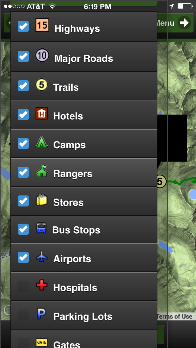
It includes all Highways, Trails, Milepost Markers, Hotels, Parking, Peaks, Parks, Gates, Airports, Hospitals and more.
John Muir Trail Map Offline has it all!!! This App works great with or without an internet connection.
Offline Maps - The app includes 2 OFFLINE maps (satellite and topo) for the region. Full GPS support. All the geographic data like trails, hotels and peaks are on your device. No internet connection required.
Online Maps - When internet is available, the App links to 3 other base maps from three internet map providers. Streets and Satellite maps are available.
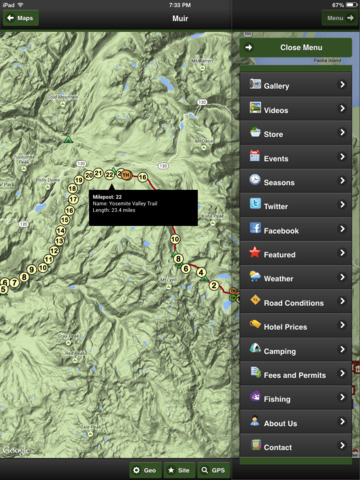
The app provides Videos, Hotels, Gallery, Facebook, About Us and Contact Information. There is also info about the John Muir Trail and other geographic features.
Our cartographers design maps that look wonderful on your iPhone, iTouch and iPad.
iPhone Screenshots
(click to enlarge)


iPad Screenshots
(click to enlarge)


App Changes
- December 29, 2014 Initial release
- January 04, 2015 New version 4.2.1
- January 04, 2015 Price decrease: $4.99 -> $2.99
- August 19, 2015 Price decrease: $2.99 -> $0.99
- December 06, 2015 New version 5.0.0
- July 03, 2016 New version 6.0.0
- July 03, 2016 Price increase: $0.99 -> $1.99
Other Apps From John Buttery