
What's New
Updated software, refreshed data, additional information and important phone numbers.
New interface, improved speed and new features. New map icons, legends, popups.
Added information for park hours, camping, fees, guides and visitor centers.
App Description
Going hiking or camping while at Yellowstone?
Yellowstone National Park is a national park located primarily in the U.S. state of Wyoming, although it also extends into Montana and Idaho. It was established by the U.S. Congress and signed into law by President Ulysses S. Grant on March 1, 1872.
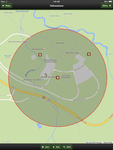
Yellowstone, widely held to be the first national park in the world, is known for its wildlife and its many geothermal features, especially Old Faithful Geyser, one of the most popular features in the park. It has many types of ecosystems, but the subalpine forest is most abundant. It is part of the South Central Rockies forests ecoregion.
This app has all the information that you will need to explore Yellowstone Park,
82 Trails and Mile Markers...
Agate Creek, Beaver Ponds, Bechler River,
Bighorn Pass, Black Butte, Blacktail Deer Creek,
Blacktail Plateau, Bliss Pass, Bootjack Gap,
Boundary Creek, Buffalo Fork, Buffalo Plateau,
Bunsen Peak, Cache Creek, Chittenden Loop,
Coyote Creek, Cresent High Lake, Delacy Creek,
Dogshead, Eagle Pass, Mountain Creek,
Fairy Creek, Little Firehole, Fan Creek, Fawn Pass,
Frost Lake, Garnet Hill Loop, Heart Lake,
Heart River, Hellroaring Creek, Hoodoo Basin,
Howard Eaton, Fishing Bridge, Howard Eaton,
Norris, Howard Eaton, Lamar River,
Lewis River Channel, Mallard Creek, Mallard Lake,
Mary Mountain, Nez Perce, Miller Creek, Mist Creek,
Mount Holmes, Winter Creek, Mount Washburn Spur,
Mountain Ash Creek, North Shore,
Shoshone Lake, Pebble Creek, Pelican Cone Cabin,
Pelican Creek, Pelican Valley, Pitchsone Plateau,
Plateau, Rescue Creek, Robinson Creek,
Sepulcher Mountain, Seven Mile Hole, Sky Rim,
Slough Creek, Snake River Cutoff, Solfatara Creek,
South Boundary, Entrance, South Boundary,
Harebell, South Boundary, Specimen Creek,
Specimen Ridge, Sportsman Lake, Spring Creek,
Summit Lake, Thorofare, East Shore,
Thunderer Cutoff, Trail Creek, Turbid Lake,
Two Ocean Plateau, Wapiti Lake and
Yellowstone River
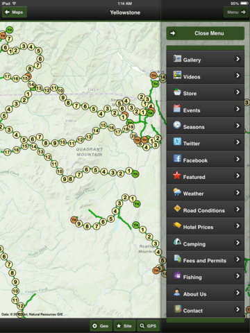
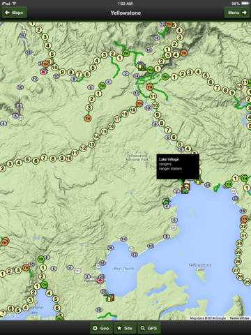
It includes all Highways, Major roads, Rivers, Trails, Milepost Markers, Hotels, Camps, Rangers, Stores, Lakes, Bears, Fires, Geysers and Elevations
Yellowstone offline trail map has it all.
This App works great with or without an internet connection.
Offline Maps - The app includes 3 OFFLINE maps (satellite, streets) for the region. Full GPS support. All the geographic data like trails, camps, hotels, stores, ranger stations are on your device. No internet connection required.
Online Maps - When internet is available, the App links to 4 other base maps from three internet map providers. Topo, Streets, Terrain and Satellite maps are available.
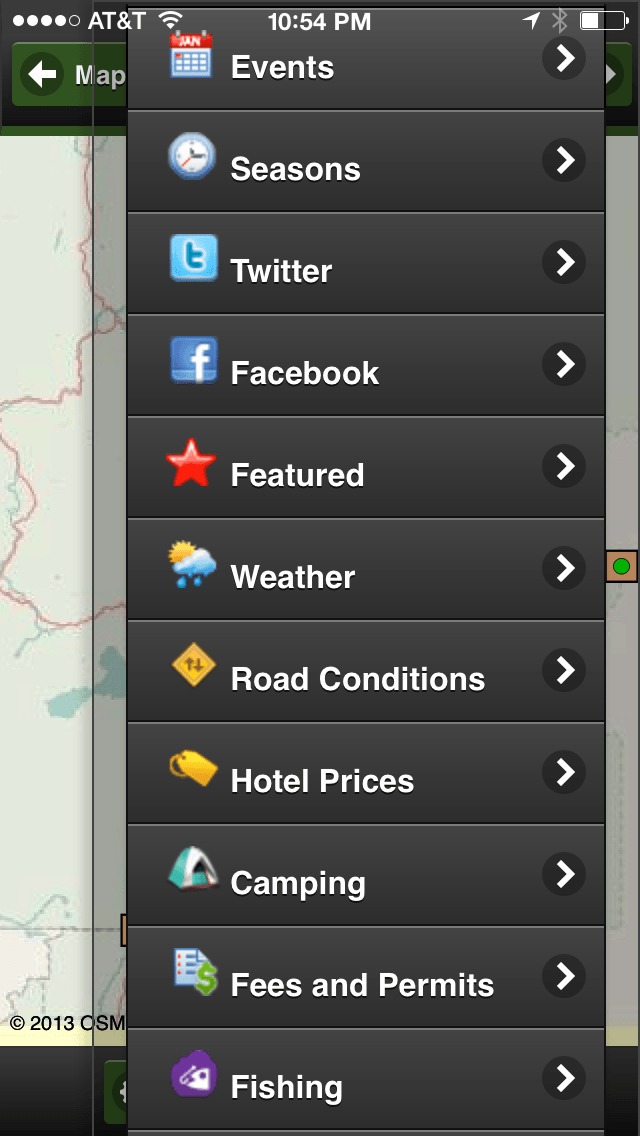
The app provides Videos, Stores, Facebook, Featured, Weather, Road Conditions, Hotel Prices, Camping Reservations, Fees and Permits, Fishing Report, About and Contact Information.
Our cartographers design maps that look wonderful on your iPhone, iTouch and iPad.
iPhone Screenshots
(click to enlarge)


iPad Screenshots
(click to enlarge)


App Changes
- November 18, 2014 Initial release
- December 01, 2014 New version 4.2.1
- August 19, 2015 Price decrease: $4.99 -> $0.99
- March 16, 2016 Price increase: $0.99 -> $1.99
- March 23, 2016 New version 5.0.0
- July 04, 2016 Price decrease: $1.99 -> FREE!
Other Apps From John Buttery