


What's New
If you are interested in footpaths please consider the regional National Park apps by JOMO Solutions Ltd. containing footpaths as defined by @OpenStreeMap contributors.
The "Share My Location" user interface is now directly accessible from the main Map View user interface.
A bug has been fixed on retina iPads that caused an 8 second delay in loading the information screen.
A small percentage of hill locations were found to be erroneous and have been corrected.
App Description
If you are interested in footpaths please consider the regional National Park apps by JOMO Solutions Ltd. containing footpaths as defined by @OpenStreeMap contributors.
4 levels of OS map detail are accessible within the application relating to different zoom levels. At the lowest zoom levels an overview of Great Britain is provided.
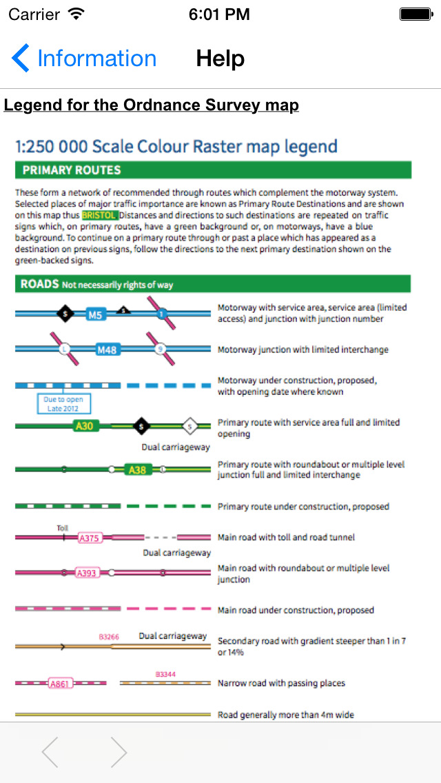
At the third level of detail, the map clearly shows the landscape features relevant to its scale, including relief, boundaries, settlements, main communications and physical features. The map data for this detail level was published by OS in January 2015.
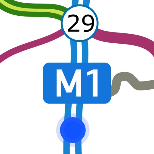
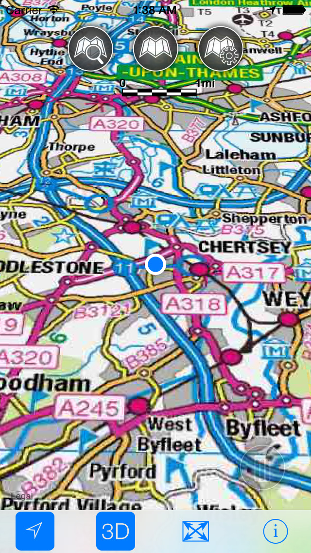
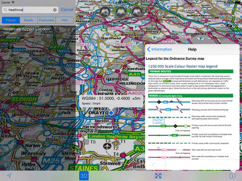
The most detailed zoom levels features a 1:250 000 scale map published by OS. The map is derived from a small-scale, vector, digital mapping product. It clearly shows the landscape features relevant to its scale, including relief, cities, towns, many villages, motorways, A and B class roads, railways, rivers and some woodlands.
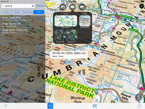
The app provides online and offline mapping useful whilst travelling by road, rail, canal, river and sea waters. A powerful offline search facility can locate over 2.8 million places, roads, post codes and hills within Great Britain. Many of the standard Apple maps features (e.g. User Tracking, 3D buildings, Points of interest) are available for use with Apple Standard, Satellite and Hybrid maps. User tracking with or without heading is also supported for Great Britain Ordnance Survey offline maps.
-Offline access to OS Great Britain (GB) maps published in 2014/2015. (No data connection required)
-Offline search functionality with over 2.8 million GB searchable locations (places, roads, post codes and hills). No data connection required.
-258,418 place names
-1,684,496 post codes
-848,718 road names
-20,327 hills
For the place name search the location's latitude and longitude are accurate to 0.1 of a minute of the centre point of the National Grid square (1 km by 1 km) in which the name falls.
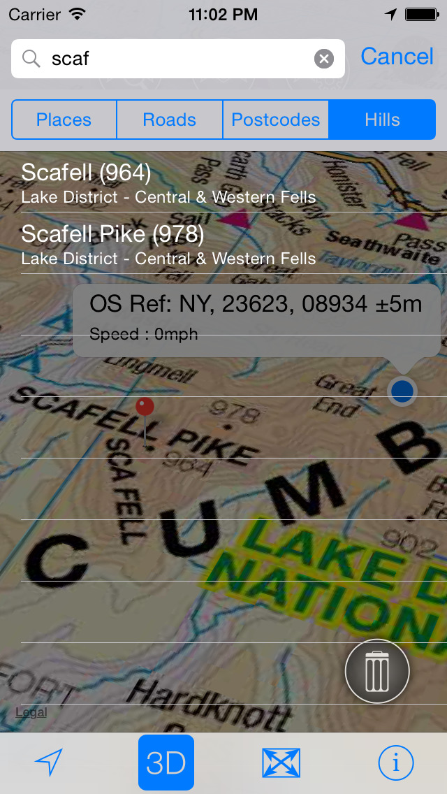
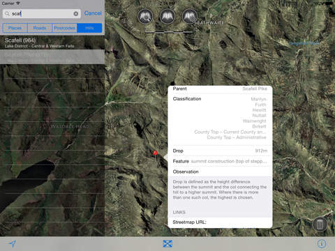
-Detailed hill information, including height, location, classification with hill specific links to Streetmap, Geograph and Hill Bagging web sites.
-Online access to worldwide Apple Standard, Satellite and Hybrid maps
-Apple 3D Buildings displayed on Apple Standard maps
-Apple maps contain Points of Interest
-Display of current location information (optionally as a GB Ordnance survey grid reference)
-User location can be tracked with or without heading on all online and offline maps (GPS capable devices only)
- "Share My Location" allowing users to share an image of their current location and location references. Buttons are provided to share location information by Facebook, Twitter, iMessage/SMS and e-mail
-Display of scale bar in either metric or imperial units
-Display of current speed
-Zoom, pan, rotation of all maps
-Pitch of Apple standard and Ordnance Survey maps
-Selection of current location annotation for display of speed and location data.
-User setting for speed display in Miles per Hour (mph) or Kilometers per Hour (kph)
-User setting for display of current GPS position as Ordnance Survey Grid Reference or WGS84 latitude and longitude
-Selection of search result pin annotations to display location information
-Collective deletion of search result annotation pins
-A user guide is provided within
The OS search data was published by Ordnance Survey in 2014.
Extracts from "The Database of British and Irish Hills" v14 published 22/04/2014 (ref. http://www.hills-database.co.uk/index.html )
No warranty
The data is supplied by Apple, Ordnance Survey and Database of British and Irish Hills.
The Information is licensed 'as is' and the Information Provider and/or Licensor excludes all representations, warranties, obligations and liabilities in relation to the Information to the maximum extent permitted by law.
The Information Provider and/or Licensor are not liable for any errors or omissions in the Information and shall not be liable for any loss, injury or damage of any kind caused by its use.
iPhone Screenshots
(click to enlarge)


iPad Screenshots
(click to enlarge)


App Changes
- August 04, 2014 Initial release
- August 07, 2014 New version 1.1.0
- September 01, 2014 New version 1.2.0
- October 10, 2014 New version 1.2.1
- October 27, 2014 Price increase: FREE! -> $0.99
- November 06, 2014 New version 2.0.0
- November 13, 2014 New version V2.1.0
- November 23, 2014 New version 2.2.0
- January 27, 2015 New version 2.3.0
- February 06, 2015 New version 2.4.0
- February 06, 2015 Price increase: $0.99 -> $2.99
- February 27, 2015 New version 2.5.0
- October 04, 2015 Price decrease: $2.99 -> $0.99