
What's New
- minor improvements
App Description
*** SALE 50% OFF ***
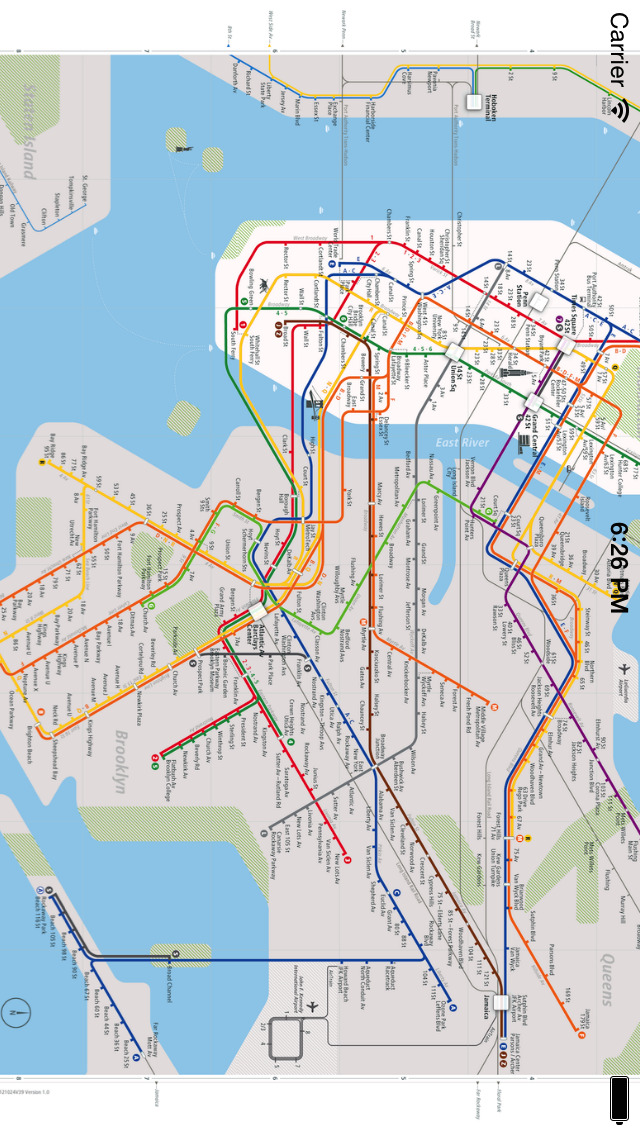
New York City Rail & Subway Map is a clear and concise route map that features:
OFFLINE DATA - no internet connection necessary.
NEW YORK CITY'S MOST BEAUTIFUL RAIL MAP - representing the state of the art in information design.
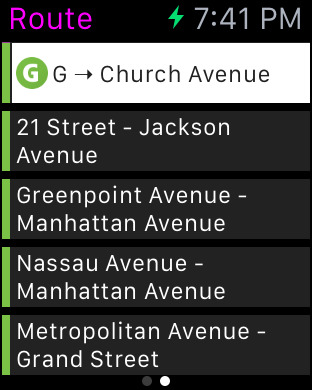
ROUTE PLANNER - instantly finds the fastest route and displays it on the map including transfer stations.
STATIONS INDEX - quickly jump to any station.
LINES OVERVIEW - shows the order of stations on each line with transit options.
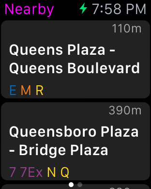
GPS SUPPORT - find the station closest to you.
HIGH RESOLUTION GRAPHICS - looks stunning on retina displays.
ROTATE and ZOOM - hold your device any way you want.
UNIVERSAL APP - optimized for iPhone, iPod Touch and iPad.
LARGE MAP - includes the 490 most important stations
STATION LOOKUP - search for a station by name
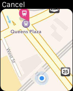
APPLE MAPS INTEGRATION - lookup your route directly from Apple Maps
=========
Disclaimer:
Continued use of GPS running in the background can dramatically decrease battery life.
iPhone Screenshots
(click to enlarge)


iPad Screenshots
(click to enlarge)


Apple Watch Screenshots
(click to enlarge)


App Changes
- July 24, 2013 Initial release
- July 24, 2013 Price decrease: $3.99 -> FREE!
- July 27, 2013 Price increase: FREE! -> $3.99
- August 26, 2013 Price decrease: $3.99 -> FREE!
- August 30, 2013 Price increase: FREE! -> $3.99
- September 13, 2013 New version 1.1
- January 03, 2014 New version 1.3
- August 02, 2014 New version 3.0
- September 30, 2014 New version 3.1
- April 26, 2015 New version 3.5
- April 28, 2015 New version 3.6
- August 11, 2015 New version 4.0
- November 28, 2015 Price increase: $3.99 -> $4.99
- December 19, 2015 New version 5.0
- March 18, 2016 New version 5.0.1
- July 16, 2016 New version 5.1
- November 05, 2016 New version 5.2
- December 21, 2016 New version 5.2.2
Other Apps From Ansgar Vollmer Und Till Knorr